Mapleton, Oregon facts for kids
Quick facts for kids
Mapleton, Oregon
|
|
|---|---|
 |
|
| Country | United States |
| State | Oregon |
| County | Lane |
| Established | 1886 |
| Area | |
| • Total | 0.96 sq mi (2.49 km2) |
| • Land | 0.90 sq mi (2.33 km2) |
| • Water | 0.06 sq mi (0.16 km2) |
| Population
(2020)
|
|
| • Total | 493 |
| • Density | 548.39/sq mi (211.65/km2) |
| Time zone | UTC-8 (Pacific (PST)) |
| • Summer (DST) | UTC-7 (PDT) |
| ZIP code |
97453
|
| Area code(s) | 458 and 541 |
| FIPS code | 41-45750 |
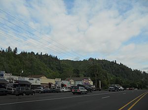
Mapleton is a small, unincorporated community in Lane County, Oregon, United States. It is located right on Oregon Route 126 and the Siuslaw River. Mapleton is about 45 miles (72 km) west of Eugene and 15 miles (24 km) east of Florence. It is also the starting point for Oregon Route 36. In 2020, about 493 people lived in Mapleton.
The Story of Mapleton
Mapleton was probably named by Julia Ann "Grandma" Bean. She noticed there were many Bigleaf Maple trees in the area. Grandma Bean and her husband, Obediah Roberts Bean, moved to the Mapleton area in 1886. The town was named soon after.
Before Mapleton had its own post office, there was one called Seaton nearby in 1885. When this post office moved to Mapleton in 1889, Mrs. Bean became the postmaster. In 1896, the post office was officially renamed Mapleton to match the town's name.
Mapleton's Weather
This area has warm, dry summers. It's not usually super hot, but it can be very pleasant. According to a system that classifies climates, Mapleton has a type of warm-summer Mediterranean climate. This means it has mild, wet winters and warm, dry summers.
| Climate data for Mapleton, Oregon (1991–2020 normals, extremes 1924–present) | |||||||||||||
|---|---|---|---|---|---|---|---|---|---|---|---|---|---|
| Month | Jan | Feb | Mar | Apr | May | Jun | Jul | Aug | Sep | Oct | Nov | Dec | Year |
| Record high °F (°C) | 68 (20) |
69 (21) |
80 (27) |
87 (31) |
99 (37) |
109 (43) |
102 (39) |
105 (41) |
98 (37) |
88 (31) |
72 (22) |
64 (18) |
109 (43) |
| Mean maximum °F (°C) | 59.5 (15.3) |
63.8 (17.7) |
69.5 (20.8) |
78.7 (25.9) |
86.2 (30.1) |
87.3 (30.7) |
93.7 (34.3) |
95.5 (35.3) |
91.0 (32.8) |
76.0 (24.4) |
65.7 (18.7) |
59.6 (15.3) |
97.5 (36.4) |
| Mean daily maximum °F (°C) | 52.0 (11.1) |
54.8 (12.7) |
58.2 (14.6) |
62.3 (16.8) |
67.9 (19.9) |
72.8 (22.7) |
79.6 (26.4) |
80.3 (26.8) |
76.6 (24.8) |
65.7 (18.7) |
56.1 (13.4) |
50.4 (10.2) |
64.7 (18.2) |
| Daily mean °F (°C) | 46.4 (8.0) |
47.9 (8.8) |
50.0 (10.0) |
53.1 (11.7) |
57.8 (14.3) |
62.0 (16.7) |
66.8 (19.3) |
67.4 (19.7) |
64.0 (17.8) |
56.6 (13.7) |
49.9 (9.9) |
45.4 (7.4) |
55.6 (13.1) |
| Mean daily minimum °F (°C) | 40.9 (4.9) |
41.1 (5.1) |
41.8 (5.4) |
43.9 (6.6) |
47.8 (8.8) |
51.1 (10.6) |
53.9 (12.2) |
54.5 (12.5) |
51.3 (10.7) |
47.4 (8.6) |
43.8 (6.6) |
40.4 (4.7) |
46.5 (8.1) |
| Mean minimum °F (°C) | 29.8 (−1.2) |
30.3 (−0.9) |
33.1 (0.6) |
34.8 (1.6) |
37.7 (3.2) |
43.7 (6.5) |
47.2 (8.4) |
46.1 (7.8) |
42.6 (5.9) |
37.8 (3.2) |
32.9 (0.5) |
28.3 (−2.1) |
25.1 (−3.8) |
| Record low °F (°C) | 19 (−7) |
17 (−8) |
26 (−3) |
27 (−3) |
29 (−2) |
38 (3) |
40 (4) |
39 (4) |
34 (1) |
22 (−6) |
19 (−7) |
8 (−13) |
8 (−13) |
| Average precipitation inches (mm) | 13.41 (341) |
9.79 (249) |
10.22 (260) |
7.22 (183) |
3.88 (99) |
2.39 (61) |
0.46 (12) |
0.70 (18) |
2.09 (53) |
6.25 (159) |
12.32 (313) |
15.25 (387) |
83.98 (2,133) |
| Average precipitation days (≥ 0.01 in) | 20.0 | 18.5 | 24.2 | 19.6 | 13.7 | 13.0 | 3.3 | 3.6 | 6.6 | 13.6 | 21.1 | 19.8 | 177.0 |
| Source: NOAA | |||||||||||||
Who Lives in Mapleton?
This section talks about the people who live in Mapleton, also known as its demographics. It includes information like the population count.
| Historical population | |||
|---|---|---|---|
| Census | Pop. | %± | |
| 2020 | 493 | — | |
| U.S. Decennial Census | |||
According to the 2020 United States Census, Mapleton had a total population of 493 people.


