Douglas County, Oregon facts for kids
Quick facts for kids
Douglas County
|
|
|---|---|
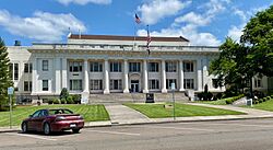
Douglas County Courthouse in Roseburg
|
|
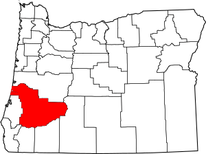
Location within the U.S. state of Oregon
|
|
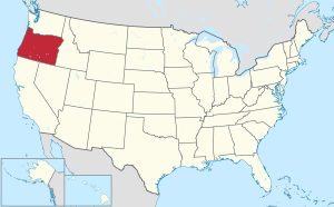 Oregon's location within the U.S. |
|
| Country | |
| State | |
| Founded | January 7, 1852 |
| Named for | Stephen A. Douglas |
| Seat | Roseburg |
| Largest city | Roseburg |
| Area | |
| • Total | 5,134 sq mi (13,300 km2) |
| • Land | 5,036 sq mi (13,040 km2) |
| • Water | 98 sq mi (250 km2) 1.9%% |
| Population
(2020)
|
|
| • Total | 111,201 |
| • Estimate
(2023)
|
112,435 |
| • Density | 21.6597/sq mi (8.3629/km2) |
| Time zone | UTC−8 (Pacific) |
| • Summer (DST) | UTC−7 (PDT) |
| Congressional districts | 2nd, 4th |
Douglas County is one of the 36 counties in the state of Oregon. A county is a part of a state, like a big neighborhood. In 2020, about 111,201 people lived here. The main city and county seat is Roseburg.
The county is named after Stephen A. Douglas. He was an American politician who helped Oregon become a state. Douglas County is the largest county west of the Cascade Range mountains in Oregon.
Contents
History of Douglas County
The land where Douglas County is now was first home to the Umpqua Indians. These native people spoke different languages. After a conflict called the Rogue River Indian War in 1856, the government moved most Umpqua people. They were sent to the Grand Ronde Indian Reservation.
However, seven Umpqua families bravely hid in the hills. They avoided being captured for many years. Today, their descendants are known as the Cow Creek Band of Umpqua Tribe of Indians. This tribe has a small reservation in Canyonville, Oregon. They also run a hotel and casino called Seven Feathers. This name honors the seven families who stayed.
Douglas County was officially created on January 7, 1852. It was formed from a part of Umpqua County. Over the years, its borders changed a few times. Some parts were added from Coos County and later Umpqua County was fully joined with Douglas County. The county's borders mostly follow the Umpqua River watershed.
In 2017, something big happened with the libraries. People voted on a plan to fund the Douglas County Library System, but it did not pass. Because of this, all public libraries in the county had to close. But don't worry! Ten cities in the county later reopened their own libraries. They wanted to make sure their communities still had access to books and learning.
Geography and Nature
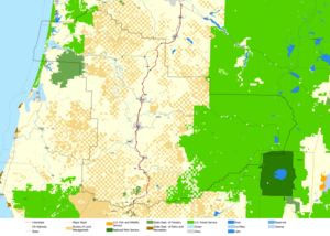
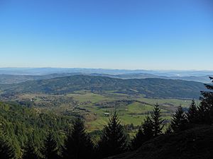
Douglas County is a large area, covering about 5,134 square miles. Most of this is land, with a small part being water. It is the fifth-largest county in Oregon by size.
A big part of the Umpqua National Forest is located here. Douglas County is special because it stretches from the Pacific Ocean all the way to the Cascade Range mountains. Only one other county in Oregon does this!
Protected Natural Areas
Several important natural places are partly within Douglas County. These areas help protect nature and wildlife.
- Crater Lake National Park (part)
- Rogue River-Siskiyou National Forest (part)
- Siuslaw National Forest (part)
- Umpqua National Forest (part)
- Willamette National Forest (part)
Neighboring Counties
Douglas County shares its borders with several other counties:
- Lane County (north)
- Klamath County (east)
- Jackson County (south)
- Josephine County (south)
- Curry County (southwest)
- Coos County (west)
People and Population
| Historical population | |||
|---|---|---|---|
| Census | Pop. | %± | |
| 1860 | 3,203 | — | |
| 1870 | 6,066 | 89.4% | |
| 1880 | 9,596 | 58.2% | |
| 1890 | 11,864 | 23.6% | |
| 1900 | 14,565 | 22.8% | |
| 1910 | 19,674 | 35.1% | |
| 1920 | 21,332 | 8.4% | |
| 1930 | 21,965 | 3.0% | |
| 1940 | 25,728 | 17.1% | |
| 1950 | 54,549 | 112.0% | |
| 1960 | 68,458 | 25.5% | |
| 1970 | 71,743 | 4.8% | |
| 1980 | 93,748 | 30.7% | |
| 1990 | 94,649 | 1.0% | |
| 2000 | 100,399 | 6.1% | |
| 2010 | 107,667 | 7.2% | |
| 2020 | 111,201 | 3.3% | |
| 2023 (est.) | 112,435 | 4.4% | |
| U.S. Decennial Census 1790–1960 1900–1990 1990–2000 2010–2020 |
|||
Recent Population Counts
In 2020, the census counted 111,201 people living in Douglas County. This number helps us understand how many people live in an area.
Back in 2010, there were 107,667 people. Most people living in the county were white. About 4.7% of the population was of Hispanic or Latino background. Many people had ancestors from Germany, Ireland, or England.
Communities in Douglas County
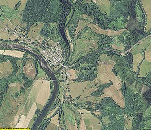
Douglas County has many towns and cities. Some are officially called "cities," while others are smaller "census-designated places" or "unincorporated communities."
Cities
Census-designated places
Unincorporated communities
Getting Around: Transportation
You can travel through Douglas County using different roads and public transport.
Roads
Several important roads cross Douglas County.
- Oregon Route 99 goes through many towns like Azalea, Myrtle Creek, and Roseburg.
- Interstate 5 is a major highway. It connects communities such as Tri-City, Canyonville, and Sutherlin.
- Oregon Route 138 runs from Roseburg towards the east. It leads to places like Diamond Lake and Crater Lake.
Buses
Local bus services help people get around Douglas County. This service is called U-Trans. In 2017, they added more routes to reach places like Oakland and Tenmile. For longer trips, Greyhound Lines offers bus service from Roseburg.
Airports
Roseburg has two public airports. These are Marion E. Carl Memorial Field and George Felt Airport.
Economy: How People Make a Living
The economy of Douglas County is largely based on its natural resources.
The Umpqua River's entire water system is almost completely within the county. Douglas County has a lot of forests, about 1.8 million acres. It even has some of the oldest trees in the world! About 25-30% of the jobs are in the forest products industry. This means many people work with wood and trees.
Farming is also important. People grow crops, have orchards, and raise animals, especially sheep. About half of the land in Douglas County is owned by the public (like national forests), and half is privately owned.
The wine industry in Oregon started in Douglas County. Richard Somer planted the first vineyard in 1961. The Umpqua Valley wine region is entirely within Douglas County.
Since 1954, nickel has been refined in Riddle. The Forest Service and Bureau of Land Management manage over half of the county's land.
Top Employers
Here are some of the biggest private employers in Douglas County as of 2015:
| # | Employer | # of Employees |
|---|---|---|
| 1 | Roseburg Forest Products | 1,885 |
| 2 | Mercy Medical Center | 1,092 |
| 3 | Swanson Group Aviation | 682 |
| 4 | TMS Call Center | 615 |
| 5 | Seven Feathers Hotel & Casino Resort | 606 |
| 6 | First Call Resolution | 424 |
| 7 | Umpqua Bank | 331 |
| 8 | Orenco Systems | 266 |
| 9 | A&M Transport, Inc. | 200 |
| 10 | Douglas County Forest Products | 160 |
Media
Here are some newspapers that serve Douglas County:
- Douglas County News
- The News-Review
- The Umpqua Post
See also
 In Spanish: Condado de Douglas (Oregón) para niños
 | Kyle Baker |
 | Joseph Yoakum |
 | Laura Wheeler Waring |
 | Henry Ossawa Tanner |


