Curry County, Oregon facts for kids
Quick facts for kids
Curry County
|
||
|---|---|---|
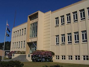
Curry County Courthouse in Gold Beach
|
||
|
||
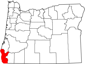
Location within the U.S. state of Oregon
|
||
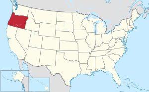 Oregon's location within the U.S. |
||
| Country | ||
| State | ||
| Founded | December 18, 1855 | |
| Seat | Gold Beach | |
| Largest city | Brookings | |
| Area | ||
| • Total | 1,988 sq mi (5,150 km2) | |
| • Land | 1,627 sq mi (4,210 km2) | |
| • Water | 361 sq mi (930 km2) 18.2%% | |
| Population
(2020)
|
||
| • Total | 23,446 | |
| • Estimate
(2021)
|
23,683 |
|
| • Density | 14/sq mi (5.3/km2) | |
| Time zone | UTC−8 (Pacific) | |
| • Summer (DST) | UTC−7 (PDT) | |
| Congressional district | 4th | |
Curry County is a county located in the very southwest part of Oregon, a state in the United States. In 2020, about 23,446 people lived there. The main town and county seat is Gold Beach. The county is named after George Law Curry, who was the governor of the Oregon Territory two times. Curry County is also home to the Brookings, OR area, which is a smaller city area.
Contents
Exploring Curry County's Geography
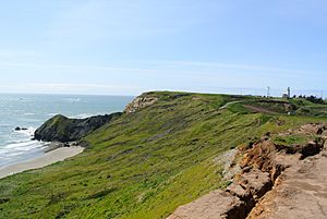
Curry County covers a total area of about 1,988 square miles. Most of this area, about 1,627 square miles, is land. The rest, about 361 square miles, is water.
The very westernmost point of Oregon is found in Curry County. It's called Cape Blanco.
This county has many important forests. You can find trees like black oak, big leaf maple, and Douglas-fir here.
Neighboring Counties
Curry County shares its borders with a few other counties:
- Coos County (to the north)
- Douglas County (to the northeast)
- Josephine County (to the east)
- Del Norte County, California (to the south, in California)
Protected Natural Areas
Parts of these special natural areas are located in Curry County:
- Oregon Islands National Wildlife Refuge
- Siskiyou National Forest
Who Lives in Curry County?
| Historical population | |||
|---|---|---|---|
| Census | Pop. | %± | |
| 1860 | 393 | — | |
| 1870 | 504 | 28.2% | |
| 1880 | 1,208 | 139.7% | |
| 1890 | 1,709 | 41.5% | |
| 1900 | 1,868 | 9.3% | |
| 1910 | 2,044 | 9.4% | |
| 1920 | 3,025 | 48.0% | |
| 1930 | 3,257 | 7.7% | |
| 1940 | 4,301 | 32.1% | |
| 1950 | 6,048 | 40.6% | |
| 1960 | 13,983 | 131.2% | |
| 1970 | 13,006 | −7.0% | |
| 1980 | 16,992 | 30.6% | |
| 1990 | 19,327 | 13.7% | |
| 2000 | 21,137 | 9.4% | |
| 2010 | 22,364 | 5.8% | |
| 2020 | 23,446 | 4.8% | |
| 2021 (est.) | 23,683 | 5.9% | |
| U.S. Decennial Census 1790-1960 1900-1990 1990-2000 2010-2020 |
|||
In 2010, there were 22,364 people living in Curry County. There were 10,417 households, which are groups of people living together.
Most people in the county were white (92.0%). Other groups included American Indian (1.9%), Asian (0.7%), and Black or African American (0.3%). About 5.4% of the people were of Hispanic or Latino background.
The average age of people in Curry County was about 53.5 years old.
Towns and Communities
Cities
- Brookings
- Gold Beach (This is the county seat, where the main government offices are)
- Port Orford
Census-Designated Places (CDPs)
These are areas that are like towns but are not officially incorporated as cities:
- Harbor
- Langlois
- Nesika Beach
- Pistol River
Unincorporated Communities
These are smaller places that are not part of any city or CDP:
Curry County's Economy
In the mid-1800s, people found gold and other valuable metals along the beaches and rivers of Curry County. This led to settlements growing along the coast. For a long time, it was hard to travel to and from Curry County, so it stayed quite separate from the rest of Oregon.
As mining became less important, the county's economy changed. It started to rely more on farming, raising animals, and products from the forests. Important forest products include Port Orford cedar and myrtlewood. Tourism also became a big part of the economy.
Today, blueberries and plants from nurseries are important farm products. Did you know that most of the Easter lilies grown in the United States come from Curry County?
Around 2001, a disease called "sudden oak death" started to affect the native tanoak trees in the county. This disease is caused by a tiny organism called Phytophthora ramorum. It likes moist places near the coast. By 2016, it had killed hundreds of thousands of tanoak trees. It also harms other types of trees and plants. This disease is a threat to the county's timber industry and plant nurseries.
In 2012, the U.S. government owned 66% of the land in Curry County. Private forest companies owned 22%. About 7% of the land was used for farming.
The Port of Brookings Harbor is a safe harbor at the mouth of the Chetco River. It is considered one of the safest harbors on the coast. The United States Coast Guard lists it as a "Harbor of Refuge."
See also
 In Spanish: Condado de Curry (Oregón) para niños
 | Jackie Robinson |
 | Jack Johnson |
 | Althea Gibson |
 | Arthur Ashe |
 | Muhammad Ali |


