
Port Orford, Oregon facts for kids
Quick facts for kids
Port Orford, Oregon
|
|
|---|---|

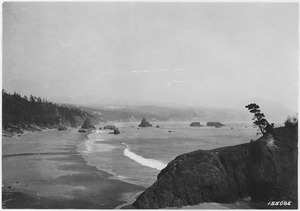
1990 Aerial view of Port Orford
|
|
| Motto(s):
"Natural. Wonders."
|
|

Location in Oregon
|
|

Port Orford, Oregon
Location in the United States
|
|
| Country | United States |
| State | Oregon |
| County | Curry |
| Incorporated | 1911 |
| Area | |
| • Total | 1.60 sq mi (4.15 km2) |
| • Land | 1.56 sq mi (4.04 km2) |
| • Water | 0.05 sq mi (0.12 km2) |
| Elevation | 43 ft (13 m) |
| Population
(2020)
|
|
| • Total | 1,146 |
| • Density | 735.09/sq mi (283.90/km2) |
| Time zone | UTC-8 (Pacific) |
| • Summer (DST) | UTC-7 (Pacific) |
| ZIP code |
97465
|
| Area code(s) | 541 |
| FIPS code | 41-59250 |
| GNIS feature ID | 2411467 |
| Website | www.portorford.org |
Port Orford is a small city located in Curry County. It sits on the southern coast of Oregon, United States. The city's population was 1,146 people in the 2020 census.
The city gets its name from George Vancouver. He originally named a nearby place, Cape Blanco, after George, Earl of Orford. He called him "a much-respected friend."
Port Orford is the westernmost city in Oregon. It is also the westernmost incorporated place in the 48 connected states of the U.S.
Contents
History of Port Orford
Before European settlers arrived, the Port Orford area was home to the Tututni people. These were Native American groups. Their languages were part of the Pacific Coast Athabaskan language family.


Early Explorers and Settlements
A Spanish explorer named Bartoleme Ferrelo mapped Cape Blanco in 1543. This cape was the farthest north point on coastal maps for a long time. In 1778, British explorer Captain Cook found land even farther west.
Captain George Vancouver saw the land and named it Port Orford in 1792. In June 1851, Captain William Tichenor arrived in Port Orford. He left nine men there. A U.S. Army fort, Fort Orford, was built nearby on September 14, 1851. It stayed open until August 22, 1856.
The State of Jefferson Idea
In October 1941, the mayor, Gilbert Gable, was unhappy. The state roads around Port Orford were in very bad condition. This made travel and business difficult. He suggested that several counties in Oregon and California should leave their states.
His idea was to create a new state called the State of Jefferson. This movement ended when the U.S. joined World War II.
Geography and Climate
Port Orford is located on U.S. Route 101. It sits between the Pacific Ocean and the Siskiyou National Forest. It is about 28 miles (45 km) north of Gold Beach. It is also about 27 miles (43 km) south of Bandon.
Port Orford is the westernmost city in the contiguous United States. This means it's the farthest west city in the main 48 states. The city covers about 1.61 square miles (4.17 sq km). Most of this area is land.
Understanding Port Orford's Climate
Port Orford has an oceanic climate. This means it has cool, very wet winters. Its summers are mild and dry. The city gets a lot of rain, about 72.61 inches (184.4 cm) each year.
Port Orford is at the northern end of Oregon's "banana belt." This area has warmer weather than usual. This is due to something called the Brookings effect.
| Climate data for Port Orford, Oregon | |||||||||||||
|---|---|---|---|---|---|---|---|---|---|---|---|---|---|
| Month | Jan | Feb | Mar | Apr | May | Jun | Jul | Aug | Sep | Oct | Nov | Dec | Year |
| Record high °F (°C) | 79 (26) |
78 (26) |
78 (26) |
84 (29) |
91 (33) |
88 (31) |
97 (36) |
96 (36) |
93 (34) |
89 (32) |
77 (25) |
80 (27) |
97 (36) |
| Mean daily maximum °F (°C) | 54.4 (12.4) |
55.0 (12.8) |
55.4 (13.0) |
56.9 (13.8) |
60.7 (15.9) |
63.9 (17.7) |
67.5 (19.7) |
68.2 (20.1) |
67.2 (19.6) |
63.1 (17.3) |
57.3 (14.1) |
54.5 (12.5) |
60.3 (15.7) |
| Mean daily minimum °F (°C) | 41.6 (5.3) |
41.2 (5.1) |
42.3 (5.7) |
44.1 (6.7) |
47.7 (8.7) |
50.9 (10.5) |
53.9 (12.2) |
53.7 (12.1) |
51.3 (10.7) |
47.6 (8.7) |
43.5 (6.4) |
40.7 (4.8) |
46.5 (8.1) |
| Record low °F (°C) | 21 (−6) |
19 (−7) |
27 (−3) |
28 (−2) |
28 (−2) |
35 (2) |
39 (4) |
35 (2) |
36 (2) |
28 (−2) |
24 (−4) |
13 (−11) |
13 (−11) |
| Average precipitation inches (mm) | 11.60 (295) |
8.51 (216) |
9.34 (237) |
6.79 (172) |
3.39 (86) |
1.90 (48) |
0.40 (10) |
0.56 (14) |
1.54 (39) |
4.82 (122) |
10.16 (258) |
12.62 (321) |
71.63 (1,818) |
| Average snowfall inches (cm) | 0 (0) |
0.1 (0.25) |
0 (0) |
0 (0) |
0 (0) |
0 (0) |
0 (0) |
0 (0) |
0 (0) |
0 (0) |
0 (0) |
0.1 (0.25) |
0.2 (0.51) |
| Average precipitation days (≥ 0.05 in) | 18.5 | 16.5 | 17 | 14 | 10 | 7 | 3 | 4 | 5 | 10.3 | 18 | 19 | 142.3 |
| Source: NOAA | |||||||||||||
Population and People
| Historical population | |||
|---|---|---|---|
| Census | Pop. | %± | |
| 1860 | 146 | — | |
| 1870 | 100 | −31.5% | |
| 1890 | 108 | — | |
| 1900 | 227 | 110.2% | |
| 1910 | 227 | 0.0% | |
| 1920 | 217 | −4.4% | |
| 1930 | 300 | 38.2% | |
| 1940 | 755 | 151.7% | |
| 1950 | 674 | −10.7% | |
| 1960 | 1,171 | 73.7% | |
| 1970 | 1,037 | −11.4% | |
| 1980 | 1,061 | 2.3% | |
| 1990 | 1,025 | −3.4% | |
| 2000 | 1,153 | 12.5% | |
| 2010 | 1,133 | −1.7% | |
| 2020 | 1,146 | 1.1% | |
| source: | |||
Port Orford's Population in 2010
In 2010, Port Orford had 1,133 people living there. There were 603 households, which are groups of people living together. About 285 of these were families. The city had about 726 people per square mile (280 per sq km).
Most of the people in the city were White (93.3%). There were also small numbers of African American, Native American, and Asian residents. About 4.3% of the population was Hispanic or Latino.
Only 11.8% of households had children under 18. About 35.3% were married couples. Many households (52.7%) were not families. The average age in the city was 54.7 years. About 11.8% of residents were under 18. About 28.8% were 65 or older.
Education in Port Orford
The city's schools are part of the Port Orford-Langlois School District. This district includes Driftwood Elementary School. It also includes Pacific High School.
Local Media
- KDPO-FM 91.9 Radio is a local radio station. It repeats the broadcast from KDOV-FM in Medford, Oregon.
Notable People from Port Orford
- Hanneke Cassel (1978–), a talented folk violinist
- Eli Clare (1963–), a well-known writer
- Samuel Colver (1817–1891), an early settler
- Richard T. Drinnon (1925–2012), a historian
- Gilbert Gable (1886–1941), a local politician and former mayor
- Nick Reynolds (1933–2008), a musician
- David Brock Smith, a politician
See also
 In Spanish: Port Orford para niños
