Bandon, Oregon facts for kids
Quick facts for kids
Bandon, Oregon
|
|
|---|---|
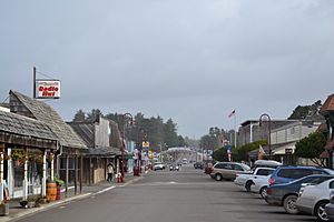
Bandon Historic District
|
|
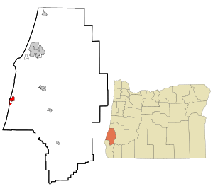
Location in Oregon
|
|
| Country | United States |
| State | Oregon |
| County | Coos |
| Incorporated | 1891 |
| Area | |
| • Total | 3.15 sq mi (8.15 km2) |
| • Land | 2.76 sq mi (7.15 km2) |
| • Water | 0.39 sq mi (1.00 km2) |
| Elevation | 72 ft (22 m) |
| Population
(2020)
|
|
| • Total | 3,321 |
| • Density | 1,203.26/sq mi (464.60/km2) |
| Time zone | UTC-8 (Pacific) |
| • Summer (DST) | UTC-7 (Pacific) |
| ZIP code |
97411
|
| Area code(s) | 541 |
| FIPS code | 41-03800 |
| GNIS feature ID | 2409782 |
Bandon (say "BAN-dun") is a city in Oregon, USA. It's located in Coos County, right where the Coquille River meets the ocean. An Irish settler named George Bennet founded Bandon in 1873. He named it after his hometown, Bandon, in Ireland. In 2020, about 3,321 people lived there.
Contents
Exploring Bandon's Past
Long ago, before 1850, the Coquille Native American people lived in the Bandon area. In 1851, gold was found at Whiskey Run Beach nearby, but it didn't change the area much. The first European settlers arrived in 1853 and started the town we know today. In 1856, after some conflicts, Native American people were moved to the Siletz Reservation.
In 1873, George Bennett, an Irish nobleman, officially founded Bandon. He and his sons came from Bandon, Ireland. The next year, the town's old name, Averille, was changed to Bandon. Over the years, more people arrived, and the town grew. A post office opened in 1877, and cheese making started in 1880. The first sawmill, school, and Catholic church were built in 1883.
George Bennett also brought a plant called gorse from Ireland. Gorse is a spiky plant that grows very thick, making it hard to walk through. It's also very oily and can catch fire easily. This plant later caused big problems for the town.
Cranberries: A Sweet History
Cranberries have been grown in Bandon since 1885. Charles McFarlin brought cranberry vines from Massachusetts and planted them. He had first come to look for gold in California, but when that didn't work out, he started growing cranberries. His cranberry bog was the first in Oregon and produced berries for 80 years! A type of cranberry, the McFarlin variety, is named after him. Bandon was also the first place to use "wet harvesting" for cranberries, where they flood the bogs to collect the berries.
In 2010, Bandon was even called one of the "Coolest Small Towns in America" by BudgetTravel magazine.
The Great Fire of 1936
On September 26, 1936, a big forest fire started east of Bandon. Suddenly, the wind changed direction and pushed the fire towards the town. The gorse plants, which were everywhere, caught fire easily because they are so oily. The fire spread quickly through the gorse.
Sadly, Bandon's entire business area was destroyed. The fire caused about $3 million in damage, and 11 people lost their lives. Firefighters found that putting water on burning gorse was like putting water on a kitchen grease fire – it just made the burning pieces spread even more.
After the fire, Bandon was rebuilt. Today, there's still gorse in Bandon, but the city has rules about how tall and thick it can grow to prevent another disaster.
Bandon's Geography and Weather
Bandon is about 3.15 square miles (8.15 square kilometers) in total size. Most of it is land, and a small part is water.
Bandon's Climate
| Weather chart for Bandon, Oregon | |||||||||||||||||||||||||||||||||||||||||||||||
|---|---|---|---|---|---|---|---|---|---|---|---|---|---|---|---|---|---|---|---|---|---|---|---|---|---|---|---|---|---|---|---|---|---|---|---|---|---|---|---|---|---|---|---|---|---|---|---|
| J | F | M | A | M | J | J | A | S | O | N | D | ||||||||||||||||||||||||||||||||||||
|
9.3
55
40
|
7.2
56
40
|
7.4
56
41
|
5.2
58
43
|
3
62
47
|
1.5
65
50
|
0.4
68
53
|
0.5
69
53
|
1.4
68
50
|
4
64
46
|
8.2
58
43
|
9.8
55
40
|
||||||||||||||||||||||||||||||||||||
| temperatures in °F precipitation totals in inches |
|||||||||||||||||||||||||||||||||||||||||||||||
|
Metric conversion
|
|||||||||||||||||||||||||||||||||||||||||||||||
Bandon has a mild climate, meaning it's not too hot or too cold. It's often drier and sunnier than other places on the Oregon coast. Winters usually have rain and cloudy skies, while summers are mostly dry. Snow doesn't happen very often, maybe once or twice a winter.
Temperatures rarely drop below freezing. Summers are cool, with average high temperatures around 68°F (20°C) in July. Sometimes, it can get warmer, into the 70s or 90s°F (20s or 30s°C), but that's not common. The highest temperature ever recorded in Bandon was 100°F (38°C) in September 1990. The lowest was 8°F (-13°C) in December 1990.
Who Lives in Bandon?
| Historical population | |||
|---|---|---|---|
| Census | Pop. | %± | |
| 1880 | 175 | — | |
| 1890 | 219 | 25.1% | |
| 1900 | 645 | 194.5% | |
| 1910 | 1,803 | 179.5% | |
| 1920 | 1,140 | −36.8% | |
| 1930 | 1,516 | 33.0% | |
| 1940 | 1,004 | −33.8% | |
| 1950 | 1,251 | 24.6% | |
| 1960 | 1,653 | 32.1% | |
| 1970 | 1,832 | 10.8% | |
| 1980 | 2,311 | 26.1% | |
| 1990 | 2,215 | −4.2% | |
| 2000 | 2,833 | 27.9% | |
| 2010 | 3,066 | 8.2% | |
| 2020 | 3,321 | 8.3% | |
| source: | |||
In 2010, about 3,066 people lived in Bandon. Most residents (92.6%) were White. About 5.5% of the population was Hispanic or Latino. The average age in Bandon was 53.4 years old. About 15.3% of the people were under 18, and 30% were 65 or older.
Bandon's Economy
Bandon used to have large fishing and timber (wood) industries. While some of these still exist, Bandon's economy now focuses on wood products, fishing, tourism, and farming. Some of the biggest employers in the area are Bandon Dunes Golf Course, Southern Coos Health District, and Oregon Overseas Timber.
Cheese Making in Bandon
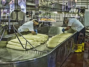
From 1928 to 2000, making cheese was a very important part of Bandon's economy. The original cheese factory was damaged in the 1936 fire but was rebuilt. In 2000, a larger company bought the "Bandon Cheese" brand and closed the factory.
However, in 2013, a new place called Face Rock Creamery opened on the same property. Here, cheesemakers create delicious gourmet cheeses by hand. Visitors can watch them make cheese, try samples, and buy products. The lead cheesemaker at Face Rock Creamery is even the son of the former lead cheesemaker from the old Bandon Cheese Factory!
Cranberry Industry: The Cranberry Capital
Bandon is known as the "Cranberry Capital of Oregon." More than 100 farmers grow cranberries on about 1,600 acres (6.5 square kilometers) around Bandon. This produces 95% of Oregon's cranberries and about 5% of all cranberries grown in the USA! Farmers harvest about 30 million pounds (14 million kg) of berries each year, mostly in the fall. Some berries are sent to other cities, and some go to a facility to be made into juice concentrate. You can even find cranberry wine made from Bandon cranberries.
Bandon also celebrates its cranberry heritage with a yearly Cranberry Festival.
Golf Resort: Bandon Dunes
Bandon Dunes Golf Resort is a famous place just north of Bandon. It has six golf courses, including five full-sized ones and a shorter 13-hole course. Several of its championship courses are considered among the best in Oregon!
Tourism: Bandon-by-the-Sea
The city is often called Bandon-by-the-Sea because of its beautiful coastal location. Many people visit Bandon for fun activities:
- Surfing and Kite Surfing: Bandon's beaches are great for surfers of all skill levels.
- Mountain Biking: The Whiskey Run Mountain Bike Trails are a popular spot for bikers.
- Storm Watching: During the winter, some tourists enjoy watching the powerful storms from safe viewpoints.
- West Coast Game Park Safari: This animal park is located just south of Bandon.
Bandon's Cranberry Festival
The Annual Cranberry Festival happens every year on the second weekend of September. It's a big celebration of the cranberry harvest and brings in visitors from all over Oregon, Washington, and California. The festival started in 1946, and 2023 marked its 77th year!
Cool Places to See in Bandon
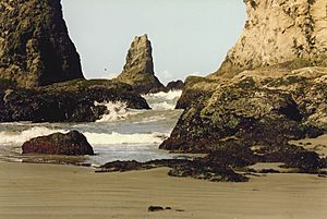
- Beaches and Rock Formations: Bandon is famous for its stunning beaches and unique rock formations, like Face Rock State Scenic Viewpoint.
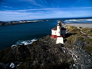
- Coquille River Lighthouse: You can find this historic lighthouse on the north side of the Coquille River, inside Bullards Beach State Park.
- Bullards Bridge: This bridge on U.S. Highway 101 leads into Bandon from the north and offers great views.
- Oregon Islands National Wildlife Refuge: This refuge protects many small islands and rocks along the coast, which are important for seabirds and marine animals.
Famous People from Bandon
- Bill Bradbury – A former Oregon Secretary of State.
- Wlnsvey Campos – A State Senator for Oregon.
- Randal O'Toole – An economist.
- James V. Scotti – An astronomer.
- Michael Waterman – A mathematician, computer scientist, and biologist.
- Timothy Zahn – An author.
Bandon in the News
- Bandon Western World – This is the local weekly newspaper.
- KBOG-LP 97.9 FM – This is a local radio station.
Sister City
Bandon has one sister city, which means it has a special friendly relationship with another city in the world:
See also
 In Spanish: Bandon (Oregón) para niños
 | Audre Lorde |
 | John Berry Meachum |
 | Ferdinand Lee Barnett |


