
Oakridge, Oregon facts for kids
Quick facts for kids
Oakridge, Oregon
|
|
|---|---|

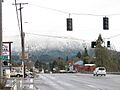
Highway 58 in Oakridge
|
|
| Motto(s):
Center of Oregon Outdoor Recreation, Mountain Biking Capital of the Northwest
|
|

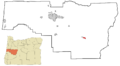
Location in Oregon
|
|
| Country | United States |
| State | Oregon |
| County | Lane |
| Incorporated | 1912 |
| Area | |
| • Total | 2.18 sq mi (5.65 km2) |
| • Land | 2.16 sq mi (5.60 km2) |
| • Water | 0.02 sq mi (0.05 km2) |
| Elevation | 1,211 ft (369 m) |
| Population
(2020)
|
|
| • Total | 3,206 |
| • Density | 1,482.89/sq mi (572.58/km2) |
| Time zone | UTC-8 (Pacific) |
| • Summer (DST) | UTC-7 (Pacific) |
| ZIP code |
97463
|
| Area code(s) | 458 and 541 |
| FIPS code | 41-54100 |
| GNIS feature ID | 2411297 |
| Website | www.ci.oakridge.or.us |
Oakridge is a city in Lane County, Oregon, in the United States. In 2020, about 3,206 people lived there.
Oakridge is located east of Westfir on Oregon Route 58. It's about 40 miles (64 km) east of Eugene. The city is surrounded by the Willamette National Forest and the Cascade Range. This makes Oakridge a popular spot for outdoor activities. People enjoy hiking, mountain biking, seeing wildflowers, fly fishing, and birding. There are also many watersports and the nearby Willamette Pass Resort for skiing.
The area was first called "Hazeldell" in 1888. Later, a train station opened in 1912. A railroad executive named it "Oak Ridge" because of the hills around it. The name was officially changed to "Oakridge" that same year. For a long time, the economy of Oakridge relied on lumber mills. After these mills closed in the 1980s, the city started focusing on outdoor recreation. New businesses like a general store, a bakery, and a brewery have opened.
Contents
History of Oakridge


People first explored the Oakridge area in 1852. They were looking for a path for pioneers to travel from Central Oregon to the Willamette Valley. Before this, the Kalapuya people had lived in villages along the rivers for a very long time.
The area had a post office named "Hazeldell" in 1888. Over time, the name changed to "Big Prairie," then "Oak Ridge." In 1912, the community officially became "Oakridge." This city has been many things: a mountain ranch, a busy railroad town, a place for loggers, and now a spot for outdoor enthusiasts.
Railroad's Impact on Oakridge
The Southern Pacific Railroad helped Oakridge grow quickly. By 1910, work began on Tunnel 22, which connected Oakridge to Westfir. Oakridge was an important stop on the Southern Pacific's Cascade line. This line goes over Willamette Pass and was built in 1926. The railroad was a big part of life and the economy in Oakridge.
Today, the Union Pacific Railroad still uses these tracks. You can often see trains in Oakridge. The Amtrak Coast Starlight passenger train passes through the town, but it does not stop there.
Lumber Mills and Changes
In 1946, the Pope and Talbot Lumber Company bought land near Oakridge. By 1948, they built a large sawmill and started a huge logging operation. This mill eventually hired over 500 people. The railroad and the sawmills helped the population grow in the 1960s and 1970s. During this time, the community of Willamette City joined Oakridge.
However, things changed. In 1978, the Hines mill in Westfir closed. By 1985, the Pope and Talbot Mill had closed too, laying off all its workers. The City of Oakridge now owns the land where the Pope and Talbot sawmill used to be.
In February 2019, an Amtrak Coast Starlight train got stuck near Oakridge for more than 36 hours. This happened because of a very heavy snowstorm.
Geography of Oakridge
Oakridge is located in a small valley at the bottom of the Cascade Range. It sits about 1,200 to 1,600 feet (366 to 488 meters) above sea level. The city is completely surrounded by the Willamette National Forest.
There are five important streams and rivers in and around Oakridge: Salmon Creek, Salt Creek, Hills Creek, and the Middle and North forks of the Willamette River. The North Fork of the Willamette River is a special "Wild and Scenic" river.
You can see Diamond Peak from many places in Oakridge. This mountain is a shield volcano located in the nearby Diamond Peak Wilderness. Waldo Lake, which is known as one of the cleanest lakes in the world, is about 20 miles (32 km) east of town. Salt Creek Falls, one of Oregon's largest waterfalls, is also about 20 miles (32 km) east.
Climate in Oakridge
Oakridge has warm and dry summers. The average monthly temperature in summer is around 71.6°F (22°C). This type of weather is called a warm-summer Mediterranean climate. Oakridge is below the snow line for the Cascades. This means it's usually the last stop on Highway 58 from Eugene where you don't need snow chains for your car.
| Climate data for Oakridge Fish Hatchery, Oregon, 1991–2020 normals, extremes 1923–present | |||||||||||||
|---|---|---|---|---|---|---|---|---|---|---|---|---|---|
| Month | Jan | Feb | Mar | Apr | May | Jun | Jul | Aug | Sep | Oct | Nov | Dec | Year |
| Record high °F (°C) | 71 (22) |
79 (26) |
86 (30) |
97 (36) |
106 (41) |
110 (43) |
112 (44) |
108 (42) |
108 (42) |
99 (37) |
78 (26) |
66 (19) |
112 (44) |
| Mean maximum °F (°C) | 53.9 (12.2) |
62.8 (17.1) |
72.2 (22.3) |
79.7 (26.5) |
86.3 (30.2) |
88.4 (31.3) |
93.2 (34.0) |
95.3 (35.2) |
92.2 (33.4) |
78.1 (25.6) |
61.7 (16.5) |
53.5 (11.9) |
97.3 (36.3) |
| Mean daily maximum °F (°C) | 43.8 (6.6) |
49.2 (9.6) |
54.5 (12.5) |
59.3 (15.2) |
65.8 (18.8) |
71.2 (21.8) |
80.0 (26.7) |
81.0 (27.2) |
75.8 (24.3) |
62.8 (17.1) |
49.0 (9.4) |
42.4 (5.8) |
61.2 (16.2) |
| Daily mean °F (°C) | 37.6 (3.1) |
40.7 (4.8) |
44.3 (6.8) |
48.3 (9.1) |
54.2 (12.3) |
59.1 (15.1) |
65.4 (18.6) |
65.5 (18.6) |
60.7 (15.9) |
51.3 (10.7) |
42.1 (5.6) |
37.0 (2.8) |
50.5 (10.3) |
| Mean daily minimum °F (°C) | 31.4 (−0.3) |
32.2 (0.1) |
34.1 (1.2) |
37.4 (3.0) |
42.6 (5.9) |
47.0 (8.3) |
50.7 (10.4) |
50.0 (10.0) |
45.5 (7.5) |
39.9 (4.4) |
35.2 (1.8) |
31.6 (−0.2) |
39.8 (4.3) |
| Mean minimum °F (°C) | 23.2 (−4.9) |
24.8 (−4.0) |
27.1 (−2.7) |
30.1 (−1.1) |
33.5 (0.8) |
39.7 (4.3) |
44.2 (6.8) |
43.3 (6.3) |
37.4 (3.0) |
30.3 (−0.9) |
26.5 (−3.1) |
22.4 (−5.3) |
19.4 (−7.0) |
| Record low °F (°C) | −1 (−18) |
2 (−17) |
18 (−8) |
25 (−4) |
21 (−6) |
29 (−2) |
33 (1) |
31 (−1) |
28 (−2) |
20 (−7) |
14 (−10) |
−1 (−18) |
−1 (−18) |
| Average precipitation inches (mm) | 6.23 (158) |
4.57 (116) |
5.01 (127) |
4.26 (108) |
3.23 (82) |
1.95 (50) |
0.53 (13) |
0.56 (14) |
1.58 (40) |
3.63 (92) |
6.66 (169) |
7.54 (192) |
45.75 (1,162) |
| Average snowfall inches (cm) | 1.3 (3.3) |
1.3 (3.3) |
0.6 (1.5) |
0.1 (0.25) |
0.0 (0.0) |
0.0 (0.0) |
0.0 (0.0) |
0.0 (0.0) |
0.0 (0.0) |
0.0 (0.0) |
0.3 (0.76) |
1.6 (4.1) |
5.2 (13) |
| Average precipitation days (≥ 0.01 in) | 15.7 | 14.0 | 15.2 | 15.8 | 11.3 | 6.7 | 2.0 | 2.1 | 4.4 | 10.4 | 15.8 | 16.8 | 130.2 |
| Average snowy days (≥ 0.1 in) | 0.9 | 0.8 | 0.6 | 0.1 | 0.0 | 0.0 | 0.0 | 0.0 | 0.0 | 0.0 | 0.2 | 1.0 | 3.6 |
| Source: NOAA | |||||||||||||
People in Oakridge
| Historical population | |||
|---|---|---|---|
| Census | Pop. | %± | |
| 1940 | 520 | — | |
| 1950 | 1,562 | 200.4% | |
| 1960 | 1,973 | 26.3% | |
| 1970 | 3,422 | 73.4% | |
| 1980 | 3,729 | 9.0% | |
| 1990 | 3,063 | −17.9% | |
| 2000 | 3,148 | 2.8% | |
| 2010 | 3,205 | 1.8% | |
| 2020 | 3,206 | 0.0% | |
| U.S. Decennial Census | |||
In 2010, there were 3,205 people living in Oakridge. This was a small increase from 3,148 people in 2000. There were 1,437 households and 849 families.
Most people in Oakridge are White (about 91%). About 1.8% are Native American. About 5.4% of the population is Hispanic or Latino.
The average age in the city was about 48 years old. About 20% of the people were under 18. About 23% were 65 years or older. The city had slightly more males (50.2%) than females (49.8%).
Oakridge's Economy
The two biggest employers in Oakridge are the Oakridge School District and the United States Forest Service.
Recently, the city's economy has been changing. It now focuses more on outdoor activities and local artists. Many new small businesses have opened. These include a bike and ski shop, an outdoor guide service, a brewery, and a bakery. The Uptown business area has a group called the Uptown Business Revitalization Association (UBRA). This group works to bring new businesses to the area. Many people who live in Oakridge travel to Eugene for work, since it's less than an hour away.
Getting Around Oakridge
Roads
State Highway 58 is an important road for trucks and cars. It connects Highway 97 and Interstate 5. Highway 58 runs east–west and links the Willamette Valley with Central Oregon. It goes through the Willamette National Forest and the Cascade Range.
Trains
The Union Pacific Railroad has a main train line that runs through Oakridge. This line carries cargo across the western United States. Amtrak also uses this line for passenger trains. You can catch an Amtrak train in Eugene to travel to other cities.
Buses
The Lane Transit District has a bus service called Diamond Express. It runs three times a day on weekdays. This bus connects Oakridge to the Eugene and Springfield areas.
Air Travel

Oakridge State Airport is a public airport located about 1 mile (1.6 km) west of Oakridge. For bigger flights, the Eugene Airport is about 45 miles (72 km) west. It offers passenger and cargo flights to many places.
Shipping Ports
The closest large shipping ports to Oakridge are the Port of Coos Bay and the Port of Portland. The Port of Coos Bay is about 145 miles (233 km) west in Coos Bay. The Port of Portland is about 149 miles (240 km) north in Portland.
Education in Oakridge
The Oakridge School District has two schools. They serve children from Oakridge, Westfir, and nearby areas like High Prairie.
- Oakridge Elementary School - For students in Kindergarten through 6th grade.
- Oakridge High School - For students in 7th through 12th grade.
In 2008, U.S. News & World Report recognized Oakridge High School as one of the best high schools in America.
For higher education, the University of Oregon and Lane Community College are located about 40 miles (64 km) to the west.
The Oakridge Public Library was built in 2012. It is located next to the city hall. A federal grant of $800,000 helped pay for it. The new library replaced a smaller one that was inside the city hall building.
Famous People from Oakridge
- Laddie Gale, an American basketball player.
- Mason Williams, a composer known for "Classical Gas".
- Maximo Yabes, a recipient of the Medal of Honor.
Images for kids
-
Highway 58 in Oakridge
-
Location in Oregon
See also
 In Spanish: Oakridge (Oregón) para niños
