Salt Creek (Middle Fork Willamette River tributary) facts for kids
Quick facts for kids Salt Creek |
|
|---|---|

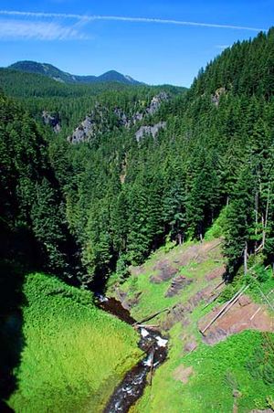
Salt Creek in the canyon below Salt Creek Falls
|
|
| Country | United States |
| State | Oregon |
| County | Lane |
| Physical characteristics | |
| Main source | Lower Betty Lake southeast of Waldo Lake 5,481 ft (1,671 m) 43°40′09″N 122°01′17″W / 43.66917°N 122.02139°W |
| River mouth | Middle Fork Willamette River just below Hills Creek Dam 1,225 ft (373 m) 43°43′31″N 122°26′16″W / 43.72528°N 122.43778°W |
| Length | 30 mi (48 km) |
Salt Creek is a river in Oregon, United States. It flows for about 30 miles (48 km) before joining the Middle Fork Willamette River. The creek gets its name from natural salt springs found along its banks. These springs are like natural salt licks, which deer love to visit.
Salt Creek starts as water flowing out of Lower Betty Lake. This lake is located in the beautiful, forested Cascade Range, just southeast of Waldo Lake.
Contents
The Journey of Salt Creek
From Lower Betty Lake, Salt Creek flows generally south. It passes through another lake called Gold Lake. Then, it meets Route 58. The creek follows this highway mostly northwest for about 26 miles (42 km). Finally, it reaches its end at the Middle Fork Willamette River, just below Hills Creek Dam.
Salt Creek Falls: A Mighty Waterfall
One of the most amazing parts of Salt Creek is Salt Creek Falls. This waterfall is about 4 miles (6.4 km) west of Willamette Pass. It's also a little more than 22 miles (35 km) upstream from where the creek joins the Willamette River.
At Salt Creek Falls, the water plunges a huge 286 feet (87 m) down! That's like falling from a 28-story building. On average, about 50,000 U.S. gallons (190,000 L) of water rushes over the falls every minute.
The Canyon Below the Falls
After the falls, Salt Creek flows into a narrow canyon. This canyon was shaped over many years by glaciers. It was also formed by basalt lava flows that came from higher up in the Cascades mountains.
McCredie Hot Springs
Along the lower part of Salt Creek, next to Route 58, you can find McCredie Hot Springs. These are natural hot springs. They are located near the place that used to be a community called McCredie Springs.
Nature Around Salt Creek
The area around Salt Creek is a temperate coniferous forest. This means it's a cool, moist forest with lots of cone-bearing trees.
Common Trees in the Forest
The main types of trees you'll find here include:
Fish Life in Salt Creek
Salt Creek is home to several types of fish, mostly trout. The main trout species are:
About Brook Trout
The brook trout are not originally from this area. They were brought and released into lakes in and around the Salt Creek watershed. Now, many of them live in the upper parts of Salt Creek.
Bull Trout: A Lost Species
Sadly, Bull trout used to live in Salt Creek. However, their homes were damaged throughout the entire Willamette River basin. Things like building dams reduced and completely removed some of these fish populations.
 | Chris Smalls |
 | Fred Hampton |
 | Ralph Abernathy |

