Millersburg, Oregon facts for kids
Quick facts for kids
Millersburg, Oregon
|
|
|---|---|

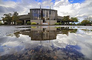
Millersburg City Hall
|
|
| Motto(s):
A Community Linking Agriculture and Industry
|
|

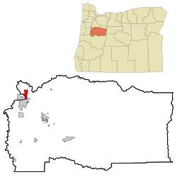
Location in Oregon
|
|
| Country | United States |
| State | Oregon |
| County | Linn |
| Incorporated | 1974 |
| Area | |
| • Total | 4.68 sq mi (12.12 km2) |
| • Land | 4.46 sq mi (11.56 km2) |
| • Water | 0.22 sq mi (0.56 km2) |
| Elevation | 220 ft (70 m) |
| Population
(2020)
|
|
| • Total | 2,919 |
| • Density | 654.04/sq mi (252.53/km2) |
| Time zone | UTC-8 (Pacific) |
| • Summer (DST) | UTC-7 (Pacific) |
| ZIP code |
97321
|
| Area code(s) | 458 and 541 |
| FIPS code | 41-48300 |
| GNIS feature ID | 2411111 |
Millersburg is a city located in Linn County, Oregon, in the United States. It started as a train station on the Southern Pacific railroad line. The station was named after a farming family who lived in the area. In 2010, about 1,329 people lived there. By 2020, the population had grown to 2,919.
Contents
History of Millersburg
Millersburg became an official city in 1974. This happened to stop the nearby city of Albany from expanding its borders. Albany wanted to include the area where the Wah Chang Corporation had a factory. This factory processed a metal called zirconium for the United States government.
Today, the factory is owned by Allegheny Technologies and is known as ATI Wah Chang. It is the biggest employer in Millersburg.
For many years, Millersburg was known for a strong smell. People often thought it came from the Wah Chang factory. However, the smell actually came from the nearby Weyerhaeuser wood products mill. This led to efforts to close both factories.
In 2008, Weyerhaeuser sold its mill to International Paper. International Paper then closed the mill at the end of 2009. This meant 270 employees lost their jobs. The mill remained empty for some time. On July 22, 2010, the old paper mill began to be taken down. A large part of it was demolished by explosion.
In 2008, a company called Peak Sun Silicon built a large factory in Millersburg. It was about 10,000 square feet (929 square meters). This factory made polysilicon, a material used in solar panels. About 50 people worked there, and the company planned to hire up to 500 more by 2013. However, Peak Sun Silicon could not pay back a loan from the Oregon Department of Energy. Because of this, the company lost its land in Oregon.
Geography of Millersburg
Millersburg covers a total area of about 4.65 square miles (12.04 square kilometers). Most of this area, about 4.43 square miles (11.47 square kilometers), is land. The remaining 0.22 square miles (0.57 square kilometers) is water.
Population and People
| Historical population | |||
|---|---|---|---|
| Census | Pop. | %± | |
| 1980 | 562 | — | |
| 1990 | 715 | 27.2% | |
| 2000 | 651 | −9.0% | |
| 2010 | 1,329 | 104.1% | |
| 2020 | 2,919 | 119.6% | |
| U.S. Decennial Census | |||
2010 Census Information
In 2010, the city of Millersburg had 1,329 people living there. These people lived in 504 households, and 387 of these were families. On average, there were about 300 people per square mile (115.8 people per square kilometer). There were 538 homes in the city.
Most of the people in Millersburg were White (91.9%). A small number were Native American (1.1%) or Asian (1.4%). About 6.6% of the population identified as Hispanic or Latino.
Out of the 504 households:
- About 34% had children under 18 living with them.
- Most households (65.3%) were married couples living together.
- Some households (7.5%) had a female head without a husband.
- A small number (4.0%) had a male head without a wife.
- About 23% were not families.
The average household had 2.63 people, and the average family had 2.92 people. The average age of people in Millersburg was 41.2 years. About 23.6% of residents were under 18 years old. About 14.1% were 65 years or older. The population was almost evenly split between males (50.6%) and females (49.4%).
See also
 In Spanish: Millersburg (Oregón) para niños

