Clatsop County, Oregon facts for kids
Quick facts for kids
Clatsop County
|
||
|---|---|---|
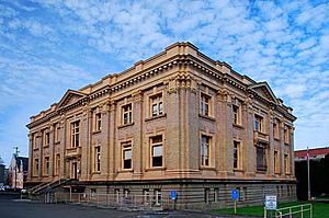
Clatsop County Courthouse in Astoria
|
||
|
||
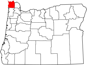
Location within the U.S. state of Oregon
|
||
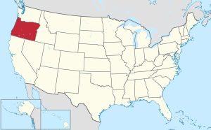 Oregon's location within the U.S. |
||
| Country | ||
| State | ||
| Founded | June 22, 1844 | |
| Named for | Clatsop Tribe | |
| Seat | Astoria | |
| Largest city | Astoria | |
| Area | ||
| • Total | 1,084 sq mi (2,810 km2) | |
| • Land | 829 sq mi (2,150 km2) | |
| • Water | 255 sq mi (660 km2) 24%% | |
| Population
(2020)
|
||
| • Total | 41,072 | |
| • Estimate
(2023)
|
41,102 |
|
| • Density | 38/sq mi (15/km2) | |
| Congressional district | 1st | |
Clatsop County is the very northernmost county in the state of Oregon. In 2020, about 41,072 people lived here. The main city and county seat is Astoria.
The county gets its name from the Clatsop tribe. These Native American people lived along the Pacific Ocean coast long before European settlers arrived. Clatsop County is part of an area called the Sunset Empire in Northwest Oregon.
Contents
History of Clatsop County
The famous Lewis and Clark Expedition spent the winter of 1805–1806 in this area. They built Fort Clatsop, which was one of the first American structures on the west coast.
Astoria, Oregon's oldest town, started as a place for trading animal furs in 1811. It was named after a person called John Jacob Astor.
Clatsop County was officially created on June 22, 1844. It was formed from parts of an older area called the Twality District. For a short time, Clatsop County even stretched north into what is now Washington. The county's borders changed a few times in the years that followed.
Before 1850, most of the county's government work happened in a community called Lexington. This area is now part of Warrenton. But as Astoria grew, it became the center for business and social life. So, in 1854, people voted to make Astoria the new county seat.
World War II Attack
Fort Stevens is a military base located near the mouth of the Columbia River. During World War II, it was the only military base on the mainland United States to be attacked by an enemy.
On June 21, 1942, a Japanese submarine fired 17 shells at the base. The damage was very small, mostly just a baseball backstop and a power line. The submarine got away because the order was given not to fire back with the large shore guns. Even though the damage was minor, the attack caused worry along the Pacific coast.
Idea to Join Washington
In 1975, some leaders in Clatsop County thought about leaving Oregon. They wanted the county to become part of Washington. This idea came from disagreements with Oregon's Governor, Bob Straub.
It happened after a company decided not to build a factory in the county. Some residents blamed the Governor for this. However, Washington's Governor, Daniel J. Evans, said Clatsop County was not welcome in his state. The idea was then dropped by the county leaders.
Geography and Nature
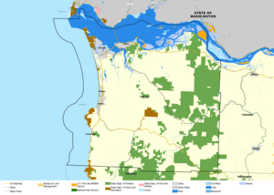
Clatsop County covers about 1,084 square miles. About 829 square miles are land, and 255 square miles are water. This means about 24% of the county is water.
The tallest point in the county is Saddle Mountain. It stands about 3,283 feet (1,001 meters) tall. It is part of the Northern Oregon Coast Range.
Main Roads
 U.S. Route 26
 U.S. Route 30
 U.S. Route 101
Protected Natural Areas
Clatsop County is home to parts of several national protected areas:
- Julia Butler Hansen National Wildlife Refuge
- Lewis and Clark National Historical Park
- Lewis and Clark National Wildlife Refuge
- Oregon Islands National Wildlife Refuge
Unique Plants
Clatsop County has several rare or special plant species. These include unique types of grasses, flowers, and other plants that are not found in many other places.
People of Clatsop County
| Historical population | |||
|---|---|---|---|
| Census | Pop. | %± | |
| 1850 | 462 | — | |
| 1860 | 498 | 7.8% | |
| 1870 | 1,255 | 152.0% | |
| 1880 | 7,222 | 475.5% | |
| 1890 | 10,016 | 38.7% | |
| 1900 | 12,765 | 27.4% | |
| 1910 | 16,106 | 26.2% | |
| 1920 | 23,030 | 43.0% | |
| 1930 | 21,124 | −8.3% | |
| 1940 | 24,697 | 16.9% | |
| 1950 | 30,776 | 24.6% | |
| 1960 | 27,380 | −11.0% | |
| 1970 | 28,473 | 4.0% | |
| 1980 | 32,489 | 14.1% | |
| 1990 | 33,301 | 2.5% | |
| 2000 | 35,630 | 7.0% | |
| 2010 | 37,039 | 4.0% | |
| 2020 | 41,072 | 10.9% | |
| 2023 (est.) | 41,102 | 11.0% | |
| U.S. Decennial Census 1790–1960 1900–1990 1990–2000 2010–2020 |
|||
In 2010, there were 37,039 people living in Clatsop County. Most people (about 90.9%) were white. Other groups included Asian, American Indian, Black, and Pacific Islander people. About 7.7% of the population was of Hispanic or Latino background.
Many people in the county have ancestors from Germany (22.8%), England (15.4%), or Ireland (14.2%). The average age of people in the county was about 43.2 years old.
Economy and Tourism
The main ways people make a living in Clatsop County are through manufacturing (making things), travel (especially tourism), and trade. Fishing and timber (wood from trees) used to be very important. They are still part of the economy, but not as much as before.
About 30% of the land in the county belongs to the state of Oregon as state forests. The Port of Astoria was started in 1914 to help with trade and business.
Fun Places to Visit
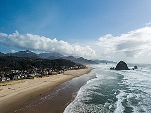
Tourism is a big part of Clatsop County's economy. Many people visit the area each year.
Astoria, Oregon, the county seat, has many fun places to see:
- The Astoria Riverfront Trolley lets you ride along the river.
- Fort Clatsop is a replica of the fort built by Lewis and Clark.
- The Uppertown Firefighters Museum shows old fire trucks and equipment.
- The Columbia River Maritime Museum teaches about ships and the sea.
Seaside, Oregon is known as Oregon's oldest beach resort town. It also has cool attractions:
- The Seaside Aquarium lets you see marine animals.
- The Seaside Historical Society Museum shares the town's history.
Communities in Clatsop County
Cities
Census-Designated Places
These are areas that are like towns but are not officially incorporated as cities.
- Jeffers Garden
- Knappa
- River Point
- Svensen
- Westport
Other Communities (Unincorporated)
These are smaller communities that are not part of a city or census-designated place.
- Arch Cape
- Bradwood
- Brownsmead
- Carnahan
- Clifton
- Elsie
- Fern Hill
- Fort Stevens
- Grand Rapids
- Hamlet
- Jeffers Garden
- Jewell
- Jewell Junction
- Lukarilla
- Melville
- Miles Crossing
- Mishawaka
- Navy Heights
- Necanicum
- Oklahoma Hill
- Olney
- Sunset Beach
- Surf Pines
- Svensen Junction
- Taylorville
- Tolovana Park
- Tongue Point Village
- Vesper
- Vinemaple
- Wauna
Former Unincorporated Communities
See also
 In Spanish: Condado de Clatsop para niños
 | William M. Jackson |
 | Juan E. Gilbert |
 | Neil deGrasse Tyson |


