South Saddle Mountain facts for kids
Quick facts for kids South Saddle Mountain |
|
|---|---|

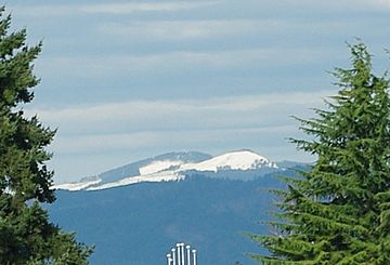
The tops of the two peaks of the mountain.
|
|
| Highest point | |
| Elevation | 3,465 ft (1,056 m) NAVD 88 |
| Geography | |
| Parent range | Northern Oregon Coast Range |
| Topo map | USGS Roaring Creek |
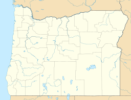
South Saddle Mountain is the tallest mountain in Washington County, Oregon, United States. It is part of the Oregon Coast Range. This peak is found in the Tillamook State Forest in the northwest part of Oregon. It is the eighth-highest peak in the entire Oregon Coast Range.
Contents
Why is it Called South Saddle Mountain?
South Saddle Mountain is one of 17 peaks in Oregon that have "Saddle" in their name. It was first known simply as Saddle Mountain.
In 1983, its name officially changed to South Saddle Mountain. This was done to avoid confusion. There is another Saddle Mountain about 33 miles (53 km) north in Clatsop County.
How South Saddle Mountain Was Formed
The story of South Saddle Mountain began about 40 million years ago. This was during a time called the Eocene age. During this period, soft rocks like sandstone and siltstone formed in the area.
Later, igneous rocks and basalt flows joined with basaltic sandstone. These materials created most of the mountain's shape. Other rocks in the area, called sedimentary rocks, formed more recently. This happened about 20 million years ago. Scientists think this region might have been an island during the Eocene age.
What Can You Find on the Mountain?
The lower peak of South Saddle Mountain has a microwave transmission tower. This tower is about 110-foot-tall (34 m). It helps send radio signals and has an AT&T microwave transmitter.
The lower parts of the mountain are popular for different activities. Many people enjoy watching birds here. It's also a favorite spot for off-road motorcycle riders.
Plants and Animals of the Mountain
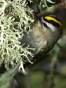
The forests around the mountain are filled with western hemlock and Douglas fir trees. Many types of birds live in this area. You might see a hermit warbler or a sooty grouse. Other birds include the chestnut-backed chickadee and the golden-crowned kinglet. You can also spot a Steller's jay or a Pacific-slope flycatcher.
Getting to South Saddle Mountain
South Saddle Mountain is about 7 miles (11 km) northwest of Henry Hagg Lake. It is also directly west of Forest Grove.
To get there, you can take Oregon Route 6. From mile post 33 near Lees Camp, turn onto Saddlemountain Road. After about nine miles on this road, you will reach a gate. The summit is then just 0.5 miles from that gate. The lower peak, which holds the radio tower, is located in Tillamook County.
 | Toni Morrison |
 | Barack Obama |
 | Martin Luther King Jr. |
 | Ralph Bunche |


