Long Tom River facts for kids
Quick facts for kids Long Tom River |
|
|---|---|

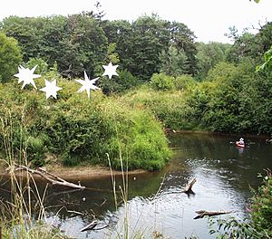
The Long Tom River as it appears while passing through the Oregon Country Fair's land near Veneta
|
|
|
Location of the mouth of the Long Tom River in Oregon
|
|
| Country | United States |
| State | Oregon |
| County | Lane and Benton |
| Physical characteristics | |
| Main source | Central Oregon Coast Range Long Tom Station, Lane County 1,131 ft (345 m) 44°13′12″N 123°26′39″W / 44.22000°N 123.44417°W |
| River mouth | Willamette River Norwood Island, Benton County 256 ft (78 m) 44°22′48″N 123°14′54″W / 44.38000°N 123.24833°W |
| Length | 57 mi (92 km) |
| Basin features | |
| Basin size | 410 sq mi (1,100 km2) |
The Long Tom River is a 57-mile (92 km) long river in western Oregon, United States. It's like a smaller river that flows into a bigger one, the Willamette River. The Long Tom River helps drain water from the southern part of the Willamette Valley, an area between the cities of Eugene and Corvallis.
Contents
Where the Long Tom River Flows
The Long Tom River starts in the Central Oregon Coast Range mountains. This is in western Lane County, about 10 mi (16 km) west of Veneta. From there, it flows east through the mountains towards Veneta.
Journey Through Fern Ridge Reservoir
The river then flows into the Fern Ridge Reservoir. This reservoir was created in 1942. The United States Army Corps of Engineers built a dam on the river to help control floods. After the reservoir, the river turns north. It flows through the Willamette Valley, running somewhat parallel to the Willamette River.
Joining the Willamette River
Finally, the Long Tom River meets the Willamette River. This meeting point is about 4 mi (6.5 km) west of Halsey.
The Long Tom River Watershed
A watershed is an area of land where all the water drains into a specific river or body of water. The Long Tom River watershed covers about 410 sq mi (1,100 km2) of land. This area is made up of different types of land:
- 45 percent is forest.
- 30 percent is used for farming.
- 8 percent is public land.
- 17 percent is for homes, both in cities and in the countryside.
People and Communities
The water from the Long Tom River helps more than 140,000 people. This includes people living in the city of Veneta. It also supports rural farming communities like Alvadore, Cheshire, Crow, Franklin, and Noti. Some industrial and business areas on the west side of Eugene also use water from the river.
Native American History
Before European settlers arrived, the lands around the Long Tom River were home to the Chelamela group. These were part of the Kalapuya Indians.
Protecting the River
Many groups work to keep the Long Tom River healthy. The Oregon Country Fair is one of these groups. They work with the Long Tom Watershed Council to protect and restore the river's environment.
River's Name Origin
The name "Long Tom River" came about in the 1800s. It was inspired by a local Native American group. This group was called Lung-tum-ler. Their name in the Kalapuyan language was [lámpʰtumpif].
Rivers and Streams Joining the Long Tom
Many smaller streams flow into the Long Tom River. These are called tributaries. They join the river from its starting point all the way to its end.
Tributaries Before the Reservoir
Some of the streams that join the river before it reaches Fern Ridge Reservoir are:
- Micheals Creek
- Jones Creek
- Swamp Creek
- Dusky Creek
- Hayes Creek
- Sweet Creek
- Green Creek
- Gold Creek
- Noti Creek
- Wilson Creek
- Indian Creek
Streams Entering Fern Ridge Reservoir
Several streams flow directly into the Fern Ridge Reservoir:
- Hannavan Creek
- Inman Creek
- Coyote Creek
Tributaries After the Reservoir
After the river leaves the reservoir, more streams join it:
- Squaw Creek
- A second Coyote Creek
- Lingo Slough
- Bear Creek
- Amazon Creek
- Ferguson Creek
- Shafer Creek
- Miller Creek
 | Janet Taylor Pickett |
 | Synthia Saint James |
 | Howardena Pindell |
 | Faith Ringgold |


