
Columbia River Basalt Group facts for kids
The Columbia River Basalt Group is the youngest and one of the best-preserved areas of huge lava flows on Earth. It covers over 210,000 square kilometers (about 81,000 square miles) mainly in eastern Oregon and Washington, western Idaho, and parts of northern Nevada. This group of basalt rocks includes the Steen and Picture Gorge basalt formations.

Contents
What is the Columbia River Basalt Group?
About 17 to 6 million years ago, during a time called the Miocene epoch, huge amounts of lava covered much of the Pacific Northwest. This created a massive area of volcanic rock, estimated to be about 174,300 cubic kilometers (about 41,800 cubic miles) in volume. Most of this lava erupted very quickly, between 17 and 14 million years ago.
Later, giant floods called the Missoula Floods carved through these lava layers. This exposed many of the basalt flows in places like Wallula Gap, the Palouse River, the Columbia River Gorge, and the Channeled Scablands.
Scientists think the Columbia River Basalt Group might be connected to similar lava flows in British Columbia, Canada. Also, some ancient lake sediments in Washington and Idaho are mixed with these lava flows.
To figure out the age of these rocks, scientists use radiometric dating. This method looks at tiny amounts of different elements in the rock to tell when the lava cooled and became solid.
Other famous flood basalt areas around the world include the Deccan Traps in India, the Emeishan Traps in China, and the Siberian Traps in Russia.
How Did the Columbia River Basalt Group Form?
Over a period of 10 to 15 million years, many layers of lava poured out from long cracks in the Earth. These cracks, called dikes, followed an old fault line from southeastern Oregon up to western British Columbia. The lava layers eventually became more than 1.8 kilometers (about 5,900 feet) thick.
As the molten rock came to the surface, the Earth's crust slowly sank into the empty space left behind. This sinking created a large, slightly lower area now known as the Columbia Plateau. The moving lava also pushed the ancient Columbia River into its current path.
When the lava flowed, it first filled old river valleys. This created natural dams and formed lakes. In the beds of these ancient lakes, scientists have found amazing fossils, like leaf prints, petrified wood, fossil insects, and bones of ancient animals.
Scientists believe that the lava flows came from a common source: the Yellowstone hotspot. This is a place deep under the Earth where hot rock rises, similar to what happens under Hawaii today. As this hot rock rises and reaches lower pressures, it melts and forms magma. When this magma breaks through the surface, it flows as lava and then hardens into basalt rock.
From Volcanoes to Lava Floods
Before about 17.5 million years ago, the Cascade volcanoes erupted regularly, just like they do today. But then, something changed, and huge amounts of lava started to flood the land.
These lava flows are divided into four main types: the Steens Basalt, Grande Ronde Basalt, Wanapum Basalt, and Saddle Mountains Basalt. Scientists use radiometric dating to find the exact age of these flows. The Columbia River flood basalt area has more than 300 separate lava flows. Each flow had an average volume of 500 to 600 cubic kilometers (about 120 to 144 cubic miles).
When these huge lava flows erupted, they also released massive amounts of gases into the air. This is called volcanic degassing. For example, one large flow called the Roza flow released a lot of sulfur dioxide, which can turn into sulfuric acid in the atmosphere. Other gases like hydrochloric acid and hydrofluoric acid were also released. These gases can affect the atmosphere and climate.
Why Did All This Lava Erupt?
Many large lava flood events around the world are linked to "hotspots." In this case, the Yellowstone hotspot is thought to be the cause. The first eruptions of the Columbia River Basalt Group happened near Steens Mountain. As the North American Plate slowly moved westward (a few centimeters each year), the eruptions seemed to move across Idaho and into Wyoming. This means the lava flows get younger as you go east along this path, which fits the hotspot idea.
Scientists have more evidence for the Yellowstone hotspot. Using special images created from seismic waves (like an X-ray of the Earth), they have found narrow, deep plumes of hot rock under Yellowstone. These plumes are much more focused than the general movement of Earth's plates.


However, not everyone agrees completely with the hotspot idea. There are still some questions, like why the Yellowstone hotspot track seems to bend. More research is needed to fully understand how these massive lava flows happened.
How Fast Did the Lava Flow?
The lava flows of the Columbia River Basalt Group have very similar chemical properties throughout each flow. This suggests they were put in place very quickly. For example, the Ginkgo flow, which is 500 kilometers (about 310 miles) long, is thought to have formed in about a week.
Scientists looked at the temperature of the Ginkgo basalt from where it started near Kahlotus, Washington to where it ended in the Pacific Ocean near Yaquina Head, Oregon. The temperature only dropped by about 20°C (36°F) along the entire flow. This means the lava must have spread very fast to stay so uniform in temperature.

The lava likely flowed smoothly, like a sheet, at speeds of 1 to 8 meters per second (about 2 to 18 miles per hour). If it had flowed slower, water from rivers would have mixed in, causing it to cool faster and form more "pillow lava" (lava that cools underwater). This idea is also supported by other research that suggests rivers would have been re-established in their canyons within a few months after a lava flow.
How Do Scientists Date These Lava Flows?
Scientists use three main tools to date the Columbia River Basalt Group flows:
- Stratigraphy: This means studying the layers of rock. Major lava flows are laid down in layers, one on top of another. Scientists can tell different layers apart by their physical look and chemical makeup. Each layer is usually named after a place where it is well exposed. This helps scientists understand the relative order of the layers (which one is older or younger).
- Radiometric dating: This method gives an exact age. It uses the decay of radioactive elements, like potassium and argon, to find out when the basalt became solid.
- Magnetostratigraphy: This technique uses the Earth's magnetic field. When lava cools, tiny magnetic minerals inside it line up with the Earth's magnetic field at that time. By looking at the pattern of magnetic directions in different layers, scientists can match them to known changes in Earth's magnetic field over time.

The Steens Basalt flows, for example, recorded a detailed history of a magnetic reversal that happened about 15 million years ago. Over 10,000 years, more than 130 flows solidified, capturing the magnetic field's direction as they cooled.

The Major Columbia River Basalt Group Flows
Steens Basalt

The Steens Basalt flows are the oldest identified eruptions of the Columbia River Basalt Group. They covered about 50,000 square kilometers (about 19,300 square miles) of the Oregon Plateau, with layers up to 1 kilometer (about 3,300 feet) thick. You can see many layers of Steens basalt on the side of Steens Mountain.
A magnetic field reversal happened during the Steens Basalt eruptions about 16.7 million years ago. The rocks at Steens Mountain provide some of the most detailed information about this magnetic field flip ever found in volcanic rocks.
Imnaha Basalt

The Imnaha basalt flows erupted around the same time as the oldest Steens flows, covering northeastern Oregon. There were 26 major flows, with one erupting roughly every 15,000 years. These flows are mostly buried by newer lava, but you can see them along the Imnaha River and Snake River.
Grande Ronde Basalt

The Grande Ronde Basalt is the next oldest, erupting from 17 to 15.6 million years ago. It makes up about 85 percent of all the lava in the Columbia River Basalt Group! This lava came from many cracks, called dikes, near Joseph, Enterprise, Troy, and Walla Walla. Some of these cracks were 5 to 10 meters (about 16 to 33 feet) wide and up to 10 kilometers (about 6 miles) long, allowing huge amounts of magma to flow out.
Much of this lava flowed north into Washington and down the Columbia River channel to the Pacific Ocean. The enormous weight of this lava caused central Washington to sink, creating the wide Columbia Basin. You can see Grande Ronde basalt flows in the 2,000-foot (about 610-meter) walls of Joseph Canyon.

The Grande Ronde basalt also flowed down the ancient Columbia River channel west of the Cascade Mountains. You can find it exposed along the Clackamas River and at Silver Falls State Park, where waterfalls plunge over many layers of this basalt.
Some individual flows were incredibly large. For example, the McCoy Canyon flow released 4,278 cubic kilometers (about 1,026 cubic miles) of basalt in layers 10 to 60 meters (about 33 to 200 feet) thick.


Wanapum Basalt
The Wanapum Basalt includes several members: Eckler Mountain (15.6 million years ago), Frenchman Springs (15.5 million years ago), Roza (14.9 million years ago), and Priest Rapids (14.5 million years ago). These flows came from vents between Pendleton, Oregon and Hanford, Washington.
The Frenchman Springs Member flowed along similar paths as the Grande Ronde basalts. It reached the Pacific Ocean and can be found in the Columbia Gorge, along the upper Clackamas River, and as far west as Yaquina Head near Newport, Oregon, which is 750 kilometers (about 466 miles) away!
Saddle Mountains Basalt
The Saddle Mountains Basalt is the youngest of the major flows. It is clearly visible at the Saddle Mountains. This group includes flows like the Umatilla Member, Asotin Member (13 million years ago), Elephant Mountain Member (10.5 million years ago), and Ice Harbor Member (8.5 million years ago), with the Lower Monumental Member being the youngest at 6 million years ago.
Related Geologic Structures
Oregon High Lava Plains

Scientists have noticed that the Oregon High Lava Plains, which has different types of volcanic rock, seems to be connected to the Columbia River Basalt Group. Both started from the same point. The High Lava Plains have been spreading westward for about 10 million years, while the Snake River Plains (another volcanic area) spread eastward.
Images for kids
-
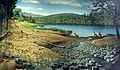
Restoration of Miocene animals at the Picture Gorge Basalts
-
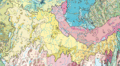
Level IV ecoregions in the Northern Basin and Range in Oregon, Idaho, Utah, and Nevada. The light brown region numbered 80g represent the High Lava Plains


