Palouse River facts for kids
Quick facts for kids Palouse River |
|
|---|---|

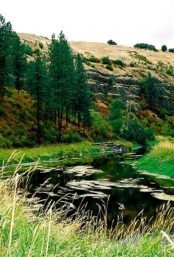
Several miles downstream from its fork in Colfax; looking west in 2007
|
|
|
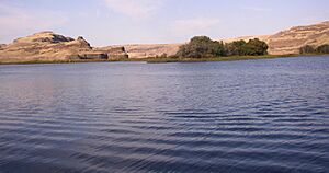
Palouse River's mouth in Washington
|
|
| Country | United States |
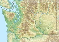
| State | Washington, Idaho |
| County | Franklin, Whitman, Adams, Latah |
| Physical characteristics | |
| Main source | Rocky Mountains 46°58′07″N 116°27′31″W / 46.9685°N 116.4587°W |
| River mouth | Snake River 541 ft (165 m) 46°35′24″N 118°12′55″W / 46.59000°N 118.21528°W |
| Length | 167 mi (269 km) |
| Basin features | |
| Basin size | 3,303 sq mi (8,550 km2) |
The Palouse River is a long river in the northwest United States. It flows through parts of Washington and Idaho. This river is a tributary, which means it's a smaller river that flows into a larger one. The Palouse River flows into the Snake River.
The Palouse River is about 167 miles (269 km) (269 km) long. It mostly flows southwest through a special area called the Palouse region in southeastern Washington. The water from the Palouse River eventually joins the Columbia River, because the Snake River is also a tributary of the Columbia.
A very long time ago, during the last ice age, huge floods called the Missoula Floods helped create the river's canyon. These powerful floods carved out the river's path over thousands of years.
Where the River Flows

The Palouse River starts in the Hoodoo Mountains in northern Idaho. It begins in a forest area called the St. Joe National Forest. From there, it flows west, following along State Highway 6 as it gets closer to the state border.
Once the river enters Washington, it flows through Whitman County. It passes through the town of Palouse and then reaches Colfax. In Colfax, another part of the river, called the South Fork, joins the main river. The South Fork starts near Moscow Mountain and flows past Moscow and Pullman.
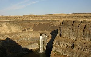
After Colfax, the Palouse River twists and turns west. Before it reaches the Snake River, it drops over the amazing Palouse Falls. The river finally flows into the Snake River between two large dams, the Little Goose Dam and the Lower Monumental Dam.
River Basin and Water Flow
A river's drainage basin is the entire area of land where water collects and drains into that river. The Palouse River's basin covers a large area of about 3,303 square miles (8,550 km2).
The amount of water flowing in a river is called its discharge. The average amount of water flowing in the Palouse River each year is about 599 cubic feet per second (17 m3/s). This measurement is taken near Hooper. Sometimes, the river has a lot more water, like during floods, with a record high flow of 27,800 cu ft/s (787 m3/s). Other times, especially in dry seasons, the river can have very little or even no water flowing.
How the River Was Formed
The land around the Palouse River has a very interesting history. During the Pleistocene epoch, which was a long time ago, huge floods called the Missoula Floods swept across eastern Washington. These floods were incredibly powerful.
The Missoula Floods carved out the deep canyon of the Palouse River, which can be 1,000 feet (300 m) deep in some places. Before these floods, the Palouse River used to flow differently, directly into the Columbia River. But the massive floods changed its path. They overflowed the land and created a new, deeper channel, forcing the river to flow into the Snake River instead.
This area has unique landforms created by these floods. You can see deep channels called coulees, waterfalls, plunge pools (deep holes at the base of waterfalls), and strange rock formations. These features are typical of "scablands," which are areas where floods have stripped away the soil and left bare rock.
 | Toni Morrison |
 | Barack Obama |
 | Martin Luther King Jr. |
 | Ralph Bunche |


