Luckiamute River facts for kids
Quick facts for kids Luckiamute River |
|
|---|---|

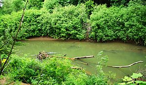
Luckiamute River at Sarah Helmick State Recreation Site
|
|
|
Location of the mouth of the Luckiamute River in Oregon
|
|
| Country | United States |
| State | Oregon |
| County | Polk and Benton |
| Physical characteristics | |
| Main source | Central Oregon Coast Range near Bald Mountain, Polk County 2,684 ft (818 m) 44°47′28″N 123°32′45″W / 44.79111°N 123.54583°W |
| River mouth | Willamette River near Buena Vista, Polk County 157 ft (48 m) 44°45′15″N 123°08′54″W / 44.75417°N 123.14833°W |
| Length | 61 mi (98 km) |
| Basin features | |
| Basin size | 315 sq mi (820 km2) |
The Luckiamute River is a river in western Oregon, United States. It flows for about 61 miles (98 km) and eventually joins the Willamette River. This river helps drain water from the Central Oregon Coast Range mountains and the western part of the Willamette Valley, an area northwest of Corvallis. Its name comes from Native American languages, but its exact meaning is not known.
About the Luckiamute River
The Luckiamute River is an important waterway in Oregon. It is a tributary of the larger Willamette River. This means the Luckiamute River flows into the Willamette River. The river's basin, or the area it drains, covers about 315 square miles (816 square kilometers).
Where Does It Flow?
The Luckiamute River begins in the remote mountains of southwestern Polk County. This is about 10 miles (16 km) west of a place called Pedee. From its source, the river flows southeast towards Hoskins in Benton County.
After Hoskins, the river turns and flows northeast back into Polk County. It passes by Pedee and then continues east across the southern part of Polk County. The Little Luckiamute River joins it from the northwest. Finally, the Luckiamute River meets the Willamette River from the west. This meeting point is about 10 miles (16 km) north of Albany.
The mouth of the Luckiamute River is about 0.25 miles (0.40 km) downstream from where the Santiam River enters the Willamette. The Santiam River flows into the Willamette from the east.
What Are Its Tributaries?
Many smaller streams and creeks flow into the Luckiamute River. These are called tributaries. They add water to the main river as it flows.
Starting from the river's source and moving downstream, some of these named tributaries include:
- Boulder Creek
- Beaver Creek
- Miller Creek
- Wolf Creek
- Rock Pit Creek
- Slick Creek
- Cougar Creek
- Slide Creek
- Harris Creek
Further downstream, you'll find:
- Hull Creek
- Foster Creek
- Jones Creek
- Bonner Creek
- Vincent Creek
- Plunkett Creek
- Price Creek
After these, there are:
- Maxfield Creek
- Bump Creek
- Ritner Creek
- Pedee Creek
- McTimmonds Creek
- Link Creek
- Dry Creek
- Jont Creek
The Little Luckiamute River is also a significant tributary. Near the lower parts of the Luckiamute River, Soap Creek also joins the main river.
River Management
The Luckiamute Watershed Council is a group that studies the river's watershed. A watershed is all the land where water drains into a specific river or body of water. This council also includes Ash Creek in its study area. Even though Ash Creek flows directly into the Willamette River, it's still important for understanding the larger river system.
 | Anna J. Cooper |
 | Mary McLeod Bethune |
 | Lillie Mae Bradford |


