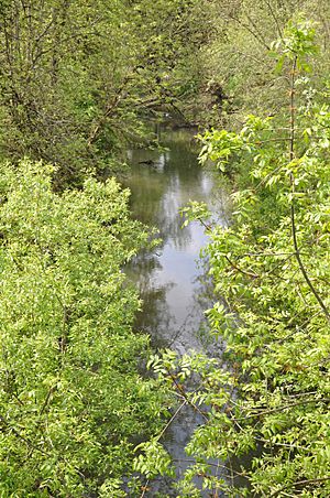
Ash Creek (Polk County, Oregon) facts for kids
Quick facts for kids Ash Creek |
|
|---|---|

Ash Creek in Independence
|
|
|
Location of Ash Creek in Oregon
|
|
| Country | United States |
| State | Oregon |
| County | Polk |
| Physical characteristics | |
| Main source | confluence of Middle Fork Ash Creek and North Fork Ash Creek northeast of Monmouth 176 ft (54 m) 44°51′32″N 123°13′08″W / 44.85889°N 123.21889°W |
| River mouth | Willamette River Independence 135 ft (41 m) 44°51′19″N 123°10′50″W / 44.85528°N 123.18056°W |
| Basin features | |
| Basin size | 36 sq mi (93 km2) |
Ash Creek is a small stream in Polk County, Oregon. It's like a short river that flows into a bigger one. Ash Creek starts when two smaller streams, called its "forks," join together. It then flows generally towards the east.
This creek ends its journey by joining the Willamette River in a town called Independence. Just before it reaches the Willamette River, Ash Creek flows under Oregon Route 51. The place where Ash Creek meets the Willamette River is about 95 miles (153 km) upstream from where the Willamette River joins the mighty Columbia River.
Contents
Where Ash Creek Begins
Ash Creek is formed by the joining of several smaller streams, which are like its branches. These branches are called "forks."
North Fork Ash Creek
The North Fork Ash Creek starts on the eastern side of the Central Oregon Coast Range. This is near the city of Dallas. From there, it flows mostly southeast until it meets the Middle Fork.
Middle Fork Ash Creek
The Middle Fork Ash Creek begins near a place called Mount Pisgah. It flows generally towards the east. Both the North Fork and the Middle Fork flow under Oregon Route 99W shortly before they meet up. When these two forks join, they create the main part of Ash Creek.
South Fork Ash Creek
There's also a third branch, the South Fork Ash Creek. This fork joins the main Ash Creek later, in the town of Independence. The South Fork starts a bit south of the Middle Fork and flows generally east. It passes under Route 99W south of Monmouth and then under Route 51 in Independence. None of these three forks have any other named streams flowing into them.
How the Area Changed
A long time ago, before people settled here in the 1800s, the area around Ash Creek was very different. It was a "boggy" or marshy place. This means it was wet and soft, with many small creeks spreading out into Ash Creek and the Willamette River.
Over time, European-American settlers changed the land. They drained the wet areas and leveled the ground. This was done to create land for farming, cutting down trees (logging), building homes, and developing towns. These changes made the area much drier and altered how the water flowed in Ash Creek.
See Also
 | Tommie Smith |
 | Simone Manuel |
 | Shani Davis |
 | Simone Biles |
 | Alice Coachman |


