Little Luckiamute River facts for kids
Quick facts for kids Little Luckiamute River |
|
|---|---|

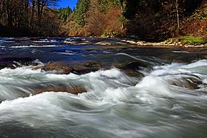
Rapids on the Little Luckiamute River
|
|
|
Location of the mouth of the Little Luckiamute River in Oregon
|
|
| Country | United States |
| State | Oregon |
| County | Polk |
| Physical characteristics | |
| Main source | Central Oregon Coast Range near Fanno Peak 2,869 ft (874 m) 44°52′45″N 123°37′37″W / 44.87917°N 123.62694°W |
| River mouth | Luckiamute River about 4 miles (6 km) upstream of Sarah Helmick State Recreation Site 203 ft (62 m) 44°47′28″N 123°17′17″W / 44.79111°N 123.28806°W |
| Length | 24 mi (39 km) |
| Basin features | |
| Basin size | 54 sq mi (140 km2) |
The Little Luckiamute River is a stream in Polk County, Oregon. It starts in the Central Oregon Coast Range near Fanno Peak. The river then flows into the Luckiamute River. This meeting point is about 4 miles (6 km) upstream from the Sarah Helmick State Recreation Site, which is southwest of Monmouth.
Contents
River's Journey: From Mountains to Main River
The Little Luckiamute River flows generally east from where it begins near Fanno Peak. It runs alongside Fanno Ridge, which is on its right side.
Early Flow and Waterfalls
As the river flows, smaller streams join it. Lost Creek comes in from the left side, creating some rapids. Camp Creek also joins from the left. A little further on, the river drops over a waterfall.
Passing Through Black Rock
Near the small community of Black Rock, Black Rock Creek adds its waters to the Little Luckiamute River from the left. For several miles after Black Rock, the George T. Gerlinger Experimental Forest is on the river's left side. Sam's Creek also flows into the river from the left, about 1 mile (1.6 km) downstream from Black Rock.
Parks and Falls City
Gerlinger County Park is located on the right side of the river. Dutch Creek joins from the left, and Berry Creek from the right. The river then reaches Falls City Falls and the town of Falls City. At these falls, the river plunges about 25 to 35 feet (7.6 to 10.7 m) into a deep gorge within a city park.
Final Stretch to the Luckiamute River
After Falls City, the river turns southeast. Waymire Creek enters from the left, and Teal Creek from the right. The river then passes under Oregon Route 223. Fern Creek joins from the left just after Route 223. Cooper Creek also enters from the left, about 1.5 miles (2.4 km) before the river's end. The Little Luckiamute River finally meets the Luckiamute River. This meeting point is about 18 miles (29 km) before the larger Luckiamute River flows into the Willamette River.
What Lives in the River?
The upper parts of the Little Luckiamute River are home to wild coastal cutthroat trout. These fish can be found in sizes ranging from 6 to 13 inches (15 to 33 cm). People often practice catch-and-release fishing here, which means they catch the fish and then let them go. This helps protect the fish population.
 | Georgia Louise Harris Brown |
 | Julian Abele |
 | Norma Merrick Sklarek |
 | William Sidney Pittman |


