North Santiam River facts for kids
Quick facts for kids North Santiam River |
|
|---|---|

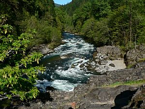
North Santiam River at Niagara County Park
|
|
|
Location of the mouth of the North Santiam River in Oregon
|
|
| Country | United States |
| State | Oregon |
| County | Linn and Marion |
| Physical characteristics | |
| Main source | Santiam Lake Cascade Range, Mount Jefferson Wilderness, Linn County 5,133 ft (1,565 m) 44°28′39″N 121°53′04″W / 44.47750°N 121.88444°W |
| River mouth | Santiam River Willamette Valley, Marion County 217 ft (66 m) 44°41′12″N 123°00′24″W / 44.68667°N 123.00667°W |
| Length | 92 mi (148 km) |
| Basin features | |
| Basin size | 766 sq mi (1,980 km2) |
The North Santiam River is a cool river in western Oregon, USA. It flows for about 92 miles (148 km) and is a branch of the larger Santiam River. This river helps drain a big area of 766 square miles (1,984 km²) from the Cascade Range mountains, located east of Salem.
Contents
Journey of the North Santiam River
The North Santiam River starts high up in the Cascade Range mountains. Its source is in eastern Linn County, near a peak called Three Fingered Jack. This area is part of the beautiful Willamette National Forest.
From Mountains to Valley
As the river begins its journey, it flows north through the mountains. It passes by places like Marion Forks. Along the way, it collects water from the western side of Mount Jefferson.
Then, the river makes a sharp turn to the west. It flows through a deep canyon past towns such as Idanha and Detroit. It reaches Niagara County Park, where the valley starts to get wider. Here, you can see some farms beginning to appear.
Continuing west, the river flows past Gates, Mill City, and Mehama. Finally, it leaves the foothills and enters the Willamette Valley near Stayton. From there, it travels about 15 miles (24 km) southwest through the valley.
Joining Other Rivers
The North Santiam River then meets the South Santiam River. Together, they form the main Santiam River. This meeting point is about 10 miles (16 km) east of where the Santiam River joins the much larger Willamette River.
Detroit Dam and Lake
The river is held back by the Detroit Dam in the mountains west of Detroit. This dam creates Detroit Lake, which is important for controlling floods. Detroit Lake State Park is a popular spot along the northern shore of the lake.
A River's History
Long ago, in the 1800s, the canyon of the North Santiam River was a very tough place for settlers to cross. It was a big challenge! But in 1887, a railroad was built through the canyon. This made it much easier for people to settle in the area and for logging companies to cut down trees in the surrounding mountains.
Animals in the River
The North Santiam River is home to many different kinds of fish and other animals.
Fish Species
Below the Big Cliff Dam, which is near Mill City, you can find certain types of fish. These include spring chinook salmon and summer steelhead. These fish are known for their long journeys upriver.
Upstream from the dam, the river is mainly used for stocking trout. This means that young trout are raised in special facilities and then released into the river. Near the very start of the river, at Santiam Lake in the Mount Jefferson Wilderness, you can also find native cutthroat trout, rainbow trout, and brook trout.
Amphibians and Wildlife
The headwaters of Marion Creek, which flows into the North Santiam River, start at Marion Lake. This lake is a special place for many different wildlife species. It's a breeding ground for amphibians, including the rough-skinned newt. These newts are fascinating creatures that spend part of their lives in water and part on land.
Water for Our Cities
The North Santiam River is very important because it provides drinking water for many towns and cities. Ten different communities get their water from the North Santiam watershed. A watershed is the entire area of land that drains into a river.
These cities include:
 | Sharif Bey |
 | Hale Woodruff |
 | Richmond Barthé |
 | Purvis Young |


