
Palm Bay, Florida facts for kids
Quick facts for kids
Palm Bay, Florida
|
|||
|---|---|---|---|

From top (left to right): Palm Bay, Palm Bay City Hall, Palm Bay overpass sign on I-95, and Turkey Creek
|
|||
|
|||
| Motto(s):
"A perfect place to grow!"
|
|||

Location of Palm Bay in Brevard County (left) and in Florida (right)
|
|||
| Country | |||
| State | |||
| County | |||
| Settled (Tillman) | c. Late 1870s | ||
| Incorporated (City of Palm Bay) |
January 16, 1960 | ||
| Government | |||
| • Type | Council-Manager | ||
| Area | |||
| • City | 89.60 sq mi (232.05 km2) | ||
| • Land | 86.42 sq mi (223.82 km2) | ||
| • Water | 3.18 sq mi (8.23 km2) 4.56% | ||
| Elevation | 19 ft (5 m) | ||
| Population
(2020)
|
|||
| • City | 119,760 | ||
| • Density | 1,385.82/sq mi (535.07/km2) | ||
| • Urban | 510,675 (US: 82nd) | ||
| • Urban density | 2,038.3/sq mi (787.0/km2) | ||
| • Metro | 606,612 (US: 95th) | ||
| Time zone | UTC−5 (Eastern (EST)) | ||
| • Summer (DST) | UTC−4 (EDT) | ||
| ZIP codes |
32905-32911
|
||
| Area code(s) | 321 | ||
| GNIS feature ID | 0288389 | ||


Palm Bay is a city located in Brevard County, Florida, in the United States. In 2020, about 119,760 people lived there. This makes it the biggest city in Brevard County by population and land size.
The older part of the city is near where Turkey Creek meets the Palm Bay. Over time, Palm Bay has grown towards the south and west. The newer areas are mostly west of Interstate 95.
Palm Bay is a main city in the Palm Bay−Melbourne−Titusville, Florida Metropolitan Statistical Area. This larger area had a population of 606,612 in 2020.
Contents
Discovering Palm Bay's Past
The first people to live in the Palm Bay area were likely the Ais people. They were drawn to the mouth of Turkey Creek where it met the Indian River. This spot had fresh water, fish, oysters, and lots of wildlife.
Early maps from the late 1700s called this area Turkey Creek, Elbow Creek, and Crane Creek. An 1870 map showed no towns near Turkey Creek. The first important European-American settler was John Tillman in the late 1870s. His wharf at Turkey Creek became known as Palm Bay on the Indian River.
By the late 1880s, Tillman had a successful orange and banana farm. His banana farm was very well known on the Indian River. Tillman's wharf was also a stop for steamboats, which brought more settlers to the area.
In the mid-1800s, there was a lumber business, orange farms, and a packing house. The area grew slowly until the railroad arrived in 1894. This made it faster to bring in goods and send farm products to markets.

Palm Bay in the 1900s
Between 1910 and 1914, a land company called the Indian River Catholic Colony started in Tillman. Farmers tried to grow two crops each season, which quickly wore out the soil. The colony did not succeed. Those who stayed built St. Joseph's Church on Miller Street, which is the oldest building still standing.
In the 1920s, the city was renamed Palm Bay. It was named after the bay nearby, which was full of sabal palm trees. This bay is located where Turkey Creek meets the larger bay.
A group of businessmen created the Melbourne-Tillman Drainage District. Starting in 1922, they dug a 180 miles (290 km) network of 80 canals. These canals helped drain 40,000 acres (160 km2) of swampy land west of Palm Bay. This made the land useful for farming and helped control floods. However, it also made the land more likely to flood during storms and harmed important wildlife areas.
Farmers grew citrus fruits and vegetables, which they sent to northern markets by train. They also sold timber and land to paper companies. Ranchers raised cattle in West Melbourne, using the Tillman and Hopkins canals.
In 1926, a fire and a strong hurricane caused a lot of damage. This led to a difficult economic time for Palm Bay. The Melbourne-Tillman Drainage District went out of business.
In 1959, General Development Corporation (GDC) bought a lot of land in Palm Bay. They planned a large housing project called Port Malabar. The city of Palm Bay officially became a city on January 16, 1960. Before it grew, the city had 2,808 people that year.
GDC played a big part in the city's growth. They built many streets, sold and built many homes, and even built a water treatment plant. The city of Palm Bay later bought this plant when GDC faced financial trouble in 1991.
The Melbourne-Tillman Water District was restarted by the County Government. In 2019, it managed 100 square miles (260 km2) of land.
Palm Bay in the 2000s
From 2003 to 2005, Palm Bay was a finalist for the All-America City Award three years in a row.
In 2008, an article in U.S. News & World Report mentioned Palm Bay.
Also in 2008, the old Port Malabar Country Club land was valued at $300,000. This was considered almost "worthless" because harmful chemicals were found in the water underground. Cleaning it up would cost about $12 million.
Many miles of roads in Palm Bay are in very bad condition. The city's Public Works Department says they are unusable. Voters have often voted against plans to raise money for road repairs. In 2005, they said no to a $58.7 million plan. In 2009, they rejected a $75.2 million tax plan. In 2010, people in areas with the worst roads voted against a $44.7 million plan to fix them. In 2011, the city created a Palm Bay Road Maintenance District to try and solve the problem.
In 2008, fires on Mother's Day destroyed 37 homes in the southwest part of the city. Some of these fires were believed to be started on purpose.
In 2009, the Brevard Zoo moved 15 families of Florida scrub jays from the city. These birds are native to Florida. They were moved to a conservation area in Mims. The Florida scrub jay is a threatened species because it stays in its territory. It cannot easily move when its home is in danger.
Palm Bay in the 2010s
In 2010, a private company shared plans for Emerald City. This would be a large planned community within Palm Bay. The company wants to build a mixed-use, eco-friendly urban area. It would include townhouses, modern medical centers, research facilities for technology companies, and shopping areas. As of 2016, Emerald City was still being planned.
In 2012, work started on the St. John's Heritage Parkway. This is a main road that runs north to south along the western edge of the city. Part of the parkway opened in 2015. This project was planned for over ten years. It aims to reduce traffic on other main roads like SR 507, CR 509, and I-95. Later parts of the project will extend the road further south and east. It will eventually connect to I-95.
In 2015, the Harris Corporation built a new technology center. This 464,000-square-foot building is one of the largest in the city's northeast. It is said to house about 1,400 scientists and engineers.
In 2017, construction began on the southern Interstate 95 interchange. The Florida Department of Transportation (FDOT) is building a new diverging diamond interchange on I-95. This is just north of Micco Road within the city. The city is also working on the southern part of the parkway. This project aims to improve traffic flow and safety. It also hopes to help the economy in southern Brevard County grow.
The city used to have radar cameras at some intersections. These cameras would give traffic tickets to drivers who ran red lights. In 2013, studies showed these intersections were not safer than those without cameras. The cameras were removed in 2014.
In 2018, voters approved a plan to fund a city-wide road repair project. This project will use a special bond worth $150,000,000. It will be paid for by annual property taxes. Planning and construction for the city's four areas are underway. The project is expected to take about eight years. Construction began in August 2019.
Palm Bay's Location and Features
Palm Bay is located at 27°59′52.52″N 80°40′12.03″W / 27.9979222°N 80.6700083°W.
The city covers a total area of 101.4 miles (101.4 mi). About 97.86 miles (97.86 mi) of this is land, and 3.1 square miles (8.1 km2), or 4.56%, is water.
Palm Bay is often divided into four parts: Northwest, Northeast, Southwest, and Southeast. Each part has different ZIP codes. The Northeast is the most developed area. The Southwest is more rural and includes an area called The Compound. This area is used by people who enjoy off-road vehicles and other outdoor activities.
In the early 1990s, Fred Poppe Regional Park was built. This park, also known as Palm Bay Regional Park, is a large soccer and athletic complex in the western part of the city. It is the biggest park in Palm Bay's park system. The Turkey Creek Sanctuary is a smaller nature reserve in the northeast part of the city.
Palm Bay's Climate
Palm Bay has hot, humid summers and generally mild winters. It has a humid subtropical climate zone (Cfa).
| Climate data for Palm Bay, Florida, 1991–2020 normals, extremes 2000–present | |||||||||||||
|---|---|---|---|---|---|---|---|---|---|---|---|---|---|
| Month | Jan | Feb | Mar | Apr | May | Jun | Jul | Aug | Sep | Oct | Nov | Dec | Year |
| Record high °F (°C) | 88 (31) |
90 (32) |
94 (34) |
97 (36) |
98 (37) |
101 (38) |
105 (41) |
100 (38) |
96 (36) |
96 (36) |
92 (33) |
89 (32) |
105 (41) |
| Mean maximum °F (°C) | 83.3 (28.5) |
85.6 (29.8) |
88.8 (31.6) |
90.8 (32.7) |
93.4 (34.1) |
95.5 (35.3) |
96.4 (35.8) |
96.6 (35.9) |
94.4 (34.7) |
92.2 (33.4) |
86.8 (30.4) |
84.9 (29.4) |
97.9 (36.6) |
| Mean daily maximum °F (°C) | 72.9 (22.7) |
75.4 (24.1) |
78.5 (25.8) |
82.8 (28.2) |
86.6 (30.3) |
89.9 (32.2) |
91.3 (32.9) |
91.8 (33.2) |
89.2 (31.8) |
84.9 (29.4) |
79.0 (26.1) |
74.6 (23.7) |
83.1 (28.4) |
| Daily mean °F (°C) | 61.0 (16.1) |
63.5 (17.5) |
66.5 (19.2) |
71.4 (21.9) |
76.0 (24.4) |
80.3 (26.8) |
82.0 (27.8) |
82.3 (27.9) |
80.4 (26.9) |
75.7 (24.3) |
68.8 (20.4) |
63.5 (17.5) |
72.6 (22.6) |
| Mean daily minimum °F (°C) | 49.0 (9.4) |
51.5 (10.8) |
54.5 (12.5) |
60.0 (15.6) |
65.4 (18.6) |
70.7 (21.5) |
72.6 (22.6) |
72.8 (22.7) |
71.5 (21.9) |
66.5 (19.2) |
58.5 (14.7) |
52.3 (11.3) |
62.1 (16.7) |
| Mean minimum °F (°C) | 33.0 (0.6) |
35.4 (1.9) |
39.0 (3.9) |
49.8 (9.9) |
56.3 (13.5) |
66.9 (19.4) |
68.9 (20.5) |
70.5 (21.4) |
67.0 (19.4) |
52.1 (11.2) |
44.4 (6.9) |
39.2 (4.0) |
31.2 (−0.4) |
| Record low °F (°C) | 23 (−5) |
27 (−3) |
30 (−1) |
40 (4) |
46 (8) |
64 (18) |
64 (18) |
67 (19) |
57 (14) |
41 (5) |
36 (2) |
25 (−4) |
23 (−5) |
| Average precipitation inches (mm) | 2.64 (67) |
2.42 (61) |
3.04 (77) |
2.81 (71) |
4.37 (111) |
7.62 (194) |
6.58 (167) |
7.11 (181) |
7.95 (202) |
5.60 (142) |
2.95 (75) |
2.46 (62) |
55.55 (1,411) |
| Source: NOAA (mean maxima/minima 2006–2020) | |||||||||||||
Neighboring Areas
Palm Bay is surrounded by several other places:
- To the west: St. Johns River; Sawgrass Lake; Lake Hell 'n Blazes; Osceola County

- To the east: Grant-Valkaria; Malabar; Indian River Lagoon

- To the north: West Melbourne; Melbourne

- To the south: Indian River County

People of Palm Bay
| Historical population | |||
|---|---|---|---|
| Census | Pop. | %± | |
| 1960 | 2,808 | — | |
| 1970 | 7,176 | 155.6% | |
| 1980 | 18,560 | 158.6% | |
| 1990 | 62,632 | 237.5% | |
| 2000 | 79,413 | 26.8% | |
| 2010 | 103,190 | 29.9% | |
| 2020 | 119,760 | 16.1% | |
| U.S. Decennial Census | |||
Population Changes (2010 and 2020)
| Race / Ethnicity (NH = Non-Hispanic) | Pop 2000 | Pop 2010 | Pop 2020 | % 2000 | % 2010 | % 2020 |
|---|---|---|---|---|---|---|
| White (NH) | 60,549 | 65,967 | 67,826 | 76.25% | 63.93% | 56.63% |
| Black or African American (NH) | 8,634 | 17,590 | 20,426 | 10.87% | 17.05% | 17.06% |
| Native American or Alaska Native (NH) | 241 | 349 | 286 | 0.30% | 0.34% | 0.24% |
| Asian (NH) | 1,325 | 1,789 | 2,273 | 1.67% | 1.73% | 1.90% |
| Pacific Islander or Native Hawaiian (NH) | 32 | 50 | 84 | 0.04% | 0.05% | 0.07% |
| Some other race (NH) | 196 | 331 | 902 | 0.25% | 0.32% | 0.75% |
| Mixed race or Multiracial (NH) | 1,586 | 2,542 | 6,527 | 2.00% | 2.46% | 5.45% |
| Hispanic or Latino (any race) | 6,850 | 14,572 | 21,436 | 8.63% | 14.12% | 17.90% |
| Total | 79,413 | 103,190 | 119,760 | 100.00% | 100.00% | 100.00% |
In 2020, there were 119,760 people living in Palm Bay. There were 39,109 households and 26,872 families.
In 2010, there were 103,190 people, 36,940 households, and 26,528 families.
Languages Spoken
As of 2000, most people in Palm Bay (88.55%) spoke English as their first language. About 11.44% spoke other languages. The most common other language was Spanish, spoken by 7.45% of the population.
Palm Bay's Economy

In 2010, Forbes magazine named Palm Bay the 11th most innovative city in the United States.
Major Employers
Some of the big companies that employ many people in Palm Bay include:
- L3Harris Technologies: They have 3,400 employees at their Palm Bay campus.
- Intersil: This company employed 700 people in 2010.
- Palm Bay Hospital
Workforce and Jobs
In 2007, about 49,935 people in Palm Bay were part of the working population. Of these, 47,542 had jobs, and 2,393 were looking for work. This meant the unemployment rate was 4.8%. By 2010, the number of unemployed people rose to 6,571 (12.7%). This was the highest rate in the county at that time.
Fun for Tourists
Palm Bay has some popular places for recreation. These include the area known as "the compound" and the Turkey Creek area. The city also has a riverfront area that the local government is working to improve for visitors.
In 2015, the Tough Mudder race, which is 12.5 miles (20.1 km) long, brought 9,875 visitors to the area. This included 6,835 people who took part in the race.
Learning in Palm Bay
All public schools in Palm Bay are managed by the Brevard County School Board.
Public Elementary Schools
- Discovery Elementary School
- Christa McAuliffe Elementary School
- Columbia Elementary School
- John F. Turner Sr. Elementary School
- Jupiter Elementary School
- Lockmar Elementary School
- Palm Bay Elementary School
- Port Malabar Elementary School
- Riviera Elementary School
- Sunrise Elementary School
- Westside Elementary School
Public Middle School
- Southwest Middle School
Public High Schools
- Bayside High School
- Palm Bay High School (This school is in Melbourne but serves students from Palm Bay and Malabar.)
- Heritage High School
Higher Education
- Eastern Florida State College
Getting Around Palm Bay

Here are some of the main roads in Palm Bay:
 U.S. 1 – This road goes through the northeast part of the city. It crosses Port Malabar Boulevard, Robert J. Conlan Boulevard, and Palm Bay Road.
 Interstate 95 – This major highway runs through the middle of the city. Palm Bay has exits at 176 (Palm Bay Road), 173 (Malabar Road), and 166 (St. Johns Heritage Parkway).
 Babcock Street – This state road goes through the northeast part of Palm Bay. It connects Melbourne (north of the city) to Malabar Road and County Road 507.
 Babcock Street – This county road goes through the far southeast part of Palm Bay. It connects to Fellsmere in Indian River County.
 Malabar Road – This state road connects the town of Malabar to eastern Palm Bay and I-95.
 Malabar Road – This county road runs through the center of Palm Bay. Palm Bay City Hall, the Police Department, and the main business area are on this road.
 Palm Bay Road – This road serves the far northern part of Palm Bay, mostly the northeast. It runs from SR 507 to CR 509.
 Minton Road – This road serves the western part of Palm Bay. It runs from West Melbourne to Malabar Road.
There are about 851 miles (1,370 km) of highways maintained by the city. Most roads west of DeGroodt Road are unpaved. In 2013, the public works director said that most roads in south Palm Bay were "failed roads" because they had not been maintained.
In 2012, Palm Bay had the lowest walkability score of any U.S. city with over 100,000 people. This means it's harder to walk to places like stores or parks.
In 2018, the city's voters approved a plan to fix the city's bad roads. The city is now working on repaving or rebuilding different sections each year.
Well-Known People from Palm Bay
- William G. Bainbridge, 5th Sergeant Major of the Army
- Deanne Bell, TV host known for Design Squad and Smash Lab
- Xavier Carter, professional track athlete
- Joe Cohen, former San Francisco 49ers defensive tackle
- Bobby Dall, bassist for the band Poison
- Ray Dandridge, Hall of Fame Baseball player, who lived and passed away in Palm Bay in 1994
- Ezio Flagello, Italian-American opera singer
- David Gewirtz, CNN writer, cyberterrorism expert, presidential scholar
- Chris Heston, San Francisco Giants pitcher
- Cameron Long (born 1988), basketball player in the Israeli Premier League
- Reggie Nelson, professional football player
Images for kids
-
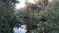
Turkey Creek in 2015
-
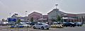
Pink Wal-Mart Supercenter built in 2005
-
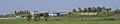
City name marker erected on I-95 in 2002
See also
 In Spanish: Palm Bay (Florida) para niños
