Daly City, California facts for kids
Quick facts for kids
Daly City, California
|
|||
|---|---|---|---|
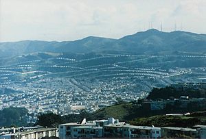
Part of Daly City, with San Bruno Mountain and the San Francisco neighborhood of Crocker-Amazon in the background
|
|||
|
|||
| Nickname(s):
Gateway to the Peninsula
|
|||
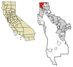
Location of Daly City in San Mateo County, California
|
|||
| Country | United States | ||
| State | California | ||
| County | San Mateo | ||
| Incorporated | March 22, 1911 | ||
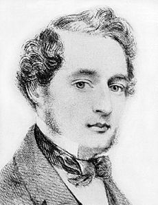
| Named for | John Daly | ||
| Government | |||
| • Type | Council-Manager | ||
| Area | |||
| • City | 7.64 sq mi (19.78 km2) | ||
| • Land | 7.64 sq mi (19.78 km2) | ||
| • Water | 0.00 sq mi (0.00 km2) | ||
| Elevation | 335 ft (102 m) | ||
| Population
(2020)
|
|||
| • City | 104,901 | ||
| • Estimate
(2022)
|
100,007 | ||
| • Rank | 333rd in the United States 75th in California 2nd in San Mateo County |
||
| • Density | 13,734.09/sq mi (5,302.44/km2) | ||
| • Urban | 3,515,933 (US: 14th) | ||
| • Metro | 4,579,599 (US: 13rd) | ||
| Time zone | UTC–8 (Pacific (PST)) | ||
| • Summer (DST) | UTC–7 (PDT) | ||
| ZIP codes |
94014, 94015, 94016, 94017
|
||
| Area code(s) | 415/628, 650 | ||
| FIPS code | 06-17918 | ||
| GNIS feature ID | 1658369 and 2410291 | ||
| Sales tax | 9.875% | ||
Daly City is the second largest city in San Mateo County, California, United States. It's part of the San Francisco Bay Area and is right next to San Francisco. The city is named after a businessman and landowner named John Donald Daly.
In 2020, about 104,901 people lived here. Many different groups of people call Daly City home. For example, about 57.3% of the people are Asian, and 23.1% are Hispanic or Latino. A big part of the population, about 33.2%, is Filipino.
Contents
History of Daly City
People have lived in the San Francisco Bay Area for a very long time, possibly since 2700 BC. The Ohlone people lived in Northern California from at least 500 AD. Even though Spain claimed this land in the 1500s, Europeans didn't have much contact with the Ohlone until 1769. That's when a Spanish group led by Don Gaspar de Portolá found San Francisco Bay.
Seven years later, in 1776, another group chose the spot for the Presidio of San Francisco, a military fort. Later that year, Franciscan missionaries started Mission San Francisco de Asís (Mission Dolores). They claimed land south of the mission for farming and raising animals. In 1778, they created a trail connecting San Francisco to the rest of California. A spot on this trail, between San Bruno Mountain and the coast hills, was called La Portezuela ("The Little Door"). This area is now known as Top of the Hill.
During Spanish rule, the area between San Bruno Mountain and the Pacific Ocean was empty. After Mexico became independent from Spain, large ranches called Ranchos were given to important Mexican citizens. Three of these ranches covered parts of what is now Daly City and Colma. These were Rancho Buri Buri, Rancho Laguna de la Merced, and Rancho Cañada de Guadalupe la Visitación y Rodeo Viejo.
After the Mexican–American War, California became part of the United States. In 1853, a US government survey said that some land near Lake Merced was government property. This led to a quick rush for land, mostly by Irish settlers who started farms in areas like Westlake and Serramonte. Many families left after a decade because thick fog ruined their crops. The remaining families switched to dairy and cattle farming, which was more successful.
As San Francisco grew in the late 1800s, Daly City also slowly developed with homes and schools along the Southern Pacific railroad lines. The area was also a place where people from San Francisco would go to gamble. A famous duel between two important political figures happened near Lake Merced. This spot is now a California Historical Landmark.
Daly City in the 20th Century
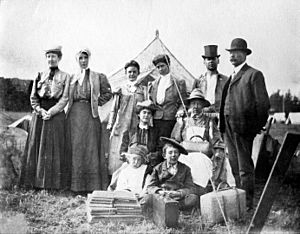
On April 18, 1906, a huge earthquake hit near Daly City. After the earthquake and the fires that followed, many people in San Francisco lost their homes. They moved to temporary shelters on nearby ranches, including the large ranch owned by John Daly. John Daly had started a dairy farm in the area in 1853 and later bought 250 acres of land at the Top of the Hill.
When many people came seeking shelter, John Daly and other farmers gave them milk and food. Daly then divided his land into smaller plots, and new neighborhoods began to appear.
As more people settled, they needed city services. They also worried that San Francisco might try to take over their area, and they felt ignored by San Mateo County. This led to a desire for the area to become its own city. The first idea in 1908 was to create a city called Vista Grande, but it was too big. On January 16, 1911, a group asked San Mateo County to make Daly City an official city. The city would have about 2,900 people. On March 18, 1911, people voted, and the idea to become a city passed by a very close vote of 132 to 130.
Daly City stayed a small community until the late 1940s. That's when a builder named Henry Doelger created Westlake, a large area of homes and businesses, including the Westlake Shopping Center. In the 1950s, Filipino American families started buying homes in Daly City.
On March 22, 1957, Daly City was again hit by an earthquake. This 5.3 magnitude quake caused some damage and closed a highway. In 1963, Daly City grew by adding the city of Bayshore. The Cow Palace, a large arena, is now in Daly City. It has hosted many big events, including political conventions.
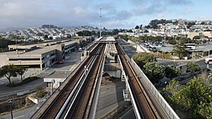
The Daly City BART station opened in 1972. This train station made it easier for people in northern San Mateo County to travel to San Francisco and other parts of the Bay Area. The train line was later extended further south.
The Daly City History Museum opened in 2009. It's in the building that used to be Daly City's first library. The museum shows exhibits about the city's past and keeps old photos and documents.
Geography of Daly City
Daly City covers about 7.7 square miles of land. It is surrounded by other cities like San Francisco, Brisbane, Pacifica, South San Francisco, and Colma. It also borders natural areas like San Bruno Mountain State Park and Lake Merced. There are several earthquake faults in and near Daly City.
Neighborhoods in Daly City
Daly City has many different neighborhoods. Some well-known ones include Westlake, St. Francis Heights, Serramonte, Top of the Hill, and Bayshore. Westlake is famous for its unique style of homes and was one of the first large planned suburbs. It even inspired a song called "Little Boxes".
Bayshore, on the east side of Daly City, used to be its own city before it joined Daly City in 1963. Some neighborhoods, like Crocker and Bayshore, have similar street layouts to nearby San Francisco neighborhoods.
Some areas that people often think of as part of Daly City are actually separate. Broadmoor is an area completely surrounded by Daly City but is not officially part of it. Colma is another separate town located between Daly City and South San Francisco. These areas have their own police and fire services but sometimes share other services with Daly City.
Climate in Daly City
Daly City has a climate similar to the western parts of San Francisco. It often gets fog in the spring and summer. Summers are usually cool and dry, while winters are mild and wet.
People in Daly City
| Historical population | |||
|---|---|---|---|
| Census | Pop. | %± | |
| 1920 | 3,779 | — | |
| 1930 | 7,838 | 107.4% | |
| 1940 | 9,625 | 22.8% | |
| 1950 | 15,191 | 57.8% | |
| 1960 | 44,791 | 194.9% | |
| 1970 | 66,922 | 49.4% | |
| 1980 | 78,519 | 17.3% | |
| 1990 | 92,311 | 17.6% | |
| 2000 | 103,621 | 12.3% | |
| 2010 | 101,123 | −2.4% | |
| 2020 | 104,901 | 3.7% | |
| 2022 (est.) | 100,007 | −1.1% | |
| U.S. Decennial Census 2020 Census |
|||
Population in 2020
In 2020, Daly City had 104,901 people and 31,836 households.
The city is very diverse:
- 57.3% Asian
- 19.2% White
- 3.5% African American
- 0.7% Pacific Islander
- 0.9% Native American
- 10.2% from other races
- 8.2% from two or more races
About 23.1% of the population is Hispanic or Latino.
| Race / Ethnicity (NH = Non-Hispanic) | Pop 2000 | Pop 2010 | Pop 2020 | % 2000 | % 2010 | % 2020 |
|---|---|---|---|---|---|---|
| White alone (NH) | 18,344 | 14,031 | 12,207 | 17.70% | 13.88% | 11.64% |
| Black or African American alone (NH) | 4,482 | 3,284 | 2,360 | 4.33% | 3.25% | 2.25% |
| Native American or Alaska Native alone (NH) | 199 | 115 | 112 | 0.19% | 0.11% | 0.11% |
| Asian alone (NH) | 52,154 | 55,711 | 59,722 | 50.33% | 55.09% | 56.93% |
| Pacific Islander alone (NH) | 904 | 752 | 705 | 0.87% | 0.74% | 0.67% |
| Other race alone (NH) | 414 | 471 | 925 | 0.40% | 0.47% | 0.88% |
| Mixed race or Multiracial (NH) | 4,052 | 2,830 | 3,633 | 3.91% | 2.80% | 3.46% |
| Hispanic or Latino (any race) | 23,072 | 23,929 | 25,327 | 22.27% | 23.66% | 24.06% |
| Total | 103,621 | 101,123 | 104,901 | 100.00% | 100.00% | 100.00% |
Daly City has the highest number of Filipino people in any mid-sized city in North America, with 40.7% of residents being of Filipino descent. Because of this, Daly City is sometimes called the "Pinoy Capital."
Culture and Fun in Daly City
The Cow Palace is a large arena that sits on the border of Daly City and San Francisco. It hosts many events, like the annual Grand National Rodeo, concerts (even by the Beatles!), and sports games. It has also hosted major political conventions.
If you like movies, the Century 20 Daly City is a big movie theater that opened in 2002.
Daly City is also home to several golf courses. The Olympic Club has hosted major golf tournaments like the U.S. Open multiple times. Parts of the San Francisco Golf Club and Lake Merced Golf Club are also in Daly City.
The city's Thornton Beach, part of the Golden Gate National Recreation Area, is a popular spot for paragliding and hang gliding because of its unique hills and winds.
Daly City is a popular place for shopping, especially for people from San Francisco. This is because there's lots of free parking, and the sales tax used to be a bit lower. Many large stores that can't fit in San Francisco have opened in Daly City's Serramonte and Westlake neighborhoods. The main shopping centers are Serramonte Center and Westlake Shopping Center.
Education in Daly City
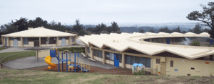
Daly City has several public school districts. The biggest ones are the Jefferson Elementary School District and Jefferson Union High School District. There are also schools from the Bayshore Elementary School District, Brisbane School District, and South San Francisco Unified School District.
Daly City has two main high schools: Westmoor High School and Jefferson High School. There's also Thornton High School and Jefferson Adult Education for older students. The city has four public library branches that are part of the Peninsula Library System.
Getting Around Daly City
Daly City has several major highways, including State Routes 1, 35, and 82, and Interstate 280. Interstate 280 is a key road that connects San Francisco to other counties south of Daly City.
Daly City is also a big center for public transportation. The Bay Area Rapid Transit (BART) train system has a station in Daly City, and another nearby called Colma Station. The Daly City BART station is where the Green and Blue lines end. This means you can get to almost anywhere in the BART system from here without changing trains.
Besides BART, the Daly City station is a stop for many bus routes, including SamTrans' ECR route and Muni's 14 Mission Rapid. There are also plans to extend the Muni Metro train system to Daly City in the future.
Sister Cities
Daly City has special partnerships with two cities in other countries:
 Quezon City, Philippines (since 1994)
 Izumisano, Japan (since 2024)
Famous People from Daly City
- Mike Guingona, a former mayor of Daly City.
- John Madden, a famous NFL player, coach, and sportscaster, who went to Jefferson High School.
- Dave Pelzer, an author.
- John Robinson, a national championship-winning football coach.
- Sam Rockwell, an Academy Award-winning actor, was born in Daly City.
- Vincent Rodriguez III, an actor.
See also
 In Spanish: Daly City para niños
 | Roy Wilkins |
 | John Lewis |
 | Linda Carol Brown |


