
Pacifica, California facts for kids
Quick facts for kids
Pacifica
|
|||
|---|---|---|---|
| City of Pacifica | |||
|
View of the Pacifica Pier
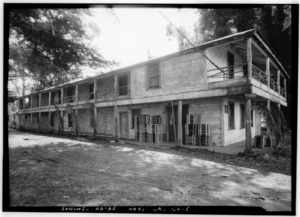
Sea Breeze Motel in Rockaway Beach
Aerial view of Pacifica
Mori Point
Taco Bell Cantina at Pacifica State Beach
|
|||
|
|||
| Nickname(s):
The fog capital of California
|
|||
| Country | United States | ||
| State | California | ||
| County | San Mateo | ||
| Incorporated | November 22, 1957 | ||
| Area | |||
| • Total | 12.59 sq mi (32.61 km2) | ||
| • Land | 12.58 sq mi (32.59 km2) | ||
| • Water | 0.01 sq mi (0.02 km2) 0.01% | ||
| Elevation | 82 ft (25 m) | ||
| Population
(2020)
|
|||
| • Total | 38,640 | ||
| • Density | 3,069.1/sq mi (1,184.9/km2) | ||
| Time zone | UTC-8 (Pacific) | ||
| • Summer (DST) | UTC-7 (PDT) | ||
| ZIP codes |
94044, 94045
|
||
| Area code | 650 | ||
| FIPS code | 06-54806 | ||
| GNIS feature IDs | 277613, 2411351 | ||
_-_%22Walker%22.jpg)


Pacifica is a city in San Mateo County, California. It is located right on the Pacific Ocean. Its name, "Pacifica," means "Peaceful" in Spanish. The city sits between the big city of San Francisco and the charming town of Half Moon Bay.
Contents
- Discover Pacifica: Beaches, Trails, and Fun
- Pacifica's Past: From Native Americans to a Modern City
- Pacifica's Natural Landscape and Weather
- People of Pacifica: Population and Community
- Working in Pacifica: Top Employers
- Pacifica in the News and on Screen
- Learning in Pacifica: Schools and Libraries
- Famous People from Pacifica
- Sister City
- See also
Discover Pacifica: Beaches, Trails, and Fun
Pacifica stretches along about 6 miles (10 km) of sandy beaches and rolling hills. The city is made up of several small valleys. These valleys are nestled between Sweeney Ridge to the east, Montara Mountain to the south, and the rocky cliffs of the Pacific Ocean to the west.

Pacifica is famous for its great surfing spots. Surfers and families love visiting Linda Mar Beach. Rockaway Beach is another beautiful area with shops and restaurants. In 2005, the highly-rated Pacifica Skatepark opened.
The city is also a popular place for mountain biking. Many trails wind through the hills, including Pedro Mountain Road and Sweeney Ridge. Parts of the Golden Gate National Recreation Area are also here. Fishermen enjoy the local beaches and the Pacifica Pier. They often catch striped bass and salmon.
Pacifica has many hiking trails along its beaches and bluffs. Some popular spots include Mori Point, San Pedro Valley County Park, and Milagra Ridge. For live shows, you can check out Pacifica Spindrift Players or Pacifica Performances. The city is also home to the Sharp Park Golf Course, designed in 1931. You can also find Shelldance Orchid Gardens, a world-class plant nursery, near Highway 1.
Pacifica is divided into about eleven main areas from north to south:
- Fairmont
- Westview (Pacific Highlands)
- Pacific Manor (Manor)
- Edgemar
- Sharp Park
- Fairway Park
- Vallemar
- Rockaway Beach
- Pedro Point and Shelter Cove
- Linda Mar (also known as Linda Mar Valley or Pedro Valley)
- Park Pacifica (also called the Back of the Valley)
Pacifica's Past: From Native Americans to a Modern City
Long before European settlers arrived, two important Ohlone Indian villages existed in Pacifica. One was called Pruristac, located near San Pedro Creek. The other was Timigtac, on Calera Creek in the Rockaway Beach neighborhood.
Pacifica is famous for being the first place where Europeans saw the San Francisco Bay. An expedition led by Gaspar de Portolà climbed the hills of Sweeney Ridge on November 4, 1769. From there, they saw the huge bay. Earlier Spanish explorers had missed it because of the thick fog. Seeing the San Francisco Bay was a big deal. It was the only large, safe harbor on the California coast. This discovery sped up Spanish settlement in California.
During the Spanish era, Pacifica was home to the San Pedro Valley Mission Outpost (1786–1793). This outpost was part of Mission Dolores. Later, it was closed down when Mexico became independent. Pacifica also has the Sánchez Adobe, built in 1846. This building still stands today. The city is part of a Mexican land grant called Rancho San Pedro (Sanchez). This land was given to Francisco Sanchez in 1839.

During World War II, the Sharp Park Detention Station was located here. It was a facility for processing Japanese Americans and others during a difficult time.
Pacifica officially became a city in 1957. This was quite recent compared to other cities in San Mateo County. Its first mayor was Jean Fassler, one of the first women mayors in California. Pacifica was formed by joining nine smaller communities. These included Fairmont, Sharp Park, and Linda Mar. The name "Pacifica" was chosen by a vote. The city's seal, designed in 1960, was inspired by a large statue called "Pacifica" from the 1939–1940 Golden Gate International Exposition.
Pacifica's Natural Landscape and Weather

Land Features
Pacifica is built around San Pedro Creek, which flows from the western side of Sweeney Ridge. The Portola expedition followed this creek when they discovered San Francisco Bay. Another creek, Calera Creek, runs through the Pacifica Quarry. This area is protected because it has important natural habitats.
Weather and Climate
| Weather chart for Pacifica, California | |||||||||||||||||||||||||||||||||||||||||||||||
|---|---|---|---|---|---|---|---|---|---|---|---|---|---|---|---|---|---|---|---|---|---|---|---|---|---|---|---|---|---|---|---|---|---|---|---|---|---|---|---|---|---|---|---|---|---|---|---|
| J | F | M | A | M | J | J | A | S | O | N | D | ||||||||||||||||||||||||||||||||||||
|
6.1
58
45
|
6.5
60
46
|
4.5
61
46
|
2.4
64
48
|
1
67
49
|
0.3
69
51
|
0.1
69
52
|
0.1
71
53
|
0.1
72
53
|
1.5
70
52
|
2.9
64
50
|
6.6
59
46
|
||||||||||||||||||||||||||||||||||||
| temperatures in °F precipitation totals in inches |
|||||||||||||||||||||||||||||||||||||||||||||||
|
Metric conversion
|
|||||||||||||||||||||||||||||||||||||||||||||||

Pacifica has a warm-summer Mediterranean climate. This means it has mild, wet winters and warm, dry summers. It's a common climate for coastal areas in California.
The average temperature in January ranges from 45.8°F to 56.7°F (7.7°C to 13.7°C). In September, temperatures range from 53.9°F to 71.8°F (12.2°C to 22.1°C). It rarely gets very hot or very cold. The highest temperature ever recorded was 102°F (39°C) in October 1987. The lowest was 23°F (-5°C) in December 1990.
Pacifica gets about 30.29 inches (769 mm) of rain each year. Most of this rain falls between October and May. Summer mornings often bring light drizzle from the fog. This fog also creates "fog drip" from trees overnight. Snowfall is very rare. The southeastern parts of the city, like Park Pacifica, tend to be sunnier than other areas.
| Climate data for Pacifica, California (Pacifica 4 SSE averages: 1991–2020) | |||||||||||||
|---|---|---|---|---|---|---|---|---|---|---|---|---|---|
| Month | Jan | Feb | Mar | Apr | May | Jun | Jul | Aug | Sep | Oct | Nov | Dec | Year |
| Record high °F (°C) | 74 (23) |
78 (26) |
82 (28) |
93 (34) |
95 (35) |
98 (37) |
100 (38) |
96 (36) |
98 (37) |
102 (39) |
81 (27) |
73 (23) |
102 (39) |
| Mean daily maximum °F (°C) | 58.1 (14.5) |
60.1 (15.6) |
61.4 (16.3) |
63.9 (17.7) |
66.9 (19.4) |
68.8 (20.4) |
69.4 (20.8) |
71.0 (21.7) |
72.3 (22.4) |
70.1 (21.2) |
64.1 (17.8) |
58.8 (14.9) |
65.4 (18.6) |
| Mean daily minimum °F (°C) | 45.3 (7.4) |
46.0 (7.8) |
46.1 (7.8) |
47.6 (8.7) |
49.4 (9.7) |
50.8 (10.4) |
52.3 (11.3) |
53.3 (11.8) |
53.4 (11.9) |
52.3 (11.3) |
49.7 (9.8) |
46.2 (7.9) |
49.4 (9.7) |
| Record low °F (°C) | 32 (0) |
27 (−3) |
33 (1) |
37 (3) |
38 (3) |
44 (7) |
42 (6) |
40 (4) |
45 (7) |
40 (4) |
37 (3) |
23 (−5) |
23 (−5) |
| Average precipitation inches (mm) | 6.14 (156) |
6.48 (165) |
4.45 (113) |
2.36 (60) |
1.00 (25) |
0.25 (6.4) |
0.01 (0.25) |
0.08 (2.0) |
0.11 (2.8) |
1.50 (38) |
2.86 (73) |
6.64 (169) |
31.88 (810) |
People of Pacifica: Population and Community
| Historical population | |||
|---|---|---|---|
| Census | Pop. | %± | |
| 1960 | 20,995 | — | |
| 1970 | 36,020 | 71.6% | |
| 1980 | 36,866 | 2.3% | |
| 1990 | 37,670 | 2.2% | |
| 2000 | 38,390 | 1.9% | |
| 2010 | 37,234 | −3.0% | |
| 2020 | 38,640 | 3.8% | |
| U.S. Decennial Census | |||
As of the 2020 census, Pacifica had a population of 38,640 people. The city is home to a diverse community.
In 2010, about 55.6% of the population was white. About 19.4% were Asian, and 16.8% were Hispanic or Latino. The average household size was 2.65 people. About 32.3% of households had children under 18.
The median age in Pacifica was 41.5 years in 2010. About 20.7% of the population was under 18 years old. About 12.1% were 65 or older.
The Reverend Herschell Harkins Memorial Pier was built in 1973. It was originally designed to carry sewage pipes into the ocean. After repairs, it became a well-known fishing spot. On one amazing weekend in July 1995, over 1,000 salmon were caught from the pier!
Working in Pacifica: Top Employers
Pacifica has several important employers that provide jobs for many residents.
| # | Employer | # of Employees |
|---|---|---|
| 1 | Pacifica School District | 499 |
| 2 | City of Pacifica | 282 |
| 3 | Safeway | 262 |
| 4 | Jefferson Union High School District | 137 |
| 5 | Oceana Market | 55 |
| 6 | Ace Hardware | 36 |
| 7 | Recology of the Coast | 35 |
| 8 | Rite Aid | 34 |
| 9 | Ross | 31 |
| 10 | North Coast County Water District | 22 |
Pacifica in the News and on Screen
Pacifica has its own local weekly newspaper, the Pacifica Tribune. It is mailed out every Wednesday. Other local news sources include the San Mateo Daily Journal and Coastside Magazine.
Pacifica Community Television (Pacifica's local public-access television channel 26) has been running for 30 years. It shows community-based programs. On national TV, Guy Fieri visited Gorilla BBQ in Pacifica for his show Diners, Drive-Ins and Dives in 2009.
Pacifica has also been a filming location for movies. The final scene of Harold and Maude, where Harold jumps off a cliff, was filmed at Mori Point. The 2003 movie House of Sand and Fog and the 2012 movie Chasing Mavericks were also filmed here. The 2007 book Story of a Girl by Sara Zarr is set in Pacifica. It was later made into a TV movie in 2017.
Learning in Pacifica: Schools and Libraries


Schools in Pacifica
The public elementary and middle school district is called Pacifica School District. It includes schools like Vallemar, Cabrillo, Ingrid B. Lacy, and Linda Mar. There are also two private K-8 schools: Good Shepherd School and Pacific Bay Christian School.
Pacifica has one private high school and two public high schools. These public high schools are part of the Jefferson Union High School District. Oceana High School is in the central part of the city. Terra Nova High School and Pacific Bay Christian School are in the south. Many students in northern Pacifica attend Jefferson High School or Westmoor High School in nearby Daly City.
Oceana High School has a unique teaching style with longer classes and projects for seniors. Students there also do community service. Terra Nova High School is more traditional. It offers many sports, clubs, and a wide range of learning experiences.
Public Libraries
San Mateo County Libraries operates two libraries in Pacifica. These are the Pacifica-Sanchez Library and the Pacifica-Sharp Park Library. They are part of the Peninsula Library System.
Famous People from Pacifica
Pacifica has been home to several notable people:
- Chuy Campusano (1944–1997), a Chicano mural artist.
- Anthony Gordon, a former college football player who grew up in Pacifica.
- Keith Hernandez, an MVP Baseball player and World Series Champion.
- Kevin Kelly, a founding editor of Wired magazine.
- Greg Reynolds, a former MLB pitcher who grew up in Pacifica. He played for Terra Nova High and Stanford University.
- Rob Schneider, a famous actor and comedian, grew up in Pacifica. He has donated about $2 million to support school music programs through his Rob Schneider Music Foundation.
Sister City
Pacifica has one sister city:
 Balaguer, Catalonia, Spain
See also
 In Spanish: Pacífica (California) para niños
