Montara Mountain facts for kids
Quick facts for kids Montara Mountain |
|
|---|---|
 |
|
| Highest point | |
| Elevation | 1,901 ft (579 m) NAVD 88 |
| Prominence | 486 ft (148 m) |
| Geography | |
| Parent range | Santa Cruz Mountains |
| Topo map | USGS Montara Mountain |
| Climbing | |
| Easiest route | Hike |
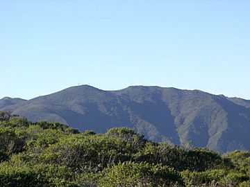
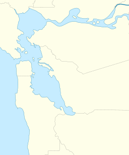
Montara Mountain is a special place located in California. It sits between the towns of Montara, California and Pacifica, California. This mountain is the northern tip of the Santa Cruz Mountains. This long mountain range runs along the San Francisco Peninsula. It helps separate the San Francisco Bay from the big Pacific Ocean.
The highest point of Montara Mountain is about 1,898 feet (579 m) above sea level. You can reach the top by hiking. One way is using the North Peak Access Road. This road starts in McNee Ranch State Park. From the north, trails like Montara Mountain Trail and Brooks Creek Trail lead up from San Pedro Valley County Park.
Amazing Plants and Animals
Montara Mountain has many unique plants and animals. This is because it is quite isolated on the peninsula. It has a special kind of soil called serpentine soil on its lower slopes. This soil helps certain plants grow.
Some very rare and endangered species of plants live here. These include Hickman's potentilla and San Mateo thornmint. A special type of manzanita bush was even named after this mountain. It is called Arctostaphylos montaraensis.
Mountain Features and Water
Sometimes, a light dusting of snow covers the top of Montara Mountain. On clear days, you can see amazing views of the whole San Francisco Bay Area.
Several creeks start on Montara Mountain. These include Denniston Creek, Arroyo de en Medio, and Dean Creek. San Pedro Creek also begins here. The steelhead fish in San Pedro Creek are a threatened species. This means their population is at risk.
Brooks Creek is a small stream that flows into San Pedro Creek. It starts on the north side of the mountain. Brooks Creek forms a tall, thin waterfall called Brooks Falls. At 207 feet, it is the tallest waterfall in San Mateo County.
A Look Back in Time
Montara Mountain has been important for travel for a long time. In October 1769, a Spanish explorer named Gaspar de Portolà crossed it. He followed an old Native American trail along the ridge. Parts of this ancient trail can still be seen today.
Later, during the Mexican Rancho era, a road called Camino Pedro Cuesta used the same path. It connected different ranches in the area. After 1848, this route was known as "Road Trail." It was very difficult for wagons to use.
In 1879, a slightly better road was built. It was called the Half Moon Bay - Colma Road. This road was still very steep. It ran closer to the ocean and a famous spot called Devil's Slide. This road was used until 1915.
 | Dorothy Vaughan |
 | Charles Henry Turner |
 | Hildrus Poindexter |
 | Henry Cecil McBay |


