Devil's Slide (California) facts for kids
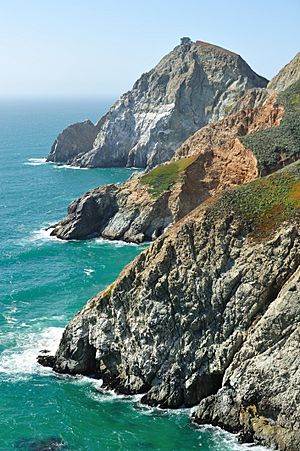
Devil's Slide is a famous rocky cliff on the coast of California, in the United States. It's located in San Mateo County, between the towns of Pacifica and Montara. People call it "Devil's Slide" because its steep, rocky edges are known for accidents and landslides.
Contents
What is Devil's Slide Like?
Devil's Slide is a very steep and rocky part of the coast. It sits between the towns of Montara and Pacifica. The land here has slopes that are very steep, usually between 30 and 50 degrees.
There are also small valleys along the coast. These valleys have deep, healthy soils. They formed from streams flowing down from Montara Mountain.
Plants and Weather
The weather here is like a Mediterranean climate, which means it has mild, wet winters and warm, dry summers. The ocean makes the temperatures stay pretty steady all year. There is also a lot of moisture in the air, often from fog.
Most of the area is covered in thick, low-growing plants called northern coastal scrub. You can also find small grassy spots and bare rocky areas. Inland, there are other types of plants. These include marshes, willow trees, grasslands, and some non-native forests. A rare and endangered species called Hickman's potentilla grows on the slopes above Martini Creek.
The Old Highway 1 at Devil's Slide
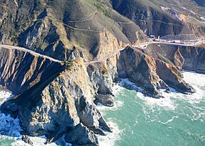
Right next to Devil's Slide is a section of California State Route 1 that used to be a highway. This part of the road was also called "Devil's Slide." It was famous for often closing because of landslides.
Construction on this road started in 1935 and finished in 1936. It replaced an older, very winding road. The new highway was known for landslides and erosion, especially during winter storms. These events often made the road impossible to use.
Road Closures and New Tunnels
The first big landslide happened in 1940 and badly damaged the road. Another large slide in 1995 closed the road for almost two years. In April 2006, the road started to crack. This showed that another slide was about to happen. The highway closed for five months while CalTrans worked to make the area stable.
These frequent closures made local people push for a new route. They wanted tunnels through the mountain to completely avoid Devil's Slide. On March 25, 2013, Caltrans closed the old road for good. It was replaced by the Tom Lantos Tunnels. These tunnels now carry the highway safely through the cliff.
Devil's Slide Trail
On March 27, 2014, the old highway section became the Devil's Slide Trail. This trail is about 1.3-mile (2.1 km) long. It is now open for people to walk and bike on. It cost about US$1.99 million to change the highway into a trail.
Military History at Devil's Slide
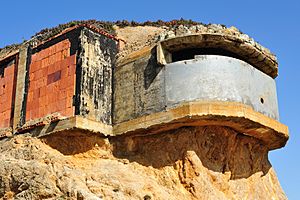
During World War II, Devil's Slide was an important military spot. It was used as an observation site to help defend the harbor of San Francisco. Before radar was invented, soldiers used binoculars and compasses. They would look for ships at sea and send their locations to a main control center.
By combining information from several observation posts, they could figure out a ship's exact location. This method is called triangulation. There were six military buildings at Devil's Slide. These included three concrete observation posts, two concrete bunkers, and a steel observation tower. The bunkers were used as command posts and for communications. One of the southernmost bunkers was sold in 1983, but some of its structure can still be seen today.
 | Kyle Baker |
 | Joseph Yoakum |
 | Laura Wheeler Waring |
 | Henry Ossawa Tanner |


