Pedro Mountain Road facts for kids
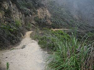
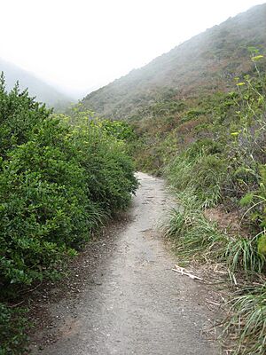
Pedro Mountain Road is the name for old roads that crossed Pedro Mountain. This mountain is a ridge between Montara Mountain and the cliffs of Devil's Slide in San Mateo County, California. Pedro Mountain made it tricky for people to travel along the coast between Pacifica, California and Montara, California. One of the most important of these roads was Coastside Boulevard, which was Highway 57 from 1914 to 1937. Today, parts of it are used as trails in McNee Ranch State Park.
Contents
History of Pedro Mountain Roads
The first time anyone wrote about a road over Pedro Mountain was in October 1769. This was in the journal of the Portola Expedition. They wrote about a "very bad road up over a high mountain." They said it was easy to climb up but very hard to go down the other side. Today, this path is called Indian Trail. It goes from Martini Creek, over Saddle Pass, and down into the Willow Brook Estates in Pacifica.
From 1848 to 1879, the path changed. It was called Road Trail. This path ran east and west along the ridge of Pedro Mountain from Saddle Pass. It then turned north and went down the ridge towards the Sanchez Adobe.
From 1879 to 1914, the road changed again. It was called the Half Moon Bay - Colma Road. This road went over the mountain closer to the ocean. It had very steep, bumpy turns. Some parts were so steep (24% grade) that cars could barely get through.
From October 1915 to June 1937, a new, paved road was built. It was called Coastside Boulevard (Highway 57). This road went up from Higgins Road in Pacifica, rising towards Saddle Pass. People liked it because it was much easier for cars. Today, parts of this road are still used by hikers, mountain bikers, and horses. It is now called the 'Old Pedro Mountain Road'. Some cyclists even call it `Planet of the Apes` for fun.
Half Moon Bay - Colma Road Challenges
The Half Moon Bay - Colma Road was narrow, steep, and winding. It was often in bad condition. Many accidents happened on this dangerous road. Some wrecked cars can still be found in the ravines below the path.
In 1913, Motoring magazine warned drivers. It said, "Pedro Mountain Road is in such poor condition that anyone going this way is simply inviting disaster." There was even a big sign that read: "DANGEROUS FOR AUTOMOBILES—TAKE ROAD VIA SAN MATEO."
Drivers who ignored the sign faced very steep hills, some as steep as 25 percent. The sharp turns needed "the coolest heads, firmest hands, and strongest brakes." Old photos of the road show how difficult it was.
Ocean Shore Railroad as an Alternative
The Ocean Shore Railroad ran from 1907 to 1920. It offered another way to travel instead of the very difficult Half Moon Bay-Colma road. After the railroad stopped running along the coast, the company could not agree with the State of California to move the highway onto the railroad's path. Later, when State Route 1 was finished, most of the highway was built next to the old railroad path. This included the tricky area around Devil's Slide.
Legislative Route 56 and State Route 1
In 1933, this part of the road became part of the highway system as Legislative Route 56. The next year, in 1934, it was named State Route 1. However, the highway was moved to the Devil's Slide area in 1937. This new path replaced State Route 1 from Montara to Rockaway Beach (now Pacifica).
You can still find pieces of the old, crumbling Pedro Mountain Road between Montara and Pacifica. In some places, the road has been washed away or covered by landslides. A small part of the highway is still used in Montara, near a local plant nursery. Even so, hikers can still explore the old routes.
Charlie Nye, Jr., who lived on the coast for a long time, remembered the road. He said, "The road coming over Pedro Mountain was terrible, just awful. Words can’t describe it. It was just impossible." He talked about "turns and more turns, hairpin turns, short turns, backward turns." He also mentioned "potholes on top of potholes." He felt that today's small landslides on Devil’s Slide are "nothing compared to that old Pedro Mountain Road."
Pedro Mountain Road Today
Today, part of the old road starts at a fence in Montara. It goes north to Martini Creek. The original bridge over the creek is gone. However, a trail leads to the ranger's house on the north side of the creek. The path continues to the northern park boundary, past Saddle Pass above Pacifica.
Hikers will find the route a moderate to tough climb. It goes up to about 930 feet (280 m) high. The road then goes down into Pacifica and becomes the city's Higgins Way. Pedro Mountain Road also crosses the North Peak Access Road, which leads to the top of Montara Mountain, just before Green Valley.
 | Delilah Pierce |
 | Gordon Parks |
 | Augusta Savage |
 | Charles Ethan Porter |


