Roseville, California facts for kids
Quick facts for kids
Roseville, California
|
|||
|---|---|---|---|
|
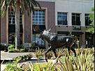
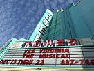
Clockwise from top right: Tower Theatre; St. Clare Church; Carnegie Museum; Fountains at Roseville
|
|||
|
|||

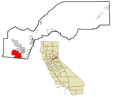
Location in Placer County and the state of California
|
|||
| Country | United States | ||
| State | California | ||
| County | Placer | ||
| Incorporated | April 10, 1909 | ||
| Government | |||
| • Type | Council-manager | ||
| Area | |||
| • Total | 44.08 sq mi (114.16 km2) | ||
| • Land | 44.08 sq mi (114.16 km2) | ||
| • Water | 0.00 sq mi (0.00 km2) 0% | ||
| Elevation | 164 ft (50 m) | ||
| Population
(2020)
|
|||
| • Total | 147,773 | ||
| • Rank | 1st in Placer County 32nd in California 164th in the United States |
||
| • Density | 3,210.2/sq mi (1,239.46/km2) | ||
| Time zone | UTC−8 (Pacific) | ||
| • Summer (DST) | UTC−7 (PDT) | ||
| ZIP codes |
95678, 95661, 95747
|
||
| Area code | 916, 279 | ||
| FIPS code | 06-62938 | ||
| GNIS feature IDs | 1659544, 2411000 | ||
Roseville is a large city in Placer County, California. It is part of the Sacramento metropolitan area. In 2019, about 141,500 people lived there. This made it the third-largest city in the Sacramento area. Major highways like Interstate 80 and State Route 65 go through Roseville.
Roseville has a long history with railroads. In the 1980s and 1990s, the city was greatly updated. Today, it is a big shopping area. Many people from nearby rural areas and the Sierra Nevada foothills come to shop and visit. Recently, Roseville has grown a lot. It has become a "boomburb" or edge city of Sacramento.
Contents
Roseville's Past: A Railroad Town
The Nisenan people lived in the Roseville area for over 2,000 years. They were later forced to leave their homes. The first settlement grew around a stagecoach stop called Griders. In 1864, the Central Pacific Railroad built tracks here. The spot where these tracks met another line was called "Junction." This "Junction" eventually became Roseville.
In 1909, Roseville became an official city. This happened three years after the Southern Pacific Railroad moved its main facilities here. After that, the city grew quickly. Businesses built over 100 new buildings. In 1913, the world's largest ice manufacturing plant was built here. It was called the Pacific Fruit Express building.
Roseville was a railroad town for many decades. By 1929, the railroad employed 1,225 people. The city's total population was 6,425. During World War II, the rail yards became very busy.
After the war, the city continued to grow. But in the 1950s, Roseville started to change. The railroad switched from steam engines to diesel engines. Also, new ways to travel and move goods appeared. The national Interstate Highway System and airlines became popular. This meant fewer people and goods traveled by train. Railroads lost jobs and changed how they worked.
Even though the railroad is still important, Roseville's growth now comes from other types of jobs.
In 1950, a new underpass for the railroad was built. This made it easier to cross the tracks. But it also meant less traffic went through downtown Roseville. Many businesses there lost customers. When Interstate 80 was finished in 1956, new businesses opened in East Roseville. The old downtown area continued to decline.
In 1973, a big explosion and fire happened at the Southern Pacific (now Union Pacific) rail yard. This event is known as the 1973 Roseville Yard Disaster.
The city's population grew steadily over the next few decades. New shopping centers, stores, and homes were built. Most of this growth happened outside the old downtown. The growth was slow until 1985. Between 1929 and 1985, the population grew by 22,563 people.
In 1985, Roseville had 28,988 people. Five years later, it had 44,685 people. By 2000, the population was 74,234. Big technology companies like Hewlett Packard (in 1979) and NEC (in 1983) moved to the city. This helped the population grow even more. By 2014, the population was 126,956 people.
Making Downtown Roseville New Again
In 1988, the city started a big plan to update its downtown area. This plan cost millions of dollars. It aimed to make the historic parts of the city look new again. Projects included improving streets and building a new Civic Plaza Complex.
A new parking garage opened in 2007. The Roseville Arts! Blueline Gallery opened in 2008. A new Civic Center opened in 2013. The Vernon Street Town Square now has a stage and a water spray area for kids. It is a place for community events.
Important Events in Roseville
On October 21, 2010, a young man started fires inside the Westfield Galleria at Roseville mall. This caused a lot of damage. The mall reopened the next year after being repaired.
Roseville's Location and Weather
Roseville covers about 42.26 square miles (109.45 square kilometers). Most of this area is land. Only a very small part is water. Several streams flow through Roseville. These include Dry Creek, Linda Creek, Secret Ravine, and Cirby Creek.
Roseville's Climate
Roseville has a hot-summer Mediterranean climate. This means it has cool, wet winters with little to no snow. Summers are hot and dry. The weather is similar to nearby Sacramento. Roseville is a bit further inland, so its winters are slightly cooler and summers are slightly hotter.
The wet season is usually from October to April. Roseville gets a little more rain than Sacramento. This is because it is east of Sacramento and at a higher elevation. The dry season lasts from June to October. Summers can be very hot, often reaching over 105°F (41°C) on the hottest days.
Average high temperatures range from 53°F (12°C) in January to 94°F (34°C) in July. Low temperatures range from 39°F (4°C) in winter to 61°F (16°C) in summer.
On March 26, 2014, a small EF0 tornado touched down in Roseville.
| Climate data for Roseville, California | |||||||||||||
|---|---|---|---|---|---|---|---|---|---|---|---|---|---|
| Month | Jan | Feb | Mar | Apr | May | Jun | Jul | Aug | Sep | Oct | Nov | Dec | Year |
| Record high °F (°C) | 75 (24) |
78 (26) |
86 (30) |
98 (37) |
107 (42) |
110 (43) |
115 (46) |
110 (43) |
115 (46) |
102 (39) |
87 (31) |
76 (24) |
115 (46) |
| Mean daily maximum °F (°C) | 53 (12) |
60 (16) |
64 (18) |
71 (22) |
80 (27) |
88 (31) |
94 (34) |
92 (33) |
87 (31) |
77 (25) |
63 (17) |
54 (12) |
74 (23) |
| Daily mean °F (°C) | 46 (8) |
51 (11) |
54 (12) |
60 (16) |
66 (19) |
73 (23) |
78 (26) |
76 (24) |
73 (23) |
65 (18) |
54 (12) |
47 (8) |
62 (17) |
| Mean daily minimum °F (°C) | 39 (4) |
42 (6) |
44 (7) |
48 (9) |
53 (12) |
58 (14) |
61 (16) |
61 (16) |
58 (14) |
52 (11) |
44 (7) |
39 (4) |
50 (10) |
| Record low °F (°C) | 21 (−6) |
23 (−5) |
27 (−3) |
33 (1) |
36 (2) |
43 (6) |
48 (9) |
46 (8) |
41 (5) |
31 (−1) |
27 (−3) |
16 (−9) |
16 (−9) |
| Average precipitation inches (mm) | 3.98 (101) |
3.46 (88) |
3.07 (78) |
1.58 (40) |
0.58 (15) |
0.12 (3.0) |
0.04 (1.0) |
0.06 (1.5) |
0.35 (8.9) |
1.08 (27) |
2.80 (71) |
3.33 (85) |
20.45 (519.4) |
| Source: http://www.myforecast.com/bin/climate.m?city=12133&metric=false | |||||||||||||
People of Roseville
| Historical population | |||
|---|---|---|---|
| Census | Pop. | %± | |
| 1870 | 115 | — | |
| 1880 | 258 | 124.3% | |
| 1890 | 345 | 33.7% | |
| 1910 | 2,608 | — | |
| 1920 | 4,477 | 71.7% | |
| 1930 | 6,425 | 43.5% | |
| 1940 | 6,653 | 3.5% | |
| 1950 | 8,723 | 31.1% | |
| 1960 | 13,421 | 53.9% | |
| 1970 | 18,221 | 35.8% | |
| 1980 | 24,347 | 33.6% | |
| 1990 | 44,685 | 83.5% | |
| 2000 | 79,921 | 78.9% | |
| 2010 | 118,788 | 48.6% | |
| 2020 | 147,773 | 24.4% | |
| 2023 (est.) | 159,135 | 34.0% | |
| U.S. Decennial Census | |||
In 2020, Roseville had a population of 147,773 people. Most people in Roseville are White. There are also many Asian, Black, and Mixed-race residents. About 16% of the population is Hispanic or Latino.
In 2010, about 99.3% of the people lived in homes. The average household had 2.62 people. About 37.5% of homes had children under 18. The median age in Roseville was 36.8 years old.
Roseville's Economy and Jobs
Roseville has many different businesses. The city has encouraged large shopping centers. It has one of the biggest auto malls in the country. These businesses bring in a lot of sales tax money. This money helps the city keep its roads and services in good shape as more people move there.
Roseville has a mix of homes, small and large companies, and many shopping places. A popular water park, Roseville Golfland SunSplash, is also in the city.
Companies like GoodLeap, which helps people get loans for solar energy, are based here. The unemployment rate in Roseville is 5.2%.
Shopping in Roseville
Shopping is a very important part of Roseville's economy. Roseville has the thirteenth highest retail sales of all cities in California. It is a major shopping spot for the region. The Westfield Galleria at Roseville is the main shopping center. It is the second-largest mall in Northern California. The Galleria recently had a big expansion project that cost $270 million.
Right across from the Galleria is "Fountains at Roseville." This is a large retail center that also has fun activities. It opened in 2008 and has many stores and restaurants. There are plans to build more hotels, shops, and offices there in the future.
Besides the Galleria and Fountains, Roseville has many other shopping areas. These are located around the Galleria and the Douglas Boulevard financial area.
Top Employers in Roseville
Here are the top ten employers in Roseville as of 2023:
| Employer | Number of jobs |
|---|---|
| Kaiser Permanente | 5,760 |
| Sutter Roseville Medical Center | 5,080 |
| TopGolf | 1,970 |
| City of Roseville | 1,620 |
| Adventist Health | 1,620 |
| Roseville City School District | 1,240 |
| Roseville Joint Union High School District | 1,084 |
| Flexcare LLC | 1,000 |
| Penumbra | 810 |
| Hewlett Packard Enterprise | 630 |
Schools and Learning
Public Schools in Roseville
Roseville has several school districts. These include the Roseville City School District, Eureka Union School District, Dry Creek Joint Elementary School District, and Roseville Joint Union High School District. The Roseville Joint Union High School District is ranked as the #41 best school district in California.
Colleges and Universities
You can find extension campuses of Brandman University and Sierra College in Roseville. The Sierra College campus is called "Roseville Center."
News and Media
Rocklin and Roseville Today is an online newspaper that comes out daily. The Roseville Press-Tribune is a local newspaper published once a week.
Roseville High School has its own student news group called Eye of the Tiger. They publish a newspaper twice a month. They also produce a news broadcast every two weeks.
The Sacramento Bee newspaper is also available in Roseville. Style Magazine, started in 2003, is a popular monthly magazine in the area.
City Services and Transport
Getting Around Roseville
Two main highways run through Roseville: Interstate 80 and State Route 65. State Route 65 connects to I-80.
Amtrak, the national passenger train system, has a station in Roseville. You can take the Capitol Corridor train route from here. Roseville is also home to J.R. Davis Yard, a large Union Pacific Railroad yard.
Roseville Transit is the public bus service in the city. It has 12 regular routes. It also offers Dial-A-Ride service and commuter service. You can connect to other bus and light rail lines from Roseville Transit stops.
Placer County Transit connects Roseville to the Watt/I-80 RT light rail station. It also links Roseville to cities like Auburn, Lincoln, and Rocklin.
City Utilities
The City of Roseville provides electricity, water, wastewater services, and solid waste collection to most areas. In 2020, Roseville and other customers received permanent federal water contracts.
Pacific Gas and Electric provides natural gas. Companies like AT&T, Comcast, and Consolidated Communications offer internet, cable, and phone services in Roseville.
Healthcare in Roseville
Major healthcare providers in Roseville include Sutter Roseville and Kaiser Permanente. There are also many smaller clinics. UC Davis Medical Center is located nearby in Sacramento.
Fire Department
The Roseville Fire Department helps protect the city from fires. They also provide emergency medical services. The department covers an area of 36 square miles (93 square kilometers). In 2010, this area had a population of 118,788 people. The department has eight fire stations.
Famous People from Roseville
People Who Live or Lived in Roseville
- George Barris, who created the Batmobile for TV.
- Isaiah Frey, an NFL football player.
- Jason Hill, an NFL football player.
- Bizz Johnson, a U.S. Representative and former mayor of Roseville.
- Dan Quinn, a mixed martial arts fighter.
- David Yost, an actor.
- Neilson Powless, a professional cyclist.
- Kolton Miller, an NFL football player.
- Jordan Kunaszyk, an NFL football player.
- Steven Anderson, a Baptist preacher.
People Born in Roseville
- Evelyn Ashford, an Olympic gold medalist runner.
- Cameron Beaubier, a motorcycle racer and five-time champion.
- Tedy Bruschi, an NFL football player.
- Dan Bunz, an NFL football player.
- Connie Champagne, a singer and actress.
- Ray Clemons, an NFL football player.
- John Ensign, a U.S. Senator.
- Leanne Hulsenberg, a professional bowler.
- Heather Lynn Johnsen, the first female tomb guard for the Tomb of the Unknown Soldier (Arlington).
- Thomas King, an American-Canadian writer.
- Andrew Knapp, a baseball player for the Philadelphia Phillies.
- Cassie McFarland, who designed a Baseball Hall of Fame coin.
- Scott Pruett, a championship race car driver.
- Molly Ringwald (born 1968), a famous actress from the Brat Pack.
- Summer Sanders, an Olympic swimmer, actress, and TV personality.
- Dominic Sandoval, a dancer and member of Quest Crew.
- Andrew Susac, a baseball player.
- Chelsea Wolfe, a heavy metal singer/songwriter.
See also
 In Spanish: Roseville (California) para niños
 | Janet Taylor Pickett |
 | Synthia Saint James |
 | Howardena Pindell |
 | Faith Ringgold |


