
Placer County, California facts for kids
Quick facts for kids
Placer County, California
|
|||
|---|---|---|---|
 .jpg)  Images from top, left to right: The Auburn Courthouse, a panorama of a forested area, Lake Tahoe in Tahoe Vista
|
|||
|
|||

Location in the state of California
|
|||
| Country | United States | ||
| State | California | ||
| Regions | Sacramento Valley, Sierra Nevada | ||
| Metro area | Greater Sacramento | ||
| Incorporated | April 25, 1851 | ||
| Named for | Placer mining, a reference to the area being a center of the California Gold Rush | ||
| County seat | Auburn | ||
| Largest city | Roseville | ||
| Government | |||
| • Type | Council–CEO | ||
| • Body |
Board of Supervisors
Bonnie Gore
Shanti Landon Jim Holmes Suzanne Jones Cindy Gustafson |
||
| Area | |||
| • Total | 1,502 sq mi (3,890 km2) | ||
| • Land | 1,407 sq mi (3,640 km2) | ||
| • Water | 95 sq mi (250 km2) | ||
| Highest elevation | 9,044 ft (2,757 m) | ||
| Population
(2020)
|
|||
| • Total | 404,739 | ||
| • Density | 269.47/sq mi (104.04/km2) | ||
| Time zone | UTC−8 (Pacific Time Zone) | ||
| • Summer (DST) | UTC−7 (Pacific Daylight Time) | ||
| Area codes | 530, 916, 279 | ||
| FIPS code | 06-061 | ||
| GNIS feature ID | 277295 | ||
| Congressional district | 3rd | ||


Placer County is a county in the state of California, USA. Its name (pronounced PLASS-ər) comes from a Spanish word meaning "sand deposit." As of 2020, about 404,739 people live here. The main city and county seat is Auburn.
Placer County is part of the larger Sacramento area. It sits in both the Sacramento Valley and the Sierra Nevada mountains. This area is also known as the Gold Country. The county stretches about 65 miles (105 km) from the suburbs of Roseville all the way to the Nevada border and the beautiful Lake Tahoe.
Contents
What's in a Name? The Story of Placer
The name "Placer County" comes from the California Gold Rush. In 1848, gold was discovered, bringing thousands of miners to the area. These miners used a method called "placer mining." This is where they washed away sand and gravel to find the heavier gold left behind.
On April 25, 1851, Placer County was officially formed. It was created from parts of Sutter and Yuba Counties. Auburn became its county seat.
A Look Back: Placer County's History
Gold mining was very important in Placer County until the 1880s. After that, people started focusing on farming the rich soil. They also harvested timber and worked for the Southern Pacific Railroad.
Auburn was settled in May 1848 when Claude Chana found gold in Auburn Ravine. It quickly became a place where gold camps could get supplies. The cornerstone of Placer's courthouse was laid on July 4, 1894. This building is still used today for courts and the sheriff's office. It also houses the Placer County Museum.
Roseville was once a small farming town. It grew into a major railroad hub after the Southern Pacific Railroad moved its switching yards there in 1908. Today, Roseville is the county's largest city.
Other towns like Loomis and Newcastle started as mining towns. But they soon became known for growing fruit. Penryn was founded by Griffith Griffith, who started a large granite quarry. Rocklin also began as a railroad town and had many granite quarries. Lincoln and Sheridan are still important for ranching and farming. Lincoln is also home to Gladding, McBean, a clay manufacturing plant that started in 1875.
In 1960, Squaw Valley in Placer County hosted the 1960 Winter Olympics. This was a big event for the area!
Exploring Placer County's Geography
Placer County covers about 1,502 square miles (3,890 km²). Most of this is land (1,407 sq mi or 3,644 km²), with some water (95 sq mi or 246 km²). Important rivers and creeks include the American River and Bunch Creek. A large part of Lake Tahoe (about 41%) is also within Placer County.
The county has three main areas:
- South Placer: This is in the Central Valley and the Sierra Nevada foothills south of Auburn. Most people live here. Roseville is the main center for jobs and shopping.
- Gold Country: This area includes the Sierra Foothills around Auburn, Colfax, and Foresthill.
- Sierra Nevada: This covers all areas east of Foresthill and northeast of Colfax, including the Lake Tahoe region.
Neighboring Counties
- Nevada County - north
- Washoe County, Nevada - northeast
- Carson City, Nevada - east
- Douglas County, Nevada - southeast
- El Dorado County - south
- Sacramento County - southwest
- Sutter County - west
- Yuba County - northwest
Protected Natural Areas
- Eldorado National Forest (part of it)
- Tahoe National Forest (part of it)
Placer County's People
| Historical population | |||
|---|---|---|---|
| Census | Pop. | %± | |
| 1860 | 13,270 | — | |
| 1870 | 11,357 | −14.4% | |
| 1880 | 14,232 | 25.3% | |
| 1890 | 15,101 | 6.1% | |
| 1900 | 15,786 | 4.5% | |
| 1910 | 18,237 | 15.5% | |
| 1920 | 18,584 | 1.9% | |
| 1930 | 24,468 | 31.7% | |
| 1940 | 28,108 | 14.9% | |
| 1950 | 41,649 | 48.2% | |
| 1960 | 56,998 | 36.9% | |
| 1970 | 77,306 | 35.6% | |
| 1980 | 117,247 | 51.7% | |
| 1990 | 172,796 | 47.4% | |
| 2000 | 248,399 | 43.8% | |
| 2010 | 348,432 | 40.3% | |
| 2020 | 404,739 | 16.2% | |
| 2023 (est.) | 423,561 | 21.6% | |
| U.S. Decennial Census 1790–1960 1900–1990 1990–2000 2010 2020 |
|||
In 2020, Placer County had a population of 404,739 people. Most residents (about 67.3%) were White. About 8.6% were Asian, and 6.3% were of two or more races. Around 15% of the population was Hispanic or Latino.
In 2000, there were 248,399 people living in the county. About 35.3% of households had children under 18. The average household had 2.63 people. The median age was 38 years old. This means half the people were older than 38 and half were younger.
The median income for a household in 2000 was $57,535. This means half of the households earned more than this, and half earned less. Only about 5.8% of the population lived below the poverty line. Unemployment in the county is usually lower than the state average.
Placer County's Economy
Placer County has many different types of jobs. Here are some of the top employers:
| # | Employer | # of Employees |
|---|---|---|
| 1 | Kaiser Permanente | 3,064 |
| 2 | Hewlett-Packard | 2,500 |
| 3 | Placer County | 2,400 |
| 4 | Union Pacific Railroad | 2,000 |
| 5 | Sutter Health | 1,983 |
| 6 | Northstar at Tahoe | 1,500 |
| 7 | Thunder Valley Casino Resort | 1,412 |
| 8 | City of Roseville | 1,282 |
| 9 | PRIDE Industries | 1,135 |
| 10 | Raley's Supermarkets | 1,006 |
mPOWER Placer: Helping the Environment
mPOWER Placer is a special program that helps property owners make their buildings more energy-efficient. It also helps them save water and use renewable energy. The program provides money to businesses, farms, and apartment buildings for these improvements. This helps the environment and saves money on energy bills!
Getting Around: Transportation
Major Roads
 Interstate 80
 State Route 28
 State Route 49
 State Route 65
 State Route 89
 State Route 174
 State Route 193
 State Route 267
Public Transport
- Placer County Transit offers bus service along the I-80 highway. It connects to the Sacramento light rail. It also has buses for people who commute to Downtown Sacramento.
- The cities of Auburn, Lincoln, and Roseville have their own local bus services. Roseville also has a bus for commuters to Sacramento.
- Gold Country Stage connects Auburn to Grass Valley.
- Tahoe Truckee Area Regional Transit runs buses in Truckee, Tahoe City, and along the North Shore of Lake Tahoe.
- For longer trips, you can use Greyhound buses or Amtrak trains.
Airports
Placer County has three airports for smaller planes:
- Lincoln Regional Airport
- Auburn Airport
- Truckee-Tahoe Airport
The closest airport for commercial flights (big passenger planes) is Sacramento International Airport.
Communities in Placer County
Cities
Towns
Census-designated places (CDPs)
Other Communities
Ghost Town
Community Populations (2020 Census)
† county seat
| Rank | City/Town/etc. | Municipal type | Population (2020 Census) |
|---|---|---|---|
| 1 | Roseville | City | 147,773 |
| 2 | Rocklin | City | 71,601 |
| 3 | Lincoln | City | 49,757 |
| 4 | Granite Bay | CDP | 21,247 |
| 5 | † Auburn | City | 13,776 |
| 6 | North Auburn | CDP | 13,452 |
| 7 | Loomis | Town | 6,836 |
| 8 | Kings Beach | CDP | 3,563 |
| 9 | Meadow Vista | CDP | 3,263 |
| 10 | Colfax | City | 1,995 |
| 11 | Foresthill | CDP | 1,692 |
| 12 | Sunnyside-Tahoe City | CDP | 1,555 |
| 13 | Tahoe Vista | CDP | 1,392 |
| 14 | Sheridan | CDP | 1,385 |
| 15 | Newcastle | CDP | 1,321 |
| 16 | Dollar Point | CDP | 1,261 |
| 17 | Penryn | CDP | 1,150 |
| 18 | Tahoma (partially in El Dorado County) | CDP | 1,034 |
| 19 | Alta | CDP | 615 |
| 20 | Carnelian Bay | CDP | 518 |
| 21 | Dutch Flat | CDP | 183 |
| 22 | Kingvale (mostly in Nevada County) | CDP | 128 |
| 23 | Auburn Rancheria | AIAN | 2 |
Schools in Placer County
Here are some of the school districts in Placer County:
Schools for all grades (K-12)
- Center Joint Unified School District
- Rocklin Unified School District
- Tahoe-Truckee Unified School District
- Western Placer Unified School District
High Schools
- East Nicolaus Joint Union High School District
- Placer Union High School District
- Roseville Joint Union High School District
- Twin Rivers Unified School District also covers a part of the county for grades 9-12.
Elementary Schools
- Ackerman Elementary School District
- Alta-Dutch Flat Union Elementary School District
- Auburn Union Elementary School District
- Colfax Elementary School District
- Dry Creek Joint Elementary School District
- Elverta Joint Elementary School District
- Eureka Union Elementary School District
- Foresthill Union Elementary School District
- Loomis Union Elementary School District
- Newcastle Elementary School District
- Placer Hills Union Elementary School District
- Pleasant Grove Joint Union Elementary School District
- Roseville City Elementary School District
Images for kids
-
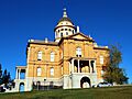
The Auburn Courthouse
-
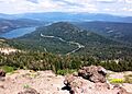
A panorama of a forested area
-
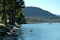
Lake Tahoe in Tahoe Vista
See also
 In Spanish: Condado de Placer para niños
