Foresthill, California facts for kids
Quick facts for kids
Foresthill, California
|
|
|---|---|

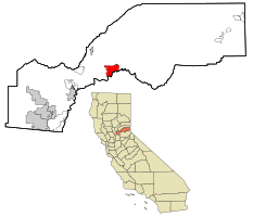
Location in Placer County and the state of California
|
|
| Country | |
| State | |
| County | |
| Area | |
| • Total | 11.188 sq mi (28.977 km2) |
| • Land | 11.188 sq mi (28.977 km2) |
| • Water | 0 sq mi (0 km2) 0% |
| Elevation | 2,169 ft (661 m) |
| Population
(2010)
|
|
| • Total | 1,483 |
| • Density | 132.55/sq mi (51.179/km2) |
| Time zone | UTC-8 (PST) |
| • Summer (DST) | UTC-7 (PDT) |
| ZIP code |
95631
|
| Area code(s) | 530 |
| FIPS code | 06-24834 |
| GNIS feature ID | 2408229 |
| Reference #: | 399 |
Foresthill is a small community in Placer County, California, United States. It's called a census-designated place (CDP), which means it's a specific area identified for population counting. Foresthill is part of the larger Sacramento metropolitan area. In 2020, about 1,692 people lived there.
Contents
Foresthill's Gold Rush History
Foresthill is located on a wide ridge. This ridge sits between the North and Middle Forks of the American River. This area was once part of an ancient riverbed, which was rich in gold.
Early Mining Days
Miners first arrived in large numbers in the spring of 1850. They followed trails from nearby towns like Auburn and Coloma. Where these trails met, the Forest House hotel and trading post was built. This became a central spot for the growing mining community.
The Gold Boom
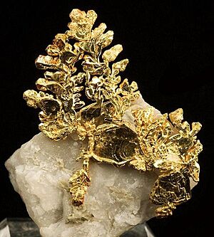
The biggest mining activity in Foresthill started in 1853. A winter landslide uncovered many gold nuggets in Jenny Lind Canyon. The Jenny Lind mine was very successful, producing about $2,500 worth of gold each day for a time. By 1880, this single mine had produced over $1 million in gold. All the mines in the Foresthill area together produced an estimated $10 million by 1868. Back then, gold sold for about $16 an ounce.
Town Growth and Development
By the 1860s, miners had dug about 125,000 feet (38,100 meters) of hard-rock tunnels. These tunnels were in, around, and even under Foresthill. By 1857, Foresthill became an important trading center for many gold camps. In 1862, the Hardy-Kennedy building was built. This was the first fireproof store in town. Today, this building is known as the Langstaff building and is still used by local businesses.
By 1880, Foresthill was one of the largest towns in Placer County. Its main street was about 80 feet (24 meters) wide. Today, Foresthill is recognized as a California Historical Landmark. You can find a special marker at 24540 Main Street.
Geography and Climate
Foresthill covers a total area of about 11.2 square miles (28.97 square kilometers). All of this area is land.
Foresthill's Climate
Foresthill has a Mediterranean climate. This means it has cool, wet winters and hot, dry summers.
| Climate data for Foresthill, California | |||||||||||||
|---|---|---|---|---|---|---|---|---|---|---|---|---|---|
| Month | Jan | Feb | Mar | Apr | May | Jun | Jul | Aug | Sep | Oct | Nov | Dec | Year |
| Mean daily maximum °F (°C) | 51.9 (11.1) |
53.8 (12.1) |
58.2 (14.6) |
63.2 (17.3) |
71.8 (22.1) |
80.9 (27.2) |
89.0 (31.7) |
89.0 (31.7) |
82.2 (27.9) |
70.6 (21.4) |
57.7 (14.3) |
51.6 (10.9) |
68.3 (20.2) |
| Daily mean °F (°C) | 43.1 (6.2) |
44.3 (6.8) |
47.4 (8.6) |
51.3 (10.7) |
59.8 (15.4) |
67.8 (19.9) |
75.3 (24.1) |
75.3 (24.1) |
70.1 (21.2) |
60.1 (15.6) |
49.5 (9.7) |
42.4 (5.8) |
57.2 (14.0) |
| Mean daily minimum °F (°C) | 34.2 (1.2) |
34.7 (1.5) |
36.6 (2.6) |
39.5 (4.2) |
47.7 (8.7) |
54.8 (12.7) |
61.6 (16.4) |
61.5 (16.4) |
57.9 (14.4) |
49.6 (9.8) |
41.2 (5.1) |
33.1 (0.6) |
46.0 (7.8) |
| Average precipitation inches (mm) | 10.01 (254) |
7.73 (196) |
7.25 (184) |
4.04 (103) |
2.26 (57) |
0.63 (16) |
0.08 (2.0) |
0.20 (5.1) |
0.74 (19) |
2.95 (75) |
6.77 (172) |
9.04 (230) |
51.69 (1,313) |
| Average snowfall inches (cm) | 6.0 (15) |
5.4 (14) |
4.6 (12) |
1.4 (3.6) |
0.1 (0.25) |
0 (0) |
0 (0) |
0 (0) |
0 (0) |
0 (0) |
0.7 (1.8) |
2.4 (6.1) |
20.6 (52.75) |
| Average precipitation days | 10 | 10 | 10 | 7 | 5 | 2 | 0 | 1 | 2 | 5 | 8 | 9 | 69 |
| Source 1: PRISM Climate Group | |||||||||||||
| Source 2: Western Regional Climate Center | |||||||||||||
Local Attractions
A notable landmark in the area is the Foresthill Bridge.
Population of Foresthill
The 2010 United States Census counted 1,483 people living in Foresthill. The population density was about 132.6 people per square mile (51.2 people per square kilometer).
Who Lives in Foresthill?
Most residents, about 92.4%, identified as White. About 2% were Native American, and smaller percentages were African American, Asian, or Pacific Islander. About 6.5% of the population identified as Hispanic or Latino.
The census showed that all 1,483 people lived in homes, not in group living situations. There were 625 households in total. About 29.1% of these households had children under 18. The average household had about 2.37 people. The average family size was 2.76 people.
Age Groups in Foresthill
The population's ages were spread out:
- 20.3% were under 18 years old.
- 8.0% were aged 18 to 24.
- 20.5% were aged 25 to 44.
- 36.4% were aged 45 to 64.
- 14.8% were 65 years or older.
The average age in Foresthill was 45.7 years. For every 100 females, there were about 99.1 males.
Most homes in Foresthill are owned by the people living in them (65.1%). The rest are rented (34.9%).
See also
 In Spanish: Foresthill para niños
 | Georgia Louise Harris Brown |
 | Julian Abele |
 | Norma Merrick Sklarek |
 | William Sidney Pittman |


