
Grand Prairie, Texas facts for kids
Quick facts for kids
Grand Prairie, Texas
|
|
|---|---|
.jpg)
Water tower at Market Square
|
|
| Nickname(s):
"G.P."
|
|

Location of Grand Prairie in Dallas County, Texas
|
|

Grand Prairie, Texas
Location in the United States
|
|
| Country | |
| State | |
| Counties | Dallas, Tarrant, Ellis |
| Incorporated as Dechman | 1863 |
| Incorporated as Grand Prairie | 1909 |
| Government | |
| • Type | Council-Manager |
| Area | |
| • City | 81.47 sq mi (210.99 km2) |
| • Land | 72.57 sq mi (187.95 km2) |
| • Water | 8.90 sq mi (23.05 km2) |
| Elevation | 528 ft (161 m) |
| Population
(2020)
|
|
| • City | 196,100 |
| • Rank | (US: 122nd) |
| • Density | 2,407.0/sq mi (929.43/km2) |
| • Urban | 5,121,892 (6th) |
| • Metro | 6,810,913 (4th) |
| • Demonym | Grand Prairian |
| Time zone | UTC−6 (CST) |
| • Summer (DST) | UTC−5 (CDT) |
| ZIP codes |
75050-75054
|
| Area code(s) | 682, 817 214, 469, 945, 972 |
| FIPS code | 48-30464 |
| GNIS feature ID | 2410632 |
Grand Prairie is a city in the U.S. state of Texas. It is located across three counties: Dallas, Tarrant, and Ellis. A small part of the city also reaches into Johnson County. Grand Prairie is part of the Dallas–Fort Worth metroplex, a large metropolitan area in Texas.
In 2020, the city had a population of 196,100 people. This makes Grand Prairie the 15th most populous city in Texas.
Contents
History of Grand Prairie
How Grand Prairie Began
The city of Grand Prairie was first started in 1863 by Alexander McRae Dechman. He named the new settlement "Dechman" after himself. He had lived in Young County, Texas, before moving to this area.
In 1863, Dechman bought a large piece of land near the Trinity River. He tried to build a home there but faced challenges. After a few years, he returned to his family.
The Railroad and a New Name
In 1876, Dechman made a deal with the T&P Railroad. He gave them half of his land to make sure the railroad would come through the town. The railroad named its station "Dechman." This made Alexander Dechman decide to move his family back to the area.
The first post office opened in 1877. However, due to a mistake in writing, it was called "Deckman" instead of "Dechman." Later that year, the railroad started calling the area "Grand Prairie." This name came from old maps that called the land between Dallas and Fort Worth "the grand prairie of Texas." To avoid confusion, the post office also changed its name to "Grand Prairie."
Becoming a City and Its Industries
Grand Prairie officially became an incorporated city in 1909. For many years, especially since World War I, Grand Prairie has been important for the defense and aviation industries.
During World War II, a large factory in the area made important aircraft like the Consolidated B-24 Liberator and the P-51 Mustang. After the war, this factory was taken over by Vought Aircraft, which later became Ling-Temco-Vought (LTV). They built famous planes like the F-8 Crusader and the A-7 Corsair II.
The LTV Missile and Space division also made missiles, which was later sold to Lockheed Martin. Lockheed Martin still operates in Grand Prairie today. Another company, Aérospatiale Helicopter, also had its main U.S. office here. It is now known as Airbus Helicopters, Inc..
Geography and Climate
Where is Grand Prairie Located?
Grand Prairie is located where Tarrant and Dallas counties meet. A small part of the city also extends into Ellis County to the south.
The city is surrounded by other cities:
- Dallas is to the east.
- Cedar Hill and Midlothian are to the southeast.
- Mansfield is to the southwest.
- Arlington is to the west.
- Fort Worth is to the northwest.
- Irving is to the north.
Land and Water Features
Grand Prairie covers a total area of about 81.47 square miles (210.99 square kilometers). Most of this area is land, with about 8.90 square miles (23.05 square kilometers) being water.
The West Fork of the Trinity River flows through Grand Prairie. A major stream called Johnson Creek also runs through the city. Johnson Creek has caused flooding in the past. To help with this, a large project was started in the 1980s to make the creek straighter, which has helped reduce flood damage.
Grand Prairie's Climate
Grand Prairie has a humid subtropical climate. This means it has hot, humid summers and mild winters.
| Climate data for Grand Prairie 1981–2013 Normals | |||||||||||||
|---|---|---|---|---|---|---|---|---|---|---|---|---|---|
| Month | Jan | Feb | Mar | Apr | May | Jun | Jul | Aug | Sep | Oct | Nov | Dec | Year |
| Record high °F (°C) | 85 (29) |
90 (32) |
100 (38) |
100 (38) |
101 (38) |
113 (45) |
110 (43) |
112 (44) |
111 (44) |
106 (41) |
91 (33) |
87 (31) |
113 (45) |
| Mean daily maximum °F (°C) | 56.6 (13.7) |
60.7 (15.9) |
68.0 (20.0) |
75.8 (24.3) |
83.4 (28.6) |
90.7 (32.6) |
95.5 (35.3) |
96.2 (35.7) |
88.5 (31.4) |
78.5 (25.8) |
67.6 (19.8) |
57.3 (14.1) |
76.6 (24.8) |
| Mean daily minimum °F (°C) | 36.5 (2.5) |
40.5 (4.7) |
47.9 (8.8) |
55.5 (13.1) |
64.0 (17.8) |
72.0 (22.2) |
75.8 (24.3) |
75.9 (24.4) |
68.1 (20.1) |
57.7 (14.3) |
46.6 (8.1) |
37.5 (3.1) |
56.6 (13.7) |
| Record low °F (°C) | −2 (−19) |
8 (−13) |
10 (−12) |
29 (−2) |
39 (4) |
53 (12) |
58 (14) |
58 (14) |
42 (6) |
24 (−4) |
16 (−9) |
1 (−17) |
−2 (−19) |
| Average precipitation inches (mm) | 2.2 (56) |
2.6 (66) |
2.9 (74) |
3.3 (84) |
5.0 (130) |
4.7 (120) |
2.4 (61) |
2.0 (51) |
2.8 (71) |
4.5 (110) |
2.5 (64) |
2.4 (61) |
37.4 (950) |
| Average snowfall inches (cm) | 0.5 (1.3) |
0.2 (0.51) |
0.1 (0.25) |
0 (0) |
0 (0) |
0 (0) |
0 (0) |
0 (0) |
0 (0) |
0 (0) |
0 (0) |
0.3 (0.76) |
1.1 (2.8) |
| Average precipitation days (≥ 0.01 in) | 7.4 | 6.6 | 7.5 | 7.2 | 10.2 | 8.0 | 4.8 | 4.9 | 5.4 | 7.5 | 6.7 | 7.2 | 83.4 |
| Average snowy days (≥ 0.1 in) | 0.4 | 0.3 | 0.3 | 0 | 0 | 0 | 0 | 0 | 0 | 0 | 0 | 0.1 | 1.1 |
| Source: Weatherbase.com | |||||||||||||
Population and People
How Many People Live in Grand Prairie?
Grand Prairie has grown a lot over the years. In 1910, fewer than 1,000 people lived there. By 2020, the population had grown to 196,100.
| Historical population | |||
|---|---|---|---|
| Census | Pop. | %± | |
| 1910 | 994 | — | |
| 1920 | 1,263 | 27.1% | |
| 1930 | 1,529 | 21.1% | |
| 1940 | 1,595 | 4.3% | |
| 1950 | 14,594 | 815.0% | |
| 1960 | 30,386 | 108.2% | |
| 1970 | 50,904 | 67.5% | |
| 1980 | 71,462 | 40.4% | |
| 1990 | 99,616 | 39.4% | |
| 2000 | 127,427 | 27.9% | |
| 2010 | 175,396 | 37.6% | |
| 2020 | 196,100 | 11.8% | |
| 2023 (est.) | 202,134 | 15.2% | |
| U.S. Decennial Census | |||
Diversity in Grand Prairie
Grand Prairie is a diverse city with people from many different backgrounds. The table below shows the racial and ethnic makeup of the city over the years.
| Race / Ethnicity (NH = Non-Hispanic) | Pop 2000 | Pop 2010 | Pop 2020 | % 2000 | % 2010 | % 2020 |
|---|---|---|---|---|---|---|
| White alone (NH) | 60,118 | 51,058 | 39,303 | 47.18% | 29.11% | 20.04% |
| Black or African American alone (NH) | 16,948 | 34,436 | 46,360 | 13.30% | 19.63% | 23.64% |
| Native American or Alaska Native alone (NH) | 678 | 709 | 670 | 0.53% | 0.40% | 0.34% |
| Asian alone (NH) | 5,574 | 11,329 | 14,778 | 4.37% | 6.46% | 7.54% |
| Pacific Islander alone (NH) | 59 | 129 | 172 | 0.05% | 0.07% | 0.09% |
| Other Race alone (NH) | 157 | 244 | 792 | 0.12% | 0.14% | 0.40% |
| Mixed race or Multiracial (NH) | 1,855 | 2,598 | 5,276 | 1.46% | 1.48% | 2.69% |
| Hispanic or Latino (any race) | 42,038 | 74,893 | 88,749 | 32.99% | 42.70% | 45.26% |
| Total | 127,427 | 175,396 | 196,100 | 100.00% | 100.00% | 100.00% |
Economy and Jobs
Major Employers in Grand Prairie
Grand Prairie has many businesses and organizations that provide jobs for its residents. Here are some of the top employers in the city:
| # | Employer | # of Employees |
|---|---|---|
| 1 | Grand Prairie Independent School District | 5,000 |
| 2 | Lockheed Martin Missiles and Fire Control | 3,400 |
| 3 | Poly-America, Inc. | 2,000 |
| 4 | Bell Helicopter-Textron | 1,300 |
| 5 | City of Grand Prairie | 1,300 |
| 6 | Lone Star Park at Grand Prairie | 950 |
| 7 | Vought Aircraft Industries | 900 |
| 8 | Republic National Distribution | 800 |
| 9 | Wal-mart | 800 |
| 10 | Arnold Transportation Services | 650 |
Airbus Helicopters, Inc., which is the U.S. branch of Airbus Helicopters, has its main office in Grand Prairie.
Fun Things to Do in Grand Prairie
Grand Prairie offers many attractions and fun places for families and visitors.
- Lone Star Park: This park opened in 1997 and hosts horse racing events. A big Thoroughbred Meeting with several races is held here every Memorial Day.
- GPX Skate Park: This skate park opened in 2000 and even hosted trials for the X Games in 2001 and 2002.
- The Theatre at Grand Prairie: This venue hosts concerts and other live events. It has had a few different names over the years, including The Verizon Theatre.
- Prairie Lights: During the holiday season, you can visit this amazing display. It's a two-mile-long drive with over three million lights and 500 lighted displays.
- Traders Village: Opened in 1973, this is described as the largest flea market in Texas. It's open on weekends from morning until dusk.
- The Ballpark in Grand Prairie: This stadium was home to the Grand Prairie AirHogs minor league baseball team from 2008 to 2020.
- Uptown Theatre: Located in downtown Grand Prairie, this historic building is a playhouse and a place for concerts.

- Turner Park: This was Grand Prairie's very first park, established in the 1940s. It features one of the best disc golf courses in North Texas.
- Epic Waters Indoor Waterpark: This is one of the largest indoor waterparks in Texas. It opened in 2018 and is considered one of the top indoor waterparks in the nation.
- Ripley's Believe It Or Not / Louis Tussaud's Palace of Wax: These attractions offer unique and interesting exhibits.
- Grand Prairie Stadium: This stadium is home to the Texas Super Kings, a major league cricket team that started playing in 2023.
Education in Grand Prairie
Public Schools in Grand Prairie
Most students in Grand Prairie attend schools within the Grand Prairie Independent School District (GPISD). This district serves most areas of Grand Prairie that are in Dallas County.
Other parts of Grand Prairie are served by different school districts, including:
- Mansfield Independent School District (MISD)
- Arlington ISD (AISD)
- Cedar Hill ISD
- Irving ISD
- Midlothian ISD
In Texas, school district boundaries do not always follow city or county lines. This means a student might live in Grand Prairie but attend a school in a neighboring district.
Grand Prairie Independent School District Schools
Here are some of the schools within the Grand Prairie Independent School District:
| High Schools | Middle Schools | Elementary Schools | Others |
|---|---|---|---|
|
|
|
|
Schools in Other Districts
- Arlington ISD: Many Grand Prairie students attend schools in the Arlington ISD. Some of these students go to James Bowie High, Sam Houston, or Lamar High School.
- Mansfield ISD: This district also serves a large number of Grand Prairie students. Schools like Anna May Daulton Elementary, Louise Cabaniss Elementary, and Cora Spencer Elementary are located within Grand Prairie city limits. Students might attend Mansfield Timberview High School, Lake Ridge High School, or Mansfield High School.
Colleges and Universities
After high school, students in Grand Prairie can attend different colleges depending on which county they live in:
- Residents in Dallas County can attend Dallas College.
- Residents in Tarrant County can attend Tarrant County Junior College.
- Residents in Ellis County can attend Navarro College.
Transportation in Grand Prairie
Major Roads and Highways
Grand Prairie has several important roads that help people travel through the city:
- Interstate 20 (I-20) and Interstate 30 (I-30) run east-west through the city.
- Spur 303 (also called Pioneer Parkway) and SH 180 (Main Street) also run east-west.
- SH 360 runs along the western edge of the city.
- SH 161, known as the President George Bush Turnpike, runs north-south through western Grand Prairie. Its main lanes opened in 2012.
- Belt Line Road is a major north-south road. South of Main Street, it's also called FM 1382.
Public Transportation
In April 2022, Grand Prairie started a new public transportation service called "Via Grand Prairie." It's an "on-demand" service that connects to DART's West Irving station, making it easier for people to get around.
Notable People from Grand Prairie
Many talented people have lived in or are from Grand Prairie, including:
- Selena Gomez, a famous singer, songwriter, and actress.
- Dimebag Darrell, a well-known musician and guitarist.
- Jeff Okudah, a professional football player for the Houston Texans.
- Hayley Orrantia, an actress and singer.
- Vergil Ortiz Jr., a professional boxer.
- Charley Taylor, a professional football player.
- Kerry Wood, a former Major League Baseball pitcher.
Images for kids
-

Water tower located next to SH 161
-
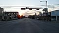
Main Street at dusk, looking west
-
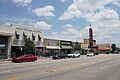
Main Street, looking east


.jpg)
See also
 In Spanish: Grand Prairie para niños
