Midlothian, Texas facts for kids
Quick facts for kids
Midlothian, Texas
|
||
|---|---|---|
 |
||
|
||
| Motto(s):
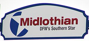
"DFW's Southern Star"
|
||
| Country | United States | |
| Texas | ||
| County | Ellis | |
| Government | ||
| • Type | Council-Manager | |
| Area | ||
| • Total | 64.23 sq mi (166.34 km2) | |
| • Land | 63.50 sq mi (164.47 km2) | |
| • Water | 0.73 sq mi (1.88 km2) | |
| Elevation | 781 ft (238 m) | |
| Population
(2020)
|
||
| • Total | 35,125 | |
| • Density | 546.86/sq mi (211.164/km2) | |
| Time zone | UTC−6 (Central (CST)) | |
| • Summer (DST) | UTC−5 (CDT) | |
| ZIP Code |
76065
|
|
| Area code(s) | 214, 469, 945, 972 | |
| FIPS code | 48-48096 | |
| GNIS feature ID | 2411097 | |
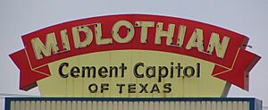
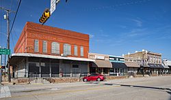
Midlothian is a city in Ellis County, Texas, United States. It is located about 25 miles southwest of Dallas. Midlothian is known as a center for the cement industry in North Texas. It has three large cement factories and a steel mill. The city has grown a lot, with its population increasing significantly between 2000 and 2010.
Contents
History of Midlothian
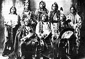
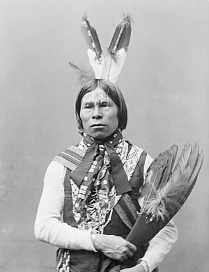
In the early 1800s, people started settling in the area that would become Ellis County. However, more people moved there after 1846. That year, Sam Houston made peace agreements with the Native American tribes living in the region. The first people to live here were the Tonkawa tribe. Other tribes, like the Anadarko, Bidai, Kickapoo, and Waco, also hunted in this area.
This part of Texas was called the Peters Colony. It was named after a company from Kentucky that helped people settle the land. The Republic of Texas encouraged people to move to North Texas in 1857. Early settlers trapped animals for their fur and traded with the Native Americans. Most of the first settlers in Ellis County came from the southern United States. They brought their ways of life, farming skills, and some also brought enslaved people.
Some of the first families to settle here were William Alden Hawkins and Larkin Newton in 1848. To claim their land, they had to build a house on their property by a certain date. Both families met the deadline and became landowners. William Alden Hawkins' grandson later bought land and built the William L and Emma Hawkins House. This house is now a special historical landmark.
Ellis County was officially created by the Texas Legislature on December 20, 1849. It was named after Richard Ellis, a Texas politician.
The name "Midlothian" was chosen in 1883. A local story says that when the railroad arrived, a Scottish train engineer felt homesick. He thought the area looked like his home in Scotland. Also, the location was about halfway between Dallas and Cleburne. With the railroad, Midlothian grew and became an official city in April 1888.
Some of the oldest buildings in the city are churches. The First United Methodist Church was built in 1902. The First Presbyterian Church followed in 1913. The Midlothian Cemetery has graves from the 1870s.
Geography and Climate
Midlothian is located in the northwest part of Ellis County. It is next to cities like Cedar Hill to the north and Waxahachie to the southeast.
In 2010, the city covered about 50.4 square miles (130.5 square kilometers). Most of this area is land, with a small part covered by water.
Climate in Midlothian
Midlothian has hot, humid summers. Its winters are usually mild to cool. This type of weather is known as a humid subtropical climate.
Population and People
| Historical population | |||
|---|---|---|---|
| Census | Pop. | %± | |
| 1890 | 297 | — | |
| 1900 | 832 | 180.1% | |
| 1910 | 868 | 4.3% | |
| 1920 | 1,298 | 49.5% | |
| 1930 | 1,168 | −10.0% | |
| 1940 | 1,027 | −12.1% | |
| 1950 | 1,177 | 14.6% | |
| 1960 | 1,521 | 29.2% | |
| 1970 | 2,322 | 52.7% | |
| 1980 | 3,219 | 38.6% | |
| 1990 | 5,141 | 59.7% | |
| 2000 | 7,480 | 45.5% | |
| 2010 | 18,037 | 141.1% | |
| 2020 | 35,125 | 94.7% | |
| 2023 (est.) | 41,352 | 129.3% | |
| U.S. Decennial Census | |||
Midlothian has grown a lot over the years. In 2020, there were 35,125 people living in the city. There were over 10,000 households.
The people living in Midlothian come from many different backgrounds. In 2020, about 68.87% of the people were non-Hispanic white. About 8.95% were African American. Around 16.07% of the population was Hispanic or Latino.
| Race | Number | Percentage |
|---|---|---|
| White or European American (NH) | 24,189 | 68.87% |
| Black or African American (NH) | 3,145 | 8.95% |
| Native American or Alaska Native (NH) | 182 | 0.52% |
| Asian (NH) | 376 | 1.07% |
| Pacific Islander (NH) | 24 | 0.07% |
| Some Other Race (NH) | 110 | 0.31% |
| Mixed/Multi-Racial (NH) | 1,455 | 4.14% |
| Hispanic or Latino | 5,644 | 16.07% |
| Total | 35,125 |
Economy and Jobs
Before the Great Depression in 1929, Midlothian's economy was based on cotton and raising cattle. Later, the cement industry became very important. Midlothian is a great place for cement production because of a special rock formation called the Austin Chalk Escarpment.
Three of the largest cement factories in the United States are in Midlothian. These include TXI, Holcim, and Ash Grove. There is also a large steel mill called Gerdau Ameristeel near the TXI cement plant.
Midlothian has a big industrial park called Railport. It is home to several distribution centers, including Target and QuikTrip. The northern part of the city has a large car distribution center and a rail facility for moving goods.
Top Employers in Midlothian
Here are some of the biggest employers in Midlothian, based on a 2023 report:
| # | Employer | # of Employees |
|---|---|---|
| 1 | Gerdau | 1,250 |
| Target | ||
| 3 | Ash Grove Texas Cement | 250 |
| Lafarge Holcim Texas | ||
| Martin Marietta Materials | ||
| QuikTrip Distribution | ||
| SunOpta Grains and Foods | ||
| Sunrider Manufacturing | ||
| 9 | Aurorium | 100 |
| Google Midlothian | ||
| MidTexas International Center | ||
| Vistra Energy |
Education in Midlothian
Most students in Midlothian attend schools in the Midlothian Independent School District (MISD). This district covers about 112 square miles. MISD offers programs for students from kindergarten through 12th grade. In the 2012–2013 school year, MISD had nine schools and over 7,500 students. There was about one teacher for every 16 students.
Students at Midlothian High School (the "Panthers") have done very well in many activities. They have won awards in agricultural competitions and music. Their baseball, soccer, and softball teams often do well in sports playoffs. A large sports stadium was built in 2006. The city's second high school is Midlothian Heritage High School.
Some parts of Midlothian are also served by the Waxahachie Independent School District. Students there attend Waxahachie High School.
Higher Education Opportunities
Midlothian also has options for college-level education. In 2012, the Midlothian Higher Education Center (MHEC) was approved. This center is a partnership between several colleges and universities. These include Navarro College-Midlothian, Tarleton State University, Texas A&M University-Commerce, and University of North Texas-Dallas. This partnership allows students to earn bachelor's and graduate degrees at Navarro College's Midlothian campus.
Transportation in Midlothian
Midlothian is located where U.S. Highway 67 and U.S. Highway 287 meet. This location makes it easy to travel to Dallas, Fort Worth, and other parts of Texas.
In May 2015, Padera Lake had very high water levels due to heavy rains. There were worries that a nearby dam might break. If it had, U.S. Route 287 could have been flooded. Luckily, water was pumped out, and a disaster was avoided.
MidWay Regional Airport
The MidWay Regional Airport (JWY) is located about three miles east of Midlothian. The cities of Midlothian and Waxahachie operate it together. This airport is for corporate and general aviation. It offers services like maintenance, repairs, and flight planning. The airport opened in 1992 and was expanded in 2012.
Eagles Nest Estates Airport
Another airport, Eagles Nest Estates Airport (T56), is about four miles northeast of Midlothian. It is part of a neighborhood called Eagles Nest Estates Airport Community. This airport is privately owned but is open to the public. It opened in 1985.
See also
 In Spanish: Midlothian (Texas) para niños
 | Tommie Smith |
 | Simone Manuel |
 | Shani Davis |
 | Simone Biles |
 | Alice Coachman |


