
List of cities in Nevada facts for kids

Nevada is a state located in the Western United States. It's known for its deserts, mountains, and cities like Las Vegas. In 2020, Nevada was the 32nd biggest state by population, with over 3.1 million people. But it's also the 7th largest state in size, covering about 109,781 square miles (284,332 square kilometers).
Nevada is divided into 17 counties and has 19 main towns or cities, which are called municipalities. These municipalities cover only a small part of the state's land (about 1%) but are home to most of its people (about 56%).
Most municipalities in Nevada are officially called cities. However, the state capital, Carson City, is special. It's considered an independent city because it's not part of any county.
To become an official city, a group of people can ask the local government leaders (called the board of county commissioners). These leaders look at many things, like where the area is, how many people live there, and how well the local economy is doing.
Cities in Nevada are grouped by how many people live there. This helps decide how many local areas (wards) they have, how city leaders are chosen, and how many city clerks they need.
- Category One: Cities with 50,000 or more people.
- Category Two: Cities with 5,000 or more people, but fewer than 50,000.
- Category Three: Cities with fewer than 5,000 people.
Cities are responsible for making sure people have important services. These include fire and police protection, good roads, clean water, and working sewers.
The city with the most people in Nevada is Las Vegas, with over 641,903 residents. The smallest is Caliente, with only 990 residents.
When it comes to size, Boulder City is the largest municipality, covering about 208.52 square miles (540.01 square kilometers). Lovelock is the smallest, at only 0.85 square miles (2.20 square kilometers).
The first place in Nevada to become an official city was Carson City, way back on March 1, 1875. The newest city is Fernley, which became a city on July 1, 2001.
Nevada's Cities
Here are some of the biggest cities in Nevada by population:
- Largest cities in Nevada by population
-
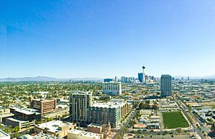
Downtown Las Vegas, Nevada's largest city by population
-
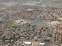
Aerial view of Henderson, a large city near Las Vegas
-

Skyline of Reno, the third most populous city in Nevada
-
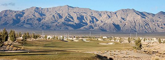
Mountains around North Las Vegas, another big city near Las Vegas
-
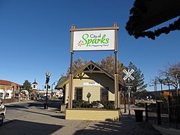
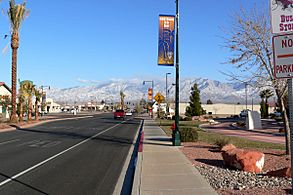
Sparks, a city next to Reno
-
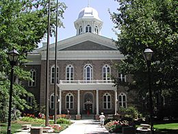
Carson City, Nevada's capital and sixth largest city by population
-
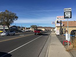
Main street of Nevada's newest city, Fernley
-
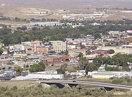
Downtown Elko, an important city in northern Nevada
-
Downtown Mesquite, a growing city in southeastern Nevada
-
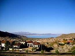
View of Boulder City, known for its history and nearby Lake Mead

.jpg)


_in_Fernley,_Nevada.jpg)


State capital and independent city County seat (main city of a county)
| City Name | Type | County | Population (2020) |
Population (2010) |
Change | Land area (2020) |
Population density (people per sq mi) |
Date it became a city | |
|---|---|---|---|---|---|---|---|---|---|
| sq mi | km2 | ||||||||
| Boulder City | City | Clark | 14,885 | 15,023 | −0.9% | 208.27 | 539.4 | 71.5/sq mi (27.6/km2) | October 1, 1959 |
| Caliente | City | Lincoln | 990 | 1,130 | −12.4% | 53.02 | 137.3 | 18.7/sq mi (7.2/km2) | October 1, 1959 |
| Carlin | City | Elko | 2,050 | 2,368 | −13.4% | 10.44 | 27.0 | 196.4/sq mi (75.8/km2) | October 22, 1925 |
| Carson City |
— | None | 58,639 | 55,274 | +6.1% | 144.53 | 374.3 | 405.7/sq mi (156.6/km2) | March 1, 1875 |
| Elko |
City | Elko | 20,564 | 18,297 | +12.4% | 17.85 | 46.2 | 1,152.0/sq mi (444.8/km2) | March 14, 1917 |
| Ely |
City | White Pine | 3,924 | 4,255 | −7.8% | 7.63 | 19.8 | 514.3/sq mi (198.6/km2) | July 20, 1907 |
| Fallon |
City | Churchill | 9,327 | 8,606 | +8.4% | 3.72 | 9.6 | 2,507.3/sq mi (968.1/km2) | December 18, 1908 |
| Fernley | City | Lyon | 22,895 | 19,368 | +18.2% | 121.31 | 314.2 | 188.7/sq mi (72.9/km2) | July 1, 2001 |
| Henderson | City | Clark | 317,610 | 257,729 | +23.2% | 106.23 | 275.1 | 2,989.8/sq mi (1,154.4/km2) | June 8, 1953 |
| Las Vegas |
City | Clark | 641,903 | 583,756 | +10.0% | 141.83 | 367.3 | 4,525.9/sq mi (1,747.5/km2) | March 16, 1905 |
| Lovelock |
City | Pershing | 1,805 | 1,894 | −4.7% | 0.86 | 2.2 | 2,098.8/sq mi (810.4/km2) | September 26, 1917 |
| Mesquite | City | Clark | 20,471 | 15,276 | +34.0% | 31.76 | 82.3 | 644.6/sq mi (248.9/km2) | May 24, 1984 |
| North Las Vegas | City | Clark | 262,527 | 216,961 | +21.0% | 101.28 | 262.3 | 2,592.1/sq mi (1,000.8/km2) | May 1, 1946 |
| Reno |
City | Washoe | 264,165 | 225,221 | +17.3% | 108.77 | 281.7 | 2,428.7/sq mi (937.7/km2) | March 16, 1903 |
| Sparks | City | Washoe | 108,445 | 90,264 | +20.1% | 36.44 | 94.4 | 2,976.0/sq mi (1,149.0/km2) | March 15, 1905 |
| Wells | City | Elko | 1,237 | 1,292 | −4.3% | 6.90 | 17.9 | 179.3/sq mi (69.2/km2) | March 28, 1927 |
| West Wendover | City | Elko | 4,512 | 4,410 | +2.3% | 7.48 | 19.4 | 603.2/sq mi (232.9/km2) | July 1, 1991 |
| Winnemucca |
City | Humboldt | 8,431 | 7,396 | +14.0% | 9.78 | 25.3 | 862.1/sq mi (332.9/km2) | October 13, 1917 |
| Yerington |
City | Lyon | 3,121 | 3,048 | +2.4% | 29.46 | 76.3 | 105.9/sq mi (40.9/km2) | March 14, 1907 |
| Total cities | — | — | 1,767,501 | 1,531,568 | +15.4% | 1,147.56 | 2,972.2 | 1,540.2/sq mi (594.7/km2) | — |
| Nevada (Entire State) | — | — | 3,104,614 | 2,700,551 | +15.0% | 109,781.18 | 284,332.0 | 28.3/sq mi (10.9/km2) | — |
See also
 In Spanish: Anexo:Localidades de Nevada para niños
