The Sundial (Zion) facts for kids
Quick facts for kids The Sundial |
|
|---|---|

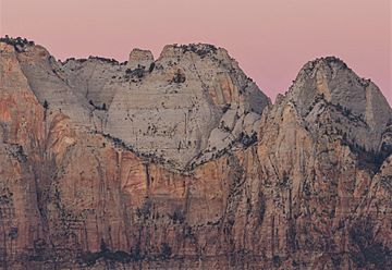
The Sundial, east aspect at dawn
(The Witch Head to right) |
|
| Highest point | |
| Elevation | 7,590 ft (2,310 m) |
| Prominence | 530 ft (160 m) |
| Isolation | 0.38 mi (0.61 km) |
| Parent peak | The West Temple (7,810 ft) |
| Geography | |
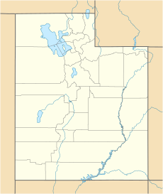
| Location | Zion National Park Washington County, Utah United States |
| Parent range | Colorado Plateau |
| Topo map | USGS Springdale West |
| Geology | |
| Age of rock | Jurassic |
| Type of rock | Navajo sandstone |
| Climbing | |
| Easiest route | class 5+ climbing |
The Sundial is a tall, white rock formation in Zion National Park, located in southwest Utah, United States. It stands at 7,590 feet (2,313 meters) high. This amazing peak is made of Navajo Sandstone, a type of rock that gives it its distinctive white color.
Contents
About The Sundial
The Sundial is found in a part of Zion National Park called the "Towers of the Virgin." It's about 2.5 miles (4 km) west of the park's main office. This huge rock towers 3,600 feet (1,100 meters) above the bottom of Zion Canyon. The Virgin River flows through the canyon below, carrying water away from the mountain.
Neighbors of The Sundial
The Sundial has many impressive neighbors! Its closest tall neighbor is The West Temple, which is about half a mile to the southeast. Other nearby peaks include Altar of Sacrifice, The Witch Head, Bee Hive, The Sentinel, Mount Spry, Bridge Mountain, and Mount Kinesava.
How The Sundial Got Its Name
This unique rock formation was named by Preston P. Patraw, who was the third superintendent of Zion National Park. He called it "The Sundial" because people in the nearby town of Grafton used it like a giant sundial to tell time. They could tell what time it was by looking at the shadows cast by the mountain. The name "The Sundial" became official in 1934, approved by the United States Board on Geographic Names.
Climate Around The Sundial
The best times to visit The Sundial are during spring and fall. The area has a Cold semi-arid climate, which means it's a desert climate. The coldest month usually has an average temperature below 32 °F (0 °C). Most of the yearly rain falls during spring and summer. This desert area gets less than 10 inches (254 mm) of rain each year. Snowfall in winter is usually light.
 | Audre Lorde |
 | John Berry Meachum |
 | Ferdinand Lee Barnett |


