National Register of Historic Places listings in Zion National Park facts for kids
Zion National Park is a super special place in Utah, famous for its amazing canyons, tall cliffs, and beautiful rivers. But did you know it's also home to many important historic sites? These places are so special that they are listed on the National Register of Historic Places (NRHP). Think of the NRHP as a special list of places across the United States that are important to history.
In Zion National Park, there are 29 different places and areas on this list. Most of them are in Washington County, Utah, and a few are in Kane County, Utah, especially near the park's East Entrance. Even though a tiny part of the park goes into Iron County, Utah, there aren't any historic places listed there. The town closest to all these cool spots is Springdale, Utah.
This list below shows all the historic places in Zion National Park, sorted from A to Z. You can also learn more about many of these places, grouped by what kind of place they are (like buildings or trails), in another article called Historical buildings and structures of Zion National Park.
Contents
Exploring Zion's Historic Treasures
These are the amazing historic places you can find in Zion National Park! Each one has a story to tell about the park's past.
| Name on the Register | Image | Date listed | Location | Description | ||
|---|---|---|---|---|---|---|
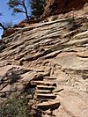
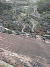
| 1 | Angels Landing Trail-West Rim Trail |
(#86003707) |
South of Scout Lookout across the Virgin River and Refrigerator Canyon 37°16′06″N 112°56′58″W / 37.268333°N 112.949444°W |
This famous trail leads to an incredible viewpoint. It's known for its steep and exciting sections. | ||
| 2 | Cable Creek Bridge |
(#96000053) |
Floor of the Valley Rd. at milepost 4.48, south of Weeping Rock Parking Area entrance 37°16′13″N 112°56′19″W / 37.270278°N 112.938611°W |
A bridge that helps visitors cross Cable Creek. It's part of the park's important transportation history. | ||
| 3 | Cable Mountain Draw Works |
(#78000281) |
North of Springdale in Zion National Park 37°15′57″N 112°55′59″W / 37.265833°N 112.933056°W |
This old machinery was used to move timber from the top of Cable Mountain down into the canyon. It shows how people used the park's resources long ago. | ||
| 4 | Canyon Overlook Trail |
(#86003722) |
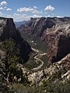
Across the highway from the parking area at the eastern end of the Zion-Mt. Carmel Tunnel to a point directly above the Great Arch of Zion 37°12′49″N 112°56′54″W / 37.213611°N 112.948333°W |
A popular trail offering amazing views of Zion Canyon. It's a great spot for photos! | ||
| 5 | Crawford Irrigation Canal |
(#86003732) |
Western bank of the Virgin River from 1 mile (1.6 km) north of the Virgin River bridge to the base of the Virgin River Formation and .5 miles (0.80 km) up Oak Creek 37°12′40″N 112°59′33″W / 37.211111°N 112.9925°W |
Springdale | An old canal built to bring water to farms in the area. It shows how early settlers used the river. | |
| 6 | East Entrance Checking Station |
(#86003711) |
Island in middle of State Route 9 37°14′01″N 112°52′06″W / 37.233611°N 112.868333°W |
This building greeted visitors entering the park from the east. It's a classic example of park architecture. | ||
| 7 | East Entrance Residence |
(#86003712) |
Eastern entrance 150 feet north of State Route 9 37°14′01″N 112°52′41″W / 37.233611°N 112.878056°W |
A historic house where park rangers lived near the East Entrance. | ||
| 8 | East Entrance Sign |
(#86003710) |
East Entrance Checking Station on northern and southern sides of State Route 9 37°14′07″N 112°52′07″W / 37.235278°N 112.868611°W |
The historic sign that welcomes visitors to Zion National Park from the east side. | ||
| 9 | East Rim Trail |
(#86003723) |
Between Weeping Rock Parking Area and Observation Point 37°16′42″N 112°55′45″W / 37.278333°N 112.929167°W |
A long and scenic trail that offers incredible views from the eastern rim of Zion Canyon. | ||
| 10 | Emerald Pools Trail |
(#86003725) |
Footbridge across the highway from Utah Parks Lodge proceeding west to the Lower Emerald Pool 37°14′58″N 112°57′16″W / 37.249444°N 112.954444°W |
A popular trail leading to beautiful pools and waterfalls. It's a favorite spot for many visitors. | ||
| 11 | Flanigan Ditch |
(#97001630) |
Zion National Park 37°12′53″N 112°58′28″W / 37.214722°N 112.974444°W |
Another historic irrigation ditch that helped early settlers get water from the river. | ||
| 12 | Floor of the Valley Road |
(#96000048) |
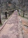
From its junction with the Zion-Mt. Carmel Highway along the North Fork of the Virgin River in Zion National Park 37°15′20″N 112°57′17″W / 37.255556°N 112.954722°W |
This main road takes visitors through the heart of Zion Canyon, offering stunning views. | ||
| 13 | Gateway to the Narrows Trail |
(#86003726) |
Temple of Sinawava at the end of Zion Canyon Scenic Dr. to a point 1 mile north on the Virgin River 37°17′48″N 112°56′42″W / 37.296667°N 112.945°W |
This trail leads to the famous "Narrows" section of the Virgin River, where the canyon walls are very close. | ||
| 14 | Grotto Camping Ground North Comfort Station |
(#86003705) |
Grotto Picnic Area near Grotto Residence, east of Scenic Dr. 37°15′33″N 112°56′33″W / 37.259167°N 112.9425°W |
A historic restroom facility at the Grotto Campground, built in a style that fits the park. | ||
| 15 | Grotto Camping Ground South Comfort Station |
(#86003704) |
Grotto Picnic Area near Grotto Residence, east of Scenic Dr. 37°15′31″N 112°56′27″W / 37.258611°N 112.940833°W |
Another historic restroom at the Grotto Campground, showing the park's early design. | ||
| 16 | Grotto Trail |
(#86003914) |
Zion National Park, 120 feet north of Zion Lodge extending south 0.2 miles parallel to the eastern side of Zion Canyon Scenic Dr. 37°15′01″N 112°57′26″W / 37.250278°N 112.957222°W |
A short but important trail connecting different areas near the Grotto. | ||
| 17 | Hidden Canyon Trail |
(#86003731) |
Hidden Canyon junction on the East Rim Trail to the mouth of Hidden Canyon 37°16′01″N 112°55′50″W / 37.266944°N 112.930556°W |
A challenging trail that leads into a narrow, hidden canyon. | ||
| 18 | Museum-Grotto Residence |
(#86003721) |
Southeast of Grotto Picnic Area 37°15′28″N 112°57′03″W / 37.257778°N 112.950833°W |
This building served as both a museum and a residence. It's an important part of the park's history. | ||
| 19 | Oak Creek Historical District |
(#86003706) |
Off State Route 9 along bank of Oak Creek 37°12′40″N 112°59′10″W / 37.211111°N 112.986111°W |
This area includes several historic buildings and structures near Oak Creek. | ||
| 20 | Oak Creek Irrigation Canal |
(#86003738) |
Western side of the North Fork of the Virgin River, 1/8 miles north of the Virgin River Bridge to the northern side of Watchman Campground Entrance Rd. 37°12′09″N 112°59′28″W / 37.2025°N 112.991111°W |
An old canal used to bring water to farms and homes in the area. | ||
| 21 | Parunuweap Canyon Archeological District |
(#96001235) |
Address Restricted |
This area contains important clues about ancient people who lived in Zion. Its exact location is kept secret to protect these valuable sites. | ||
| 22 | Pine Creek Irrigation Canal |
(#86003734) |
Eastern bank of the Virgin River 0.25 miles north of the Virgin River bridge to the southwestern end of the Watchman Residential Loop 37°12′06″N 112°58′40″W / 37.201667°N 112.977778°W |
Another historic canal that helped bring water to the park's early residents and facilities. | ||
| 23 | Pine Creek Residential Historic District |
(#86003736) |
Western side of State Route 9 500 feet south of the bridge over the Virgin River 37°12′59″N 112°58′32″W / 37.216389°N 112.975556°W |
This area includes historic homes where park staff lived, showing how the park developed over time. | ||
| 24 | South Campground Amphitheater |
(#86003717) |
South Campground 37°12′12″N 112°58′55″W / 37.203333°N 112.981944°W |
An outdoor theater where park rangers would give talks and programs to campers. | ||
| 25 | South Campground Comfort Station |
(#86003708) |
South Campground at the northern end of the campsite loop 37°12′14″N 112°58′21″W / 37.203889°N 112.9725°W |
A historic restroom building at the South Campground, designed to blend in with the park's natural beauty. | ||
| 26 | South Entrance Sign |
(#86003713) |
South Entrance 37°12′04″N 112°59′22″W / 37.201111°N 112.989444°W |
The historic sign that welcomes visitors to Zion National Park from the south side. | ||
| 27 | Zion Lodge Historic District |
(#82001718) |
North of Springdale in Zion National Park; also west of State Route 9 on the eastern and western sides of The Zion Canyon Scenic Drive near Birch Creek 37°15′01″N 112°57′17″W / 37.250278°N 112.954722°W |
This important area includes the famous Zion Lodge and other buildings. It shows how the park was developed for visitors. | ||
| 28 | Zion Nature Center-Zion Inn |
(#86003719) |
North of South Campground facilities 37°12′21″N 112°58′25″W / 37.205833°N 112.973611°W |
This building has served different purposes, including a nature center where visitors can learn about the park. | ||
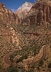
| 29 | Zion – Mount Carmel Highway |
(#86003709) |
Along Utah State Route 9 between Springdale and Mount Carmel Junction 37°13′19″N 112°55′58″W / 37.221944°N 112.932778°W |
This amazing highway includes tunnels and switchbacks, making it a historic engineering marvel that opened up the park. |


