Rangely, Colorado facts for kids
Quick facts for kids
Rangely, Colorado
|
|
|---|---|

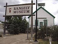
Rangely Museum
|
|
| Nickname(s):
Way outside of ordinary!
|
|

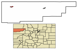
Location of Rangely in Rio Blanco County, Colorado.
|
|
| Country | |
| State | |
| County | Rio Blanco |
| Incorporated (town) | August 27, 1946 |
| Government | |
| • Type | Statutory Town |
| Area | |
| • Total | 4.30 sq mi (11.15 km2) |
| • Land | 4.30 sq mi (11.15 km2) |
| • Water | 0.00 sq mi (0.00 km2) |
| Elevation | 5,276 ft (1,608 m) |
| Population
(2020)
|
|
| • Total | 2,299 |
| • Density | 534.7/sq mi (206.19/km2) |
| Time zone | UTC−7 (Mountain (MST)) |
| • Summer (DST) | UTC−6 (MDT) |
| ZIP code |
81648
|
| Area code(s) | 970 |
| FIPS code | 08-62880 |
| GNIS feature ID | 2412528 |
Rangely is a town in Rio Blanco County, Colorado, United States. It's a "statutory town," which means it follows specific state laws for towns. In 2020, about 2,299 people lived there. Rangely is also home to Colorado Northwestern Community College.
Contents
About Rangely
Rangely is home to one of the two campuses of the Colorado Northwestern Community College. The town got its name from Rangeley, Maine. A person from Maine, Lee S. Chase, helped start the community. The first post office in Rangely opened in 1884.
Geography and Climate
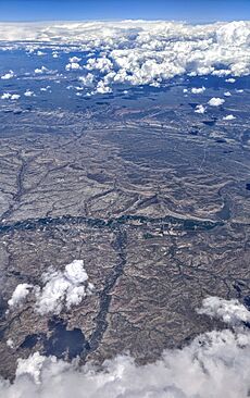
Rangely covers about 4.3 square miles (11.15 square kilometers) of land. The area is a mountain desert, meaning it's dry for most of the year.
Rangely's Climate
Rangely has a "cold semi-arid climate." This means it's usually dry, but it can get quite cold. The hottest temperature ever recorded in Rangely was 108°F (42°C) on June 21, 1974. The coldest temperature was -37°F (-38°C), recorded on February 15, 1895, and again on January 2, 1952.
| Climate data for Rangely, Colorado, 1991–2020 normals, extremes 1894–present | |||||||||||||
|---|---|---|---|---|---|---|---|---|---|---|---|---|---|
| Month | Jan | Feb | Mar | Apr | May | Jun | Jul | Aug | Sep | Oct | Nov | Dec | Year |
| Record high °F (°C) | 64 (18) |
67 (19) |
78 (26) |
86 (30) |
95 (35) |
108 (42) |
104 (40) |
106 (41) |
98 (37) |
87 (31) |
74 (23) |
60 (16) |
108 (42) |
| Mean maximum °F (°C) | 44.8 (7.1) |
53.8 (12.1) |
68.6 (20.3) |
78.0 (25.6) |
86.5 (30.3) |
96.0 (35.6) |
99.6 (37.6) |
97.2 (36.2) |
91.3 (32.9) |
80.3 (26.8) |
62.9 (17.2) |
48.5 (9.2) |
100.2 (37.9) |
| Mean daily maximum °F (°C) | 31.1 (−0.5) |
39.5 (4.2) |
53.6 (12.0) |
62.4 (16.9) |
72.9 (22.7) |
85.2 (29.6) |
92.5 (33.6) |
89.7 (32.1) |
80.2 (26.8) |
65.5 (18.6) |
48.4 (9.1) |
33.1 (0.6) |
62.8 (17.1) |
| Daily mean °F (°C) | 16.9 (−8.4) |
24.9 (−3.9) |
38.3 (3.5) |
46.4 (8.0) |
56.3 (13.5) |
66.9 (19.4) |
74.0 (23.3) |
71.5 (21.9) |
62.0 (16.7) |
48.3 (9.1) |
33.6 (0.9) |
19.7 (−6.8) |
46.6 (8.1) |
| Mean daily minimum °F (°C) | 2.6 (−16.3) |
10.2 (−12.1) |
22.9 (−5.1) |
30.3 (−0.9) |
39.7 (4.3) |
48.6 (9.2) |
55.4 (13.0) |
53.3 (11.8) |
43.8 (6.6) |
31.1 (−0.5) |
18.7 (−7.4) |
6.2 (−14.3) |
30.2 (−1.0) |
| Mean minimum °F (°C) | −11.8 (−24.3) |
−5.1 (−20.6) |
11.6 (−11.3) |
20.3 (−6.5) |
30.1 (−1.1) |
39.4 (4.1) |
49.4 (9.7) |
47.7 (8.7) |
33.9 (1.1) |
20.2 (−6.6) |
6.0 (−14.4) |
−8.9 (−22.7) |
−15.0 (−26.1) |
| Record low °F (°C) | −37 (−38) |
−37 (−38) |
−17 (−27) |
−6 (−21) |
8 (−13) |
25 (−4) |
33 (1) |
24 (−4) |
20 (−7) |
−4 (−20) |
−15 (−26) |
−32 (−36) |
−37 (−38) |
| Average precipitation inches (mm) | 0.67 (17) |
0.68 (17) |
0.87 (22) |
1.06 (27) |
1.22 (31) |
0.73 (19) |
0.68 (17) |
0.96 (24) |
1.29 (33) |
1.23 (31) |
0.88 (22) |
0.62 (16) |
10.89 (276) |
| Average snowfall inches (cm) | 8.0 (20) |
5.6 (14) |
3.1 (7.9) |
1.4 (3.6) |
0.1 (0.25) |
0.0 (0.0) |
0.0 (0.0) |
0.0 (0.0) |
0.0 (0.0) |
0.6 (1.5) |
3.3 (8.4) |
7.4 (19) |
29.5 (74.65) |
| Average extreme snow depth inches (cm) | 7.3 (19) |
6.7 (17) |
3.5 (8.9) |
0.8 (2.0) |
0.0 (0.0) |
0.0 (0.0) |
0.0 (0.0) |
0.0 (0.0) |
0.0 (0.0) |
0.6 (1.5) |
2.6 (6.6) |
6.4 (16) |
9.1 (23) |
| Average precipitation days (≥ 0.01 in) | 5.7 | 4.8 | 5.3 | 6.6 | 6.8 | 3.9 | 4.8 | 6.2 | 5.9 | 5.7 | 4.5 | 5.1 | 65.3 |
| Average snowy days (≥ 0.1 in) | 4.4 | 3.4 | 1.7 | 0.9 | 0.1 | 0.0 | 0.0 | 0.0 | 0.0 | 0.4 | 2.2 | 4.4 | 17.5 |
| Source 1: NOAA | |||||||||||||
| Source 2: National Weather Service | |||||||||||||
History of Rangely

The land around Rangely has a very interesting history. It shaped how people lived there, from ancient times to today. The geology of the area brought miners and oil workers. The rivers and streams attracted early people and ranchers.
Ancient Times and Geology
About 300 million years ago, during the Pennsylvanian and Permian periods, a shallow sea covered this area. Marine creatures from that time became fossils, which you can still find around Rangely. Huge sand dunes formed at the edges of this sea. These dunes turned into a special kind of rock called the Weber Formation. This rock folded into a ridge shape called an "anticline." Later, as the sea dried up, dinosaurs left their bones. Also, many plants grew and eventually turned into oil and coal.
Early Peoples
The many canyons and valleys in the Rangely area had creeks and rivers. These attracted early groups like the Fremont and Ute peoples. The Fremont people came to Rangely from Utah between 400 B.C. and 650 A.D. We know about them from the tools, homes, and campsites they left behind. You can see examples of Fremont art on rocks along Colorado 139 and Dragon Trail.
The art of the Ute people tells their history. It shows their conflicts with white settlers who arrived in the 1800s. Their art was also the first to include horses, which were brought by the Spanish.
Settlers and the Oil Boom
The first white settlers to make a permanent home in Rangely were Joseph Studer and C.P. Hill in 1882. This was the same year the Ute people were moved to reservations. Lee S. Chase, a cousin of Mr. Hill, named the town after his hometown, Rangeley, Maine. Mr. Hill started ranching and opened a trading post. Supplies were brought in by wagon from far away. By 1913, there were enough families for a large one-room schoolhouse. This schoolhouse is now at the Rangely Outdoor Museum.
The Ute people had known about oil in the area for a long time. The first shallow oil wells were drilled in 1903. They produced about 10 barrels of oil per day. In 1931, the Chevron company arrived. In 1932, they drilled the first deep oil well, Raven A-1. It reached a huge amount of oil in the Weber formation, more than 6,000 feet deep. However, there wasn't a market for the oil yet, so the well was capped.
Everything changed during World War II, when there was a huge demand for oil. Chevron reopened the Raven A-1 well, and Rangely quickly became a busy oil town. By 1946, deep well drilling was the main industry. The town grew rapidly with new businesses like motels, cafes, and a movie theater. In 1947, Rangely officially became a town, and Fred Nichols was elected Mayor.
In the 1960s, the Rangely oil field was very important for the country. It was considered so vital that bomb shelters were built at the college. They were stocked with supplies in case of an emergency.

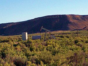
By 1949, there were 478 oil wells in the Weber formation. The Rangely Weber Sand Unit became the largest oil field in the Rocky Mountain Region. It has produced over 815 million barrels of oil. Today, this field has many producing wells and provides about one-third of Colorado's oil. It produces around 20,000 barrels of oil every day. The oil field provides jobs for about 300 people. It also makes up about 70 percent of the property tax money for Rio Blanco County.
In 2015, the Colorado Northwestern Community College in Rangely started digging up dinosaur bones. They found a very rare Duckbill Dinosaur fossil, including skin and tendons. This dinosaur, named Walter, was carefully dug up. In 2019, the fossils were flown to a special storage place at the college's Craig Campus.
Historic Places to Visit
Near Rangely, you can find several ancient Fremont culture sites. These are listed as National Register of Historic Places:
- Prehistoric sites
- Collage Shelter Site – This site dates back to 500–1499 AD.
- Cañon Pintado – This area has art and artifacts from 500–1899 AD.
- Carrot Men Pictograph Site – This site features rock art from 500–1499 AD.
- Fremont Lookout Fortification Site – This ancient fort dates from 0–1499 AD.
Population of Rangely
| Historical population | |||
|---|---|---|---|
| Census | Pop. | %± | |
| 1950 | 808 | — | |
| 1960 | 1,464 | 81.2% | |
| 1970 | 1,591 | 8.7% | |
| 1980 | 2,113 | 32.8% | |
| 1990 | 2,278 | 7.8% | |
| 2000 | 2,096 | −8.0% | |
| 2010 | 2,365 | 12.8% | |
| 2020 | 2,299 | −2.8% | |
As of the 2020 census, Rangely had 2,299 people living there. There were 1,118 housing units and 825 families. Most residents were White, but the town also has people of African American, Native American, Asian, and other backgrounds. Some people are from two or more races.
The average age in Rangely was 33.3 years old. About 12.9% of the population were veterans.
Local Landmarks
For many years, Rangely had an old water tank. It was special because sounds inside it would echo for up to 40 seconds! Now, this 65-foot tower is called The Tank Center for Sonic Arts. It's used as a place for concerts and recording music.
Kenney Reservoir is about five miles east of town. You can go camping, fishing, and boating there.
See also
 In Spanish: Rangely (Colorado) para niños
 | Janet Taylor Pickett |
 | Synthia Saint James |
 | Howardena Pindell |
 | Faith Ringgold |

