Bernardo de Miera y Pacheco facts for kids
Quick facts for kids
Bernardo de Miera y Pacheco
|
|
|---|---|
| Born |
Bernardo de Miera y Pacheco
August 4, 1713 |
| Died | April 4, 1785 (aged 71) |
| Nationality | Spanish |
| Occupation | cartographer |
| Signature | |
 |
|
Bernardo de Miera y Pacheco (born August 4, 1713 – died April 4 or 11, 1785) was a very important mapmaker in a region once called New Spain. This area included parts of North and Central America. He was also a talented artist, especially known for carving religious statues from wood, called Santero art.
People called him a polymath, which means he was skilled in many different subjects. He knew a lot about making maps, astronomy (studying stars), math, geology (studying rocks), and even military strategies. He was also good at painting, sculpting, and drawing.
Contents
Life and Work
Early Life and Family
Bernardo de Miera y Pacheco was born in a place called Valle de Carriedo in Cantabria, Spain. His father was a captain in the Cantabrian Cavalry, and Bernardo was trained to be a military engineer.
Like many others at the time, he moved to New Spain. This was a large territory that included parts of what is now North and Central America. On May 20, 1741, he married Maria Estefania Domínguez de Mendoza in Chihuahua.
They had two sons, Anacléto (Cléto) and Manuel. In 1743, the family settled in El Paso, which is now on the border of the United States and Mexico.
Many Talents and Early Maps
Bernardo de Miera y Pacheco was a man with many skills. He worked as a merchant, collected debts, managed a ranch, and was a military officer. As an officer, he took part in five military missions.
In 1747, Captain Miera led a group of soldiers. They went with Padre Juan Menchero, who was trying to teach the Navajo people about Christianity. They wanted to help them settle around Mount Taylor.
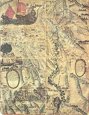
Even though Padre Menchero's mission wasn't successful, Miera created the first map of the area they traveled through. In 1749, he mapped the Rio Grande river. He mapped it from El Paso all the way downstream to where it meets the Rio Conchos.
Artist and Move to Santa Fe
Miera was also a skilled painter and carver. Some of his artworks can still be seen today in churches and museums. For example, the Church of Cristo Rey in Santa Fe has a very important piece of his art. It is called the Castrense altar screen.
In 1754 or 1756, he moved his family to Santa Fe. He was appointed as the alcalde, which was like a mayor or local leader, for the pueblos of Pecos and Galisteo. He also took part in three military actions against the Comanches.
Important Maps for New Mexico
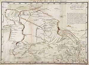
The leader of New Spain asked his governors in the northern areas to create maps of their lands. Francisco Antonio Marín del Valle, who was the Governor of New Mexico, asked Miera for help.
They worked together on this project from late June to December 1, 1757. The very important map was finished by April 1758. Miera went on to make at least two more maps for Governor Marín.
Miera was given a large piece of land, about 4428 acres, near Ceboletta. This land was later made a bit smaller, to about 4107 acres.
Expeditions and Final Maps
Miera also worked as the mapmaker for the 1776 Domínguez–Escalante expedition. This was a journey to explore new lands. Miera often disagreed with the other leaders of the group, and he was also sick quite often during the trip.
The expedition did not find the route they were looking for to Monterey. However, Miera's maps were extremely valuable for explorers who came after them.
In 1779, Miera joined Governor of New Mexico Juan Bautista de Anza on a military trip. They went to stop the Comanches, who had been raiding Taos. As a result of this trip, Miera drew what might have been his last map. This map showed the area around the Rio Grande, from Santa Fe up to the Arkansas River.
Bernardo de Miera y Pacheco passed away in Santa Fe on April 4 or 11, 1785. His wife, Estefania, had died less than a year and a half before him, also in Santa Fe.
Legacy
Miera's maps were studied by a famous explorer named Alexander von Humboldt in 1803. Humboldt used them to help create his own maps. A year later, Humboldt shared this information with the American President, Thomas Jefferson.
Miera's work was then copied by American mapmakers. The original map he made in 1758 disappeared sometime after 1930 in Mexico City. However, a copy was made in the 1970s from photographs of the original. This means his important work continues to be studied and appreciated today.
See also
 In Spanish: Bernardo Miera y Pacheco para niños
 | Precious Adams |
 | Lauren Anderson |
 | Janet Collins |


