
Kanarraville, Utah facts for kids
Quick facts for kids
Kanarraville, Utah
|
|
|---|---|

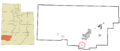
Location in Iron County and the state of Utah
|
|
| Country | United States |
| State | Utah |
| County | Iron |
| Settled | 1861 |
| Incorporated | 1933 |
| Named for | Paiute Chief Canarrah (or Quanarrah) |
| Area | |
| • Total | 0.45 sq mi (1.15 km2) |
| • Land | 0.45 sq mi (1.15 km2) |
| • Water | 0.00 sq mi (0.00 km2) |
| Elevation | 5,565 ft (1,696 m) |
| Population
(2010)
|
|
| • Total | 355 |
| • Density | 914.61/sq mi (352.99/km2) |
| Time zone | UTC-7 (Mountain (MST)) |
| • Summer (DST) | UTC-6 (MDT) |
| ZIP code |
84742
|
| Area code(s) | 435 |
| FIPS code | 49-40030 |
| GNIS feature ID | 2412814 |
Kanarraville is a small town in Iron County, Utah, United States. In 2010, about 355 people lived there.
Contents
Kanarraville's Population Over Time
Kanarraville has seen its population change over the years. Here is a quick look at how many people have lived in the town since 1890.
| Historical population | |||
|---|---|---|---|
| Census | Pop. | %± | |
| 1890 | 282 | — | |
| 1900 | 225 | −20.2% | |
| 1910 | 249 | 10.7% | |
| 1920 | 326 | 30.9% | |
| 1930 | 279 | −14.4% | |
| 1940 | 309 | 10.8% | |
| 1950 | 263 | −14.9% | |
| 1960 | 236 | −10.3% | |
| 1970 | 204 | −13.6% | |
| 1980 | 255 | 25.0% | |
| 1990 | 228 | −10.6% | |
| 2000 | 311 | 36.4% | |
| 2010 | 355 | 14.1% | |
| 2019 (est.) | 407 | 14.6% | |
| U.S. Decennial Census | |||
Who Lives in Kanarraville?
In 2000, there were 311 people living in Kanarraville. These people lived in 125 different homes. Most of the people were white. A small number were Native American or from other backgrounds. About 4.5% of the population was Hispanic or Latino.
Many homes were families, with 68% being married couples. About 24% of homes had children under 18. The average home had about 2.5 people.
Age Groups in the Town
The people in Kanarraville are of different ages. About 22% of the population was under 18. About 21.5% were 65 years old or older. The average age in the town was 44 years old.
Kanarraville's Location and Climate
Kanarraville is located in Utah. It covers an area of about 1.2 square kilometers (0.45 square miles). All of this area is land.
The town is next to the southwest end of Cedar Valley. It is also at the bottom of the Hurricane Cliffs. These cliffs are on the eastern side of the town.
Weather in Kanarraville
Kanarraville has a type of weather called a "warm-summer Mediterranean climate." This means the summers are warm but not too hot. They are also very dry. The average monthly temperature never goes above 71.6 degrees Fahrenheit.
History of Kanarraville
Kanarraville was first settled in 1861 and 1862. It was originally called Kanarra. The town was named after a Paiute Chief named Canarrah or Quanarrah. The settlers spelled his name as Kanarrah or Kanarra.
The first settlers came from Fort Harmony. They had to leave their old fort because heavy rains in 1862 washed away its adobe walls. Another town, New Harmony, was also started by people who had to leave Fort Harmony.
Images for kids
-
Location of Kanarraville in Iron County, Utah
See also
 In Spanish: Kanarraville (Utah) para niños
