Mineral County, Colorado facts for kids
Quick facts for kids
Mineral County
|
|
|---|---|
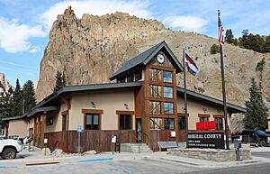
The Mineral County Courthouse in Creede
|
|
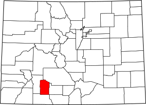
Location within the U.S. state of Colorado
|
|
 Colorado's location within the U.S. |
|
| Country | |
| State | |
| Founded | March 27, 1893 |
| Seat | Creede |
| Largest town | Creede |
| Area | |
| • Total | 878 sq mi (2,270 km2) |
| • Land | 876 sq mi (2,270 km2) |
| • Water | 2.0 sq mi (5 km2) 0.2%% |
| Population
(2020)
|
|
| • Total | 865 |
| • Density | 1.0/sq mi (0.4/km2) |
| Time zone | UTC−7 (Mountain) |
| • Summer (DST) | UTC−6 (MDT) |
| Congressional district | 3rd |
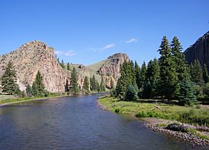
Mineral County is a county in the state of Colorado, United States. It was named for the many valuable minerals found in its mountains and streams.
In 2020, about 865 people lived here. This makes it one of the least populated counties in Colorado. The main town and county seat is Creede.
Contents
Exploring Mineral County's Land
The U.S. Census Bureau says Mineral County covers about 878 square miles. Most of this area is land, with only a small part (0.2%) being water.
Neighboring Counties
Mineral County shares borders with these other counties:
- Saguache County to the northeast
- Rio Grande County to the east
- Archuleta County to the south
- Hinsdale County to the west
Main Roads and Highways
These are the important roads that go through Mineral County:
 U.S. Highway 160
 State Highway 149
Protected Natural Areas
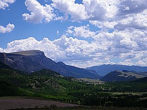
A large part of Mineral County is protected land. In fact, 95% of the county is managed by the U.S. government. These areas include:
- Rio Grande National Forest
- San Juan National Forest
- La Garita Wilderness
- Weminuche Wilderness
Trails and Scenic Routes
You can explore Mineral County on these famous trails and byways:
- Colorado Trail
- Continental Divide National Scenic Trail
- Lake Fork National Recreation Trail
- Silver Thread Scenic Byway
Who Lives in Mineral County?
| Historical population | |||
|---|---|---|---|
| Census | Pop. | %± | |
| 1900 | 1,913 | — | |
| 1910 | 1,239 | −35.2% | |
| 1920 | 779 | −37.1% | |
| 1930 | 640 | −17.8% | |
| 1940 | 975 | 52.3% | |
| 1950 | 698 | −28.4% | |
| 1960 | 424 | −39.3% | |
| 1970 | 786 | 85.4% | |
| 1980 | 804 | 2.3% | |
| 1990 | 558 | −30.6% | |
| 2000 | 831 | 48.9% | |
| 2010 | 712 | −14.3% | |
| 2020 | 865 | 21.5% | |
| 2023 (est.) | 944 | 32.6% | |
| U.S. Decennial Census 1790-1960 1900-1990 1990-2000 2010-2020 |
|||
In 2000, there were 831 people living in Mineral County. They lived in 377 homes. The population density was about 1 person per square mile.
Many people in the county are White. A small number are Native American or from other backgrounds. About 2% of the people were Hispanic or Latino.
The average age of people in Mineral County in 2000 was 45 years old.
Towns and Communities
Main Town
Other Communities
These places are not officially towns but have people living there:
- Spar City
- Wagon Wheel Gap
Old Ghost Towns
Some places in Mineral County used to be busy but are now empty. These are called ghost towns:
- Bachelor City
- Wason
- Weaver
See also
 In Spanish: Condado de Mineral (Colorado) para niños
 | Delilah Pierce |
 | Gordon Parks |
 | Augusta Savage |
 | Charles Ethan Porter |


