Archuleta County, Colorado facts for kids
Quick facts for kids
Archuleta County
|
|
|---|---|

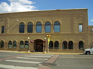
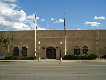
Archuleta County Courthouse
|
|

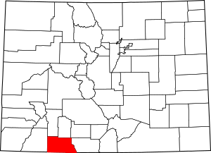
Location within the U.S. state of Colorado
|
|
 Colorado's location within the U.S. |
|
| Country | |
| State | |
| Founded | April 14, 1885 |
| Named for | Antonio D. Archuleta |
| Seat | Pagosa Springs |
| Largest town | Pagosa Springs |
| Area | |
| • Total | 1,356 sq mi (3,510 km2) |
| • Land | 1,350 sq mi (3,500 km2) |
| • Water | 5.3 sq mi (14 km2) 0.4% |
| Population
(2020)
|
|
| • Total | 13,359 |
| • Density | 9.9/sq mi (3.8/km2) |
| Time zone | UTC−7 (Mountain) |
| • Summer (DST) | UTC−6 (MDT) |
| Congressional district | 3rd |
Archuleta County is a county located in the U.S. state of Colorado. As of the 2020 census, about 13,359 people lived there. The main town and county seat is Pagosa Springs. It is the only official town in the county.
Contents
History of Archuleta County
Archuleta County was created by the Colorado government on April 14, 1885. It was formed from the western part of Conejos County. The county was named after Jose Manuel Archuleta. He was the head of an old Spanish family from New Mexico. It also honored his son, Antonio D. Archuleta, who was a Senator for Conejos County at that time.
Geography and Nature
Archuleta County covers a total area of about 1,356 square miles. Most of this area, about 1,350 square miles, is land. The rest, about 5.3 square miles, is water. This means only a small part (0.4%) of the county is water.
Neighboring Counties
Archuleta County shares borders with several other counties:
- Mineral County, Colorado - to the north
- Rio Grande County, Colorado - to the northeast
- Conejos County, Colorado - to the east
- Rio Arriba County, New Mexico - to the south
- San Juan County, New Mexico - to the southwest
- La Plata County, Colorado - to the west
- Hinsdale County, Colorado - to the northwest
Local Airport
- Stevens Field is the main airport in the county.
Main Roads and Highways
These are the important roads that run through Archuleta County:
 U.S. Highway 84
 U.S. Highway 160
 State Highway 17
 State Highway 151
Protected Natural Areas
Archuleta County is home to several important natural areas:
- Rio Grande National Forest
- San Juan National Forest
- Chimney Rock National Monument
- South San Juan Wilderness
State Parks
- Navajo State Park is a protected area managed by the state.
Famous Trails
You can find these well-known trails in the county:
- Continental Divide National Scenic Trail
- Old Spanish National Historic Trail
Rivers and Streams
Many waterways flow through Archuleta County:
- Chamita River
- Dutton Creek
- Little Navajo River
- Martinez Creek
- McCabe Creek
- Mill Creek
- Piedra River
- Rio Blanco
- Rio Chama
- San Juan River
- Stollsteimer Creek
- Williams Creek
People and Population
In 2020, there were 13,359 people living in Archuleta County. These people lived in about 5,736 households. On average, there were about 2.34 people in each home. The county has about 9.9 people per square mile.
Most people in the county are White (90.9%). There are also people who are Black or African American (0.9%), Native American (3.8%), and Asian (1.2%). About 3.1% of the population are from two or more races. Also, 18.5% of the people are of Hispanic or Latino background.
Towns and Communities
Archuleta County has one official town and several other communities.
Main Town
- Pagosa Springs is the largest and only official town.
Other Communities
- Arboles is a census-designated place. This means it's a community that the census bureau defines, but it's not an officially incorporated town.
Other Unincorporated Places
These are smaller communities that are not officially towns or cities:
- Chimney Rock
- Chromo
- Juanita
- Dyke: This place was likely named after Wm. Dyke. He was the first county sheriff around 1890 and later a county commissioner. You can find Dyke on maps from the USGS and FAA.
Education in Archuleta County
Students in Archuleta County attend schools in these districts:
- Archuleta County School District 50-JT
- Bayfield School District 10 JT-R
- Ignacio School District 11-JT
See also
 In Spanish: Condado de Archuleta para niños
 | Jessica Watkins |
 | Robert Henry Lawrence Jr. |
 | Mae Jemison |
 | Sian Proctor |
 | Guion Bluford |


