
Arapahoe County, Colorado facts for kids
Quick facts for kids
Arapahoe County
|
|||
|---|---|---|---|

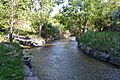
Little Dry Creek in Englewood
|
|||
|
|||

Location within the U.S. state of Colorado
|
|||
 Colorado's location within the U.S. |
|||
| Country | |||
| State | |||
| Founded | November 1, 1861 | ||
| Named for | The Arapaho Nation | ||
| Seat | Littleton | ||
| Largest city | Aurora | ||
| Area | |||
| • Total | 805 sq mi (2,080 km2) | ||
| • Land | 798 sq mi (2,070 km2) | ||
| • Water | 7.3 sq mi (19 km2) 0.9%% | ||
| Population
(2020)
|
|||
| • Total | 655,070 (3rd) | ||
| • Density | 821/sq mi (317/km2) | ||
| Time zone | UTC−7 (Mountain) | ||
| • Summer (DST) | UTC−6 (MDT) | ||
| Congressional districts | 1st, 4th, 6th | ||


Arapahoe County is a county in the state of Colorado. A county is like a smaller region within a state, often with its own local government. In 2020, about 655,070 people lived here, making it the third most populated county in Colorado.
The main government center, called the county seat, is Littleton. The biggest city in the county is Aurora. The county got its name from the Arapaho Native American tribe. They used to live in this area a long time ago. Arapahoe County is known as "Colorado's First County" because it existed even before the big gold rush.
Contents
History of Arapahoe County
Early Beginnings and Gold Rush
On August 25, 1855, the Kansas Territory created a very large Arapahoe County. This county covered the entire western part of the Kansas Territory. It was named after the Arapaho Nation, who were the original inhabitants of the land.
In July 1858, people found gold along the South Platte River. This discovery started the famous Pike's Peak Gold Rush. Many miners felt far away from the Kansas and Nebraska governments. So, they decided to create their own area called the Territory of Jefferson in October 1859.
Forming Colorado Territory
The Jefferson Territory was never officially recognized by the U.S. government. When Kansas became a state in 1861, the mining areas were left without a clear government.
Then, on February 28, 1861, the U.S. Congress created the Territory of Colorado. On November 1, 1861, the Colorado leaders set up 17 original counties. Arapahoe County was one of them. It was much larger back then, stretching far to the east and north. Denver City was the county seat until 1902.
Changes and New Boundaries
In 1901, the Colorado government decided to divide Arapahoe County into three parts. These new parts were the City and County of Denver, Adams County, and a smaller part that was first called South Arapahoe County.
This change officially happened on November 15, 1902. Littleton became the temporary county seat for South Arapahoe County. A few months later, in April 1903, the name South Arapahoe County was changed back to Arapahoe County. In November 1904, voters chose Littleton to be the permanent county seat.
Geography of Arapahoe County

Arapahoe County covers about 805 square miles. Most of this area is land, with a small amount of water. The county is about 72 miles wide from east to west. It is between 4 and 12 miles tall from north to south.
There are two small parts of Arapahoe County that are completely surrounded by the City and County of Denver. These are the City of Glendale and the Holly Hills neighborhood. These are called "exclaves."
Neighboring Counties
Arapahoe County shares borders with these other counties:
- City and County of Denver – to the northwest and also surrounds the exclaves
- Adams County – to the north
- Washington County – to the east
- Lincoln County – to the southeast
- Elbert County – to the south
- Douglas County – to the southwest
- Jefferson County – to the west
Main Roads and Highways
Many important roads run through Arapahoe County:
 Interstate 25
 Interstate 70
 Interstate 225
 I-70 Bus.
 I-70 Bus.
- I-70 Bus.
- I-70 Bus.
 U.S. Highway 85
 U.S. Highway 285
 State Highway 30
 State Highway 36
 State Highway 40
 State Highway 75
 State Highway 79
 State Highway 83
 State Highway 88
 State Highway 177
 State Highway 470
- E-470 (a road where you pay a fee to drive)
Parks and Trails
- Cherry Creek State Park is a popular state park.
You can also find historic and recreation trails here:
- Smoky Hill Trail
- South Platte Trail
- Highline Canal National Recreation Trail
- Platte River Greenway National Recreation Trail
Population and People
| Historical population | |||
|---|---|---|---|
| Census | Pop. | %± | |
| 1870 | 6,829 | — | |
| 1880 | 38,644 | 465.9% | |
| 1890 | 132,135 | 241.9% | |
| 1900 | 153,017 | 15.8% | |
| 1910 | 10,263 | −93.3% | |
| 1920 | 13,766 | 34.1% | |
| 1930 | 22,647 | 64.5% | |
| 1940 | 32,150 | 42.0% | |
| 1950 | 52,125 | 62.1% | |
| 1960 | 113,426 | 117.6% | |
| 1970 | 162,142 | 42.9% | |
| 1980 | 293,621 | 81.1% | |
| 1990 | 391,511 | 33.3% | |
| 2000 | 487,967 | 24.6% | |
| 2010 | 572,003 | 17.2% | |
| 2020 | 655,070 | 14.5% | |
| 2023 (est.) | 656,061 | 14.7% | |
| U.S. Decennial Census 1790-1960 1900-1990 1990-2000 2010-2020 |
|||
Arapahoe County has grown a lot over the years. In 2000, there were almost 488,000 people living there. The population is quite diverse. About 80% of the people were White, and there were also many African American, Asian, and Native American residents. About 12% of the population was Hispanic or Latino.
Education in Arapahoe County
Schools for Kids (K-12)
Arapahoe County has nine public school districts. These include Aurora, Cherry Creek, and Littleton.
In the 2023-2024 school year, Cherry Creek and Littleton were ranked among the top school districts in Colorado. Also, Cherry Creek High School and Grandview High School were ranked as some of the best public high schools in the state.
There are also several private schools. These include St. Mary's Academy and Regis Jesuit High School. Kent Denver School was even ranked as Colorado's number one high school.
Colleges and Universities
Arapahoe County is home to two large community colleges. These are Arapahoe Community College in Littleton and the Community College of Aurora.
You can also find the University of Colorado Anschutz Medical Campus here. This campus is in Aurora and focuses on medical studies.
Cities and Towns
Arapahoe County has many different communities.
Cities
- Aurora (mostly in Arapahoe County, but also in Adams and Douglas Counties)
- Centennial
- Cherry Hills Village
- Englewood
- Glendale (a small area inside Denver)
- Greenwood Village
- Littleton (mostly in Arapahoe County, but also in Douglas and Jefferson Counties)
- Sheridan
Towns
- Bennett (partly in Adams County)
- Bow Mar (partly in Jefferson County)
- Columbine Valley
- Deer Trail
- Foxfield
Other Communities (Census-Designated Places)
These are areas that are not officially cities or towns, but have a recognized population.
- Aetna Estates
- Brick Center
- Byers
- Cherry Creek
- Columbine (partly in Jefferson County)
- Comanche Creek
- Dove Valley
- Four Square Mile
- Holly Hills (a small area inside Denver)
- Inverness
- Peoria
- Strasburg (partly in Adams County)
- Watkins (partly in Adams County)
Former Communities
Some communities that used to be separate are now part of larger cities:
- Castlewood (now part of Centennial)
- Southglenn (now part of Centennial)
Images for kids
-
Little Dry Creek in Englewood
See also
 In Spanish: Condado de Arapahoe para niños
