
Washington County, Colorado facts for kids
Quick facts for kids
Washington County
|
|
|---|---|
.JPG)
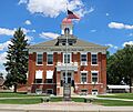
The old Washington County Courthouse in Akron
|
|

Location within the U.S. state of Colorado
|
|
 Colorado's location within the U.S. |
|
| Country | |
| State | |
| Founded | February 9, 1887 |
| Named for | George Washington |
| Seat | Akron |
| Largest town | Akron |
| Area | |
| • Total | 2,524 sq mi (6,540 km2) |
| • Land | 2,518 sq mi (6,520 km2) |
| • Water | 5.9 sq mi (15 km2) 0.2%% |
| Population
(2020)
|
|
| • Total | 4,817 |
| • Estimate
(2023)
|
4,855 |
| • Density | 1.9085/sq mi (0.73687/km2) |
| Time zone | UTC−7 (Mountain) |
| • Summer (DST) | UTC−6 (MDT) |
| Congressional district | 4th |
Washington County is a place in eastern Colorado, a state in the United States. In 2020, about 4,817 people lived here. It's the smallest "Washington County" in the whole United States by population. The main town, or county seat, is Akron. This county is named after George Washington, who was a famous US President.
Contents
History of Washington County
Washington County was created in 1887 by the Colorado government. It was once part of a bigger area called Weld County. Later, in 1889, the eastern part of Washington County became its own county, Yuma County. Then, in 1903, another county called Arapahoe County gave some of its land to Washington County. This made Washington County the shape and size it is today.
Like many places in eastern Colorado, Washington County faced tough times during The Great Depression. Many people moved away, and the population dropped a lot. In recent years, the number of people living here hasn't changed much.
Every July, Washington County hosts the Eastern Colorado Roundup. This is Colorado's first carnival that was started and owned by local people. You can enjoy rodeos, fun rides, and see many different animals.
Geography and Nature
Washington County covers a total area of about 2,524 square miles. Most of this area, about 2,518 square miles, is land. A small part, about 5.9 square miles, is water.
Neighboring Counties
Washington County shares its borders with several other counties:
- Logan County to the northeast
- Yuma County to the east
- Kit Carson County to the southeast
- Lincoln County to the southwest
- Adams County to the west
- Arapahoe County to the west
- Morgan County to the northwest
Main Roads and Trails
Several important roads pass through Washington County:
 Interstate 76
 I-76 Bus.
 U.S. Highway 34
 U.S. Highway 36
 State Highway 59
 State Highway 61
 State Highway 63
 State Highway 71
You can also find parts of these long trails here:
- American Discovery Trail
- South Platte Trail
Population Over Time
| Historical population | |||
|---|---|---|---|
| Census | Pop. | %± | |
| 1890 | 2,301 | — | |
| 1900 | 1,241 | −46.1% | |
| 1910 | 6,002 | 383.6% | |
| 1920 | 11,208 | 86.7% | |
| 1930 | 9,591 | −14.4% | |
| 1940 | 8,336 | −13.1% | |
| 1950 | 7,520 | −9.8% | |
| 1960 | 6,625 | −11.9% | |
| 1970 | 5,550 | −16.2% | |
| 1980 | 5,304 | −4.4% | |
| 1990 | 4,812 | −9.3% | |
| 2000 | 4,926 | 2.4% | |
| 2010 | 4,814 | −2.3% | |
| 2020 | 4,817 | 0.1% | |
| 2023 (est.) | 4,855 | 0.9% | |
| U.S. Decennial Census 1790–1960 1900–1990 1990–2000 2010–2020 |
|||
In 2000, there were 4,926 people living in Washington County. These people lived in 1,989 homes, and 1,408 of these were families. The county had about 2 people per square mile.
Most people in the county were White (96.39%). A small number were Native American (0.57%), Asian (0.10%), or Black (0.04%). About 6.29% of the people were Hispanic or Latino.
About 31.30% of homes had children under 18 living there. Most homes (60.70%) were married couples. The average home had 2.46 people, and the average family had 2.97 people.
The median age in the county was 40 years old. This means half the people were older than 40 and half were younger. About 26.50% of the people were under 18.
The median income for a household was $32,431 per year. For families, it was $37,287. About 11.40% of all people in the county lived below the poverty line. This included 16.30% of children under 18.
Towns and Communities
Washington County has several towns and communities:
Towns
Census Designated Place
Unincorporated Communities
Ghost Towns
These are towns that no longer have people living in them:
Education in Washington County
There are five school districts in Washington County:
- Akron R-1
- Arickaree R-2
- Lone Star 101
- Otis R-3
- Woodlin R-104
Here are some of the schools in these districts:
- Akron R-1 includes Akron High School.
- Arickaree R-2 includes Arickaree School, which teaches all grades from kindergarten to 12th grade.
- Lone Star 101 includes Lone Star School, also teaching all grades from kindergarten to 12th grade.
- Otis R-3 includes Otis Elementary School and Otis Jr.-Sr. High School.
Images for kids
-
The old Washington County Courthouse in Akron
See also
 In Spanish: Condado de Washington (Colorado) para niños
