
Logan County, Colorado facts for kids
Quick facts for kids
Logan County
|
|
|---|---|

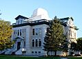
Logan County Courthouse
|
|

Location within the U.S. state of Colorado
|
|
 Colorado's location within the U.S. |
|
| Country | |
| State | |
| Founded | February 25, 1887 |
| Named for | John A. Logan |
| Seat | Sterling |
| Largest city | Sterling |
| Area | |
| • Total | 1,845 sq mi (4,780 km2) |
| • Land | 1,839 sq mi (4,760 km2) |
| • Water | 6.3 sq mi (16 km2) 0.3%% |
| Population
(2020)
|
|
| • Total | 21,528 |
| • Estimate
(2023)
|
20,619 |
| • Density | 11.668/sq mi (4.5052/km2) |
| Time zone | UTC−7 (Mountain) |
| • Summer (DST) | UTC−6 (MDT) |
| Congressional district | 4th |
Logan County is a county located in the U.S. state of Colorado. It was founded on February 25, 1887. The county was named after General John A. Logan.
The main city and county seat is Sterling. As of the 2020 census, about 21,528 people lived in Logan County. It is part of the Sterling, CO Micropolitan Statistical Area.
Contents
Geography of Logan County
Logan County is located in northeastern Colorado. The U.S. Census Bureau says the county covers about 1,845 square miles. Most of this area, about 1,839 square miles, is land. A small part, about 6.3 square miles, is water.
Neighboring Counties
Logan County shares borders with several other counties and states.
- Cheyenne County, Nebraska - to the north
- Phillips County - to the east
- Sedgwick County - to the east
- Yuma County - to the southeast
- Washington County - to the south
- Morgan County - to the southwest
- Weld County - to the west
- Kimball County, Nebraska - to the northwest
Main Roads and Transportation
Several important roads run through Logan County. These highways help people travel and transport goods.
 Interstate 76
 I-76 Bus.
 U.S. Highway 6
 U.S. Highway 138
 State Highway 14
 State Highway 61
 State Highway 63
 State Highway 113
Public transportation options are also available.
- Burlington Trailways
- Express Arrow
Parks and Trails
Logan County has a state park and several trails for outdoor activities.
- North Sterling State Park
- American Discovery Trail
- Pawnee Pioneer Trails
- South Platte Trail
People of Logan County (Demographics)
The number of people living in Logan County has changed over the years.
| Historical population | |||
|---|---|---|---|
| Census | Pop. | %± | |
| 1890 | 3,070 | — | |
| 1900 | 3,292 | 7.2% | |
| 1910 | 9,549 | 190.1% | |
| 1920 | 18,427 | 93.0% | |
| 1930 | 19,946 | 8.2% | |
| 1940 | 18,370 | −7.9% | |
| 1950 | 17,187 | −6.4% | |
| 1960 | 20,302 | 18.1% | |
| 1970 | 18,852 | −7.1% | |
| 1980 | 19,800 | 5.0% | |
| 1990 | 17,567 | −11.3% | |
| 2000 | 20,504 | 16.7% | |
| 2010 | 22,709 | 10.8% | |
| 2020 | 21,528 | −5.2% | |
| 2023 (est.) | 20,619 | −9.2% | |
| U.S. Decennial Census 1790–1960 1900–1990 1990–2000 2010–2020 |
|||
In 2000, there were about 20,504 people living in the county. The population density was about 11 people per square mile. Most residents were White (91.65%). About 11.90% of the population identified as Hispanic or Latino.
The average age in Logan County in 2000 was 36 years old. About 24.70% of the population was under 18 years old.
Communities in Logan County
Logan County has one city, several towns, and other smaller communities.
City
- Sterling (the county seat)
Towns
Census-Designated Places (CDPs)
These are areas that are like towns but are not officially incorporated.
Unincorporated Communities
These are smaller communities that do not have their own local government.
- Dailey
- Proctor
- Saint Petersburg
- Willard
Ghost Towns
Logan County also has several ghost towns. These are places where people used to live but are now mostly abandoned.
- Ackerman
- Armstrong
- Beta
- Buchanan
- Galien
- Graylin
- Griff
- Jessica
- Kelly
- Lesy
- Logan
- Marcott
- Mount Hope
- New Haven
- Powell
- Red Lion
- Rockland
- Selma
- Shahan
- Tobin
- Twin Mills
- Westplains
- Winston
Images for kids
-
Logan County Courthouse
See also
 In Spanish: Condado de Logan (Colorado) para niños
