Englewood, Colorado facts for kids
Quick facts for kids
Englewood, Colorado
|
|
|---|---|
| City of Englewood | |
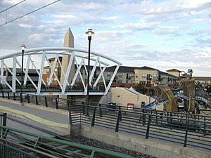
CityCenter Englewood.
|
|
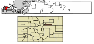
Location of the City of Englewood in Arapahoe County, Colorado.
|
|
| Country | |
| State | |
| County | Arapahoe County |
| Founded | 1860, as Orchard Place |
| Incorporated | May 9, 1903 |
| Government | |
| • Type | Home rule municipality |
| Area | |
| • Total | 6.652 sq mi (17.229 km2) |
| • Land | 6.565 sq mi (17.002 km2) |
| • Water | 0.088 sq mi (0.227 km2) |
| Elevation | 5,371 ft (1,637 m) |
| Population
(2020)
|
|
| • Total | 33,659 |
| • Density | 5,127/sq mi (1,980/km2) |
| • Metro | 2,963,821 (19th) |
| • CSA | 3,623,560 (17th) |
| • Front Range | 5,055,344 |
| Time zone | UTC−07:00 (MST) |
| • Summer (DST) | UTC−06:00 (MDT) |
| ZIP codes |
80110 & 80113, PO Boxes 80150 & 80151 & 80155
|
| Area code(s) | Both 303 and 720 |
| FIPS code | 08-24785 |
| GNIS feature ID | 0204715 |
| Website | City of Englewood |
|
|
|
The City of Englewood is a city in Arapahoe County, Colorado, United States. It's a "home rule municipality," which means it has the power to govern itself on local matters. In 2020, about 33,659 people lived there. Englewood is part of the larger Denver–Aurora–Lakewood, CO Metropolitan Statistical Area. It is located just south of Denver in the South Platte River Valley.
Contents
History of Englewood
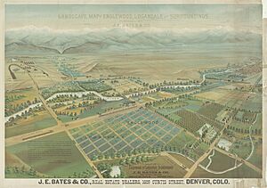
Englewood's story began in 1858 when gold was found near Little Dry Creek. This discovery was made by William Green Russell. Two years later, in 1860, Thomas Skerritt, who is seen as the city's founder, built his home in the area. He called this place Orchard Place.
Early Developments in Englewood
In 1864, Skerritt built the first road connecting Denver to Orchard Place using his own plow. The first telephone arrived in the area in 1879. A special horse-drawn trolley, called the Cherrelyn horsecar, started running in 1883. Horses pulled the trolley up Broadway, and then it rolled down by itself using gravity. This trolley became a famous symbol of the city.
Englewood officially became a city on May 9, 1903. J.C. Jones became the first mayor. He owned a lot of land in what is now north Englewood. The city's first newspaper, the Herald, started soon after. In 1905, a large hospital, now known as Swedish Medical Center, was founded. The first paved roads and street lights were installed in 1906. The police and fire departments were created in 1907. The Cherrelyn horse trolley stopped running in 1908.
Growth and Modernization
A big change happened in 1948 when Englewood bought 2,500 acres of land. They built McLellan Reservoir, which gave the city its own water supply. This meant Englewood didn't have to rely on Denver for water anymore. In fact, Englewood now provides water to many areas south of Denver. After this, the city grew very quickly, with most of its buildings constructed by 1960.
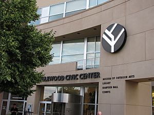
In 1965, City Park was sold to build Cinderella City. When it opened in 1968, it was one of the biggest malls in the world. The developers helped create many new parks across the city to replace the one that was sold. About 30 years later, the mall was taken down. In its place, a new city center was built with a new Civic Center, library, and city hall. A new light-rail train system also started running in Englewood in 2000.
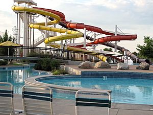
In 2004, Englewood opened the Pirates Cove water park. This was part of a big plan to improve the city's parks. Many improvements were also made to the South Platte River trail system and the Englewood Recreation Center. Englewood is a "full-service" city, meaning it has its own parks, library, and public services. It even helps clear snow for nearby towns.
Geography of Englewood
Englewood is located at 39°38′49″N 104°59′31″W / 39.64694°N 104.99194°W. The city is about 5,371 feet (1,637 meters) above sea level, which is higher than Denver.
In 2020, the city covered a total area of about 6.65 square miles (17.229 square kilometers). A small part of this area, about 0.09 square miles (0.227 square kilometers), is water.
Englewood's Climate
Englewood has a climate similar to Denver's. However, it's a bit milder and more stable because it's in a low part of the South Platte River valley. Winds are usually not very strong here. The climate is described as a cold, semiarid climate.
| Climate data for Englewood, Colorado | |||||||||||||
|---|---|---|---|---|---|---|---|---|---|---|---|---|---|
| Month | Jan | Feb | Mar | Apr | May | Jun | Jul | Aug | Sep | Oct | Nov | Dec | Year |
| Record high °F (°C) | 72 (22) |
75 (24) |
87 (31) |
89 (32) |
94 (34) |
105 (41) |
108 (42) |
104 (40) |
100 (38) |
96 (36) |
81 (27) |
76 (24) |
108 (42) |
| Mean daily maximum °F (°C) | 43 (6) |
46 (8) |
53 (12) |
61 (16) |
70 (21) |
81 (27) |
87 (31) |
84 (29) |
76 (24) |
64 (18) |
51 (11) |
43 (6) |
63 (17) |
| Mean daily minimum °F (°C) | 19 (−7) |
22 (−6) |
28 (−2) |
36 (2) |
45 (7) |
53 (12) |
59 (15) |
57 (14) |
48 (9) |
37 (3) |
26 (−3) |
19 (−7) |
37 (3) |
| Record low °F (°C) | −32 (−36) |
−33 (−36) |
−25 (−32) |
−7 (−22) |
13 (−11) |
27 (−3) |
36 (2) |
32 (0) |
15 (−9) |
−8 (−22) |
−21 (−29) |
−32 (−36) |
−33 (−36) |
| Average precipitation inches (mm) | 0.39 (9.9) |
0.40 (10) |
0.94 (24) |
1.24 (31) |
1.17 (30) |
1.13 (29) |
1.52 (39) |
1.35 (34) |
0.72 (18) |
0.59 (15) |
0.54 (14) |
0.42 (11) |
10.42 (265) |
| Source: MSN Weather | |||||||||||||
People of Englewood
| Historical population | |||
|---|---|---|---|
| Census | Pop. | %± | |
| 1910 | 2,983 | — | |
| 1920 | 4,356 | 46.0% | |
| 1930 | 7,980 | 83.2% | |
| 1940 | 9,680 | 21.3% | |
| 1950 | 16,869 | 74.3% | |
| 1960 | 33,398 | 98.0% | |
| 1970 | 33,695 | 0.9% | |
| 1980 | 30,021 | −10.9% | |
| 1990 | 29,387 | −2.1% | |
| 2000 | 31,727 | 8.0% | |
| 2010 | 30,255 | −4.6% | |
| 2020 | 33,659 | 11.3% | |
| U.S. Decennial Census | |||
In 2000, there were 31,727 people living in Englewood. Most people were White (87.8%), with smaller groups of African American, Native American, and Asian residents. About 13% of the population was Hispanic or Latino.
The average age in the city was 36 years old. About 20.3% of the people were under 18 years old. Many households (36.7%) were married couples, and about 48.1% were not families.
Education in Englewood
Most students in Englewood attend schools run by the Englewood Public Schools district. Some small parts of the city are served by the Littleton Public Schools and the Sheridan Public Schools.
Englewood Schools
The Englewood district has two high schools: Englewood High and Colorado's Finest High School Of Choice. There are also two middle schools: Englewood Middle School and Englewood Leadership Academy. For younger students, there are four elementary schools: Bishop, Clayton, Charles Hay, and Cherrelyn.
Englewood also has private schools, like Saint Louis School (K-12 Catholic) and All Souls School (K-8). Humanex Academy is a private middle and high school for students with learning differences.
Economy of Englewood
Many people work in Englewood. One big company based here is TTEC, which helps businesses with their customer service.
Top Employers in Englewood
Here are some of the biggest employers in Englewood, based on a 2017 report:
| # | Employer | # of Employees | % of City Employed |
|---|---|---|---|
| 1 | Swedish Medical Center | 2,041 | 7.50% |
| 2 | Craig Hospital | 815 | 3.00% |
| 3 | Encore Electric | 560 | 2.06% |
| 4 | Englewood School District | 491 | 1.80% |
| 5 | City of Englewood | 425 | 1.56% |
| 6 | Groove Toyota Dealership | 420 | 1.54% |
| 7 | Kärcher North America | 367 | 1.35% |
| 8 | Metro Community Provider Network | 331 | 1.22% |
| 9 | Transdev North America | 295 | 1.08% |
| 10 | Regional Transportation District (RTD) | 251 | 0.92% |
Points of Interest
- Merrill Wheel-Balancing System
Nearby Areas
The name "Englewood" is used for several ZIP codes (80110, 80111, 80112, 80113). These ZIP codes cover areas next to the city, and even some areas much larger than the city itself. So, sometimes an address might say "Englewood, Colorado," but it's actually in a different city like Sheridan, Cherry Hills Village, Greenwood Village, or Centennial.
Englewood is bordered by:
| North: Denver | ||
| West: Sheridan, Bow Mar, Denver, Littleton | East: Denver, Cherry Hills Village, Greenwood Village | |
| South: Littleton, Greenwood Village |
Notable People
Some famous people who were born or lived in Englewood include:
- David Crockett Graham, a missionary and archaeologist.
- Carlotta Walls LaNier, a civil rights activist.
- Louis W. Menk, a railroad executive.
- Brad Lidge, a former baseball pitcher.
See also
 In Spanish: Englewood (Colorado) para niños
 | Selma Burke |
 | Pauline Powell Burns |
 | Frederick J. Brown |
 | Robert Blackburn |


