
Teller County, Colorado facts for kids
Quick facts for kids
Teller County
|
||
|---|---|---|

Teller County Court House in Cripple Creek
|
||
|
||

Location within the U.S. state of Colorado
|
||
 Colorado's location within the U.S. |
||
| Country | ||
| State | ||
| Founded | March 23, 1899 | |
| Named for | Henry M. Teller | |
| Seat | Cripple Creek | |
| Largest city | Woodland Park | |
| Area | ||
| • Total | 559 sq mi (1,450 km2) | |
| • Land | 557 sq mi (1,440 km2) | |
| • Water | 1.9 sq mi (5 km2) 0.3%% | |
| Population
(2020)
|
||
| • Total | 24,710 | |
| • Density | 44/sq mi (17/km2) | |
| Time zone | UTC−7 (Mountain) | |
| • Summer (DST) | UTC−6 (MDT) | |
| Congressional district | 5th | |

Teller County is a county located in the state of Colorado in the United States. In 2020, about 24,710 people lived here. The main town where the county government is located is Cripple Creek. The biggest city in the county is Woodland Park.
Teller County is part of the larger Colorado Springs area.
Contents
History of Teller County
A long time ago, people found gold near Cripple Creek. This brought many miners to the area. However, the miners and the mine owners had different ideas about how things should be run. Many owners lived in Colorado Springs.
Because of these differences, a new county was created in 1899. It was named Teller County. It was carved out of the western part of Pikes Peak. The county was named after Henry M. Teller, who was a United States Senator.
Just five years after it was formed, Teller County became famous for a big worker dispute. This event was called the Colorado Labor Wars.
Geography of Teller County
Teller County covers a total area of about 559 square miles. Most of this area, about 557 square miles, is land. Only a small part, about 1.9 square miles, is water.
Counties Nearby
Teller County shares its borders with several other counties:
- Douglas County to the north
- Jefferson County to the north
- El Paso County to the east
- Fremont County to the south
- Park County to the west
Main Roads
Two important highways run through Teller County:
 U.S. Highway 24
 State Highway 67
Protected Natural Areas
Teller County has some special protected areas:
- Cripple Creek National Historic District
- Florissant Fossil Beds National Monument
- Pike National Forest
State Parks
- Mueller State Park
Trails and Scenic Drives
You can find these interesting routes in the county:
- American Discovery Trail
- Gold Belt Tour National Scenic and Historic Byway
People of Teller County
In 2020, the population of Teller County was 24,710 people. The county is home to many different people. Most people in the county are White. There are also people from other backgrounds, including Black or African American, Native American, Asian, and Pacific Islander. Some people are also Hispanic or Latino.
The average age of people living in Teller County is about 39 years old. Many families live here, and about one-third of households have children under 18.
Communities in Teller County
Teller County has several towns and cities:
Cities
- Cripple Creek
- Victor
- Woodland Park
Town
- Green Mountain Falls (partly in El Paso County)
Census-Designated Places
These are areas that are like towns but are not officially incorporated:
Unincorporated Communities
These are small communities that are not part of any city or town:
Images for kids
-
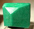
Amazonite crystal, from Crystal Peak area near Florissant
-
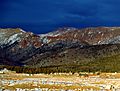
Mountains in Teller County
-
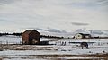
A ranch home with an airplane in the county
-
Casinos in Cripple Creek
-
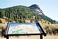
Dome Rock, Mueller State Park


See also
 In Spanish: Condado de Teller para niños
