Midland, Colorado facts for kids
Quick facts for kids
Midland, Colorado
|
|
|---|---|

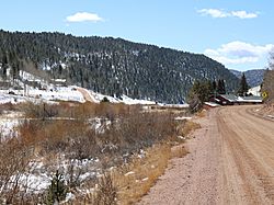
Midland in 2022
|
|

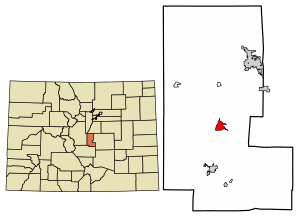
Location of the Midland CDP in Teller County, Colorado
|
|
| Country | |
| State | |
| County | Teller County |
| Founded | 1893 |
| Government | |
| • Type | unincorporated community |
| Area | |
| • Total | 4.504 km2 (1.739 sq mi) |
| • Land | 4.458 km2 (1.721 sq mi) |
| • Water | 0.046 km2 (0.018 sq mi) |
| Elevation | 2,867 m (9,407 ft) |
| Population
(2020)
|
|
| • Total | 182 |
| • Density | 40.41/km2 (104.66/sq mi) |
| Time zone | UTC-7 (MST) |
| • Summer (DST) | UTC-6 (MDT) |
| ZIP Code |
Divide 80814
|
| Area code(s) | 719 |
| GNIS feature ID | 2583266 |
Midland is a small community in Teller County, Colorado, United States. It's not an official town or city, but it's recognized as a census-designated place (CDP). This means the United States Census Bureau collects information about the people living there. Midland is part of the larger Colorado Springs, CO Metropolitan Statistical Area. In 2020, about 182 people lived in Midland. The local post office that serves Midland is in Divide, Colorado, with the Zip Code 80814.
Midland's History
Midland was founded in 1893. It became known because of the Midland Terminal Railway. This railway had a station right in Midland. The station was located about halfway between two other places: Divide, Colorado and Cripple Creek, Colorado. The railway was important for connecting these areas.
Midland's Geography
The Midland CDP covers an area of about 4.504 square kilometers (which is about 1.74 square miles). Most of this area is land, but a small part, about 0.046 square kilometers (or 0.018 square miles), is water.
Midland's Population
The United States Census Bureau first officially defined Midland as a CDP for the United States Census 2010. This means they started counting the population of this specific area.
| Midland CDP, Colorado | ||
|---|---|---|
| Year | Pop. | ±% |
| 2010 | 156 | — |
| 2020 | 182 | +16.7% |
| Source: United States Census Bureau | ||
See also
 In Spanish: Midland (Colorado) para niños
 | Janet Taylor Pickett |
 | Synthia Saint James |
 | Howardena Pindell |
 | Faith Ringgold |


