Gilpin County, Colorado facts for kids
Quick facts for kids
Gilpin County
|
|||
|---|---|---|---|

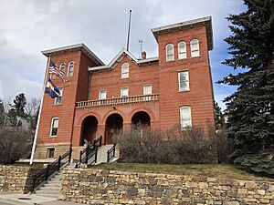
The Gilpin Combined Court, the county courthouse.
|
|||
|
|||

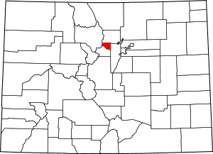
Location within the U.S. state of Colorado
|
|||
 Colorado's location within the U.S. |
|||
| Country | |||
| State | |||
| Founded | November 1, 1861 | ||
| Named for | William Gilpin | ||
| Seat | Central City | ||
| Largest city | Central City | ||
| Area | |||
| • Total | 150 sq mi (400 km2) | ||
| • Land | 150 sq mi (400 km2) | ||
| • Water | 0.4 sq mi (1 km2) 0.2%% | ||
| Population
(2020)
|
|||
| • Total | 5,808 | ||
| • Density | 39/sq mi (15/km2) | ||
| Time zone | UTC−7 (Mountain) | ||
| • Summer (DST) | UTC−6 (MDT) | ||
| Congressional district | 2nd | ||
Gilpin County is a county located in the U.S. state of Colorado. It is one of the smallest counties in Colorado by land area. As of the 2020 census, about 5,808 people lived there. The main town, also called the county seat, is Central City.
The county was started in 1861. At that time, Colorado was still a territory, which is like a part of the U.S. that isn't a full state yet. Gilpin County was named after William Gilpin. He was the first governor of the Colorado Territory. Gilpin County is also part of the larger Denver area.
Contents
Exploring Gilpin County's Land
The U.S. government says that Gilpin County covers about 150 square miles (388 square kilometers). Most of this area is land. Only a very small part, about 0.4 square miles (1 square kilometer), is water. This makes it the second-smallest county in Colorado.
Neighboring Counties
Gilpin County shares its borders with these other counties:
- Boulder County – to the north
- Jefferson County – to the east
- Clear Creek County – to the south
- Grand County – to the west
Main Roads and Highways
Here are some of the important roads that go through Gilpin County:
Protected Natural Areas
Gilpin County is home to parts of several protected natural areas. These places help keep nature safe and beautiful.
- Arapaho National Forest
- James Peak Wilderness
- Roosevelt National Forest
State Parks and Trails
- Golden Gate Canyon State Park
- Continental Divide National Scenic Trail
- Peak to Peak Scenic and Historic Byway
People of Gilpin County
| Historical population | |||
|---|---|---|---|
| Census | Pop. | %± | |
| 1870 | 5,490 | — | |
| 1880 | 6,489 | 18.2% | |
| 1890 | 5,867 | −9.6% | |
| 1900 | 6,690 | 14.0% | |
| 1910 | 4,131 | −38.3% | |
| 1920 | 1,364 | −67.0% | |
| 1930 | 1,212 | −11.1% | |
| 1940 | 1,625 | 34.1% | |
| 1950 | 850 | −47.7% | |
| 1960 | 685 | −19.4% | |
| 1970 | 1,272 | 85.7% | |
| 1980 | 2,441 | 91.9% | |
| 1990 | 3,070 | 25.8% | |
| 2000 | 4,757 | 55.0% | |
| 2010 | 5,441 | 14.4% | |
| 2020 | 5,808 | 6.7% | |
| 2023 (est.) | 5,926 | 8.9% | |
| U.S. Decennial Census 1790-1960 1900-1990 1990-2000 2010-2020 |
|||
The number of people living in Gilpin County has changed a lot over the years. In 1870, there were about 5,490 people. By 1950, the population had dropped to 850. However, the number of residents has grown steadily since then. In 2020, about 5,808 people called Gilpin County home.
In 2000, most people in Gilpin County were White (about 94%). Smaller groups included Black or African American, Native American, and Asian people. About 4% of the population was Hispanic or Latino. The average age of people living in the county was 38 years old.
Towns and Places in Gilpin County

Gilpin County has a few towns and other places where people live.
Cities
Census-Designated Places
These are areas that are like towns but are not officially incorporated as cities.
- Coal Creek (this place is also in Boulder and Jefferson counties)
- Rollinsville
Other Communities
Historic Sites
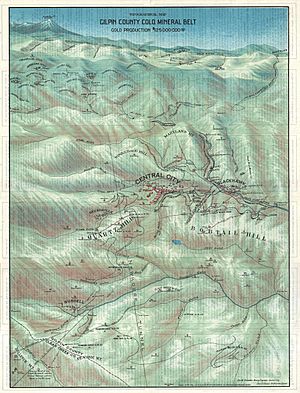
- Central City/Black Hawk Historic District is a special area. It helps protect the history of the old mining towns of Central City and Black Hawk.
See also
 In Spanish: Condado de Gilpin para niños
 | Janet Taylor Pickett |
 | Synthia Saint James |
 | Howardena Pindell |
 | Faith Ringgold |


