Julesburg, Colorado facts for kids
Quick facts for kids
Julesburg, Colorado
|
|
|---|---|

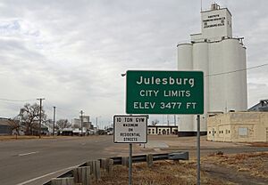
Entering Julesburg from northeast (2017)
|
|

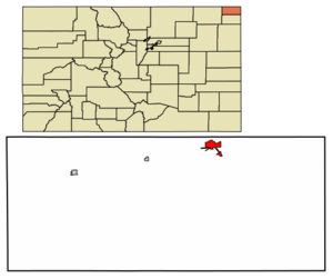
Location within Sedgwick County and Colorado
|
|
| Country | United States |
| State | Colorado |
| County | Sedgwick County Seat |
| Incorporated | November 18, 1886 |
| Named for | Jules Beni |
| Area | |
| • Total | 1.51 sq mi (3.92 km2) |
| • Land | 1.51 sq mi (3.92 km2) |
| • Water | 0.00 sq mi (0.00 km2) |
| Elevation | 3,478 ft (1,060 m) |
| Population
(2020)
|
|
| • Total | 1,307 |
| • Density | 866/sq mi (333.4/km2) |
| Time zone | UTC−7 (MST) |
| • Summer (DST) | UTC−6 (MDT) |
| ZIP Code |
80737
|
| Area code | 970 |
| FIPS code | 08-39965 |
| GNIS ID | 202892 |
Julesburg is a small town in Colorado, United States. It is the main town and county seat of Sedgwick County, Colorado. In 2020, about 1,307 people lived there. Julesburg is known for its interesting history, especially its role in the Pony Express days.
Contents
History of Julesburg
Julesburg started as a trading post, a place where people could trade goods. It was named after a man named Jules Beni. This area was very important because it was part of the Pony Express route from 1860 to 1861. The Pony Express was a fast mail service that used riders on horses to deliver messages across the country.
The Story of Jack Slade

One famous story from Julesburg's past involves a man named Joseph A. "Jack" Slade. He worked for the Central Overland California and Pikes Peak Express Company, which ran the Pony Express. Slade was trying to catch people who were stealing horses. One of these horse thieves was Jules Beni, the person Julesburg was named after.
Slade found Beni in Julesburg. Beni shot Slade, and many thought Slade would not survive. But Slade amazingly recovered! Beni continued to cause trouble by stealing horses. Slade was determined to stop him. Eventually, Slade and some of his cowboys captured Beni. This dramatic story shows how wild and dangerous the American West could be.
The Battle of Julesburg
Julesburg was also home to a military outpost called Fort Rankin, later known as Fort Sedgwick. In 1865, a big event happened here called the Battle of Julesburg. About one thousand Cheyenne, Arapaho, and Lakota warriors attacked Julesburg. They were seeking revenge for a terrible event called the Sand Creek Massacre.
On January 7, 1865, the warriors fought against about 60 U.S. army soldiers and 50 armed civilians. The Native American warriors won this battle. In the weeks that followed, they raided areas along the South Platte River valley. On February 2, they returned to Julesburg and burned down most of the buildings in the town. However, they did not attack the soldiers and civilians who were safe inside the fort. At that time, Julesburg was a very busy town with over 1,000 buildings.
Where is Julesburg?
Julesburg is located at 40°59′18″N 102°16′0″W / 40.98833°N 102.26667°W. It covers an area of about 1.3 square miles (3.92 square kilometers), and all of it is land.
The town sits on the north side of the South Platte River. Important roads like U.S. 138, U.S. 385, and I-76 pass through or near it. Julesburg is the northernmost town in Colorado, very close to the border with Nebraska.
Weather in Julesburg
Julesburg has a semi-arid climate, which means it's generally dry. Winters are cold and dry, while summers are hot and usually have more rain.
| Climate data for Julesburg, Colorado, 1991–2020 normals, extremes 1893–present | |||||||||||||
|---|---|---|---|---|---|---|---|---|---|---|---|---|---|
| Month | Jan | Feb | Mar | Apr | May | Jun | Jul | Aug | Sep | Oct | Nov | Dec | Year |
| Record high °F (°C) | 74 (23) |
79 (26) |
88 (31) |
94 (34) |
100 (38) |
107 (42) |
109 (43) |
109 (43) |
106 (41) |
95 (35) |
85 (29) |
77 (25) |
109 (43) |
| Mean maximum °F (°C) | 63.4 (17.4) |
67.7 (19.8) |
77.9 (25.5) |
83.6 (28.7) |
91.9 (33.3) |
97.6 (36.4) |
100.8 (38.2) |
96.7 (35.9) |
95.4 (35.2) |
86.6 (30.3) |
74.8 (23.8) |
61.6 (16.4) |
101.4 (38.6) |
| Mean daily maximum °F (°C) | 40.5 (4.7) |
44.0 (6.7) |
54.5 (12.5) |
61.9 (16.6) |
70.7 (21.5) |
81.5 (27.5) |
87.6 (30.9) |
85.3 (29.6) |
78.3 (25.7) |
64.5 (18.1) |
51.2 (10.7) |
40.5 (4.7) |
63.4 (17.4) |
| Daily mean °F (°C) | 28.2 (−2.1) |
31.1 (−0.5) |
40.2 (4.6) |
48.3 (9.1) |
57.7 (14.3) |
68.4 (20.2) |
74.4 (23.6) |
72.1 (22.3) |
63.6 (17.6) |
49.9 (9.9) |
37.6 (3.1) |
28.3 (−2.1) |
50.0 (10.0) |
| Mean daily minimum °F (°C) | 15.9 (−8.9) |
18.2 (−7.7) |
25.9 (−3.4) |
34.6 (1.4) |
44.7 (7.1) |
55.3 (12.9) |
61.3 (16.3) |
58.9 (14.9) |
48.8 (9.3) |
35.3 (1.8) |
24.0 (−4.4) |
16.0 (−8.9) |
36.6 (2.5) |
| Mean minimum °F (°C) | −5.4 (−20.8) |
−2.5 (−19.2) |
8.0 (−13.3) |
19.7 (−6.8) |
29.2 (−1.6) |
43.6 (6.4) |
51.4 (10.8) |
48.5 (9.2) |
35.3 (1.8) |
16.9 (−8.4) |
5.4 (−14.8) |
−4.2 (−20.1) |
−12.0 (−24.4) |
| Record low °F (°C) | −34 (−37) |
−30 (−34) |
−23 (−31) |
−8 (−22) |
19 (−7) |
32 (0) |
35 (2) |
38 (3) |
16 (−9) |
−3 (−19) |
−14 (−26) |
−38 (−39) |
−38 (−39) |
| Average precipitation inches (mm) | 0.41 (10) |
0.41 (10) |
1.00 (25) |
1.77 (45) |
3.00 (76) |
3.20 (81) |
2.33 (59) |
2.79 (71) |
1.52 (39) |
1.43 (36) |
0.41 (10) |
0.29 (7.4) |
18.56 (469.4) |
| Average snowfall inches (cm) | 3.7 (9.4) |
4.0 (10) |
3.3 (8.4) |
2.3 (5.8) |
0.1 (0.25) |
0.0 (0.0) |
0.0 (0.0) |
0.0 (0.0) |
0.0 (0.0) |
2.0 (5.1) |
2.8 (7.1) |
3.5 (8.9) |
21.7 (54.95) |
| Average precipitation days (≥ 0.01 in) | 1.5 | 2.5 | 3.9 | 5.7 | 8.1 | 7.9 | 7.0 | 6.8 | 4.7 | 4.6 | 2.3 | 1.3 | 56.3 |
| Average snowy days (≥ 0.1 in) | 1.8 | 2.2 | 1.5 | 1.1 | 0.1 | 0.0 | 0.0 | 0.0 | 0.0 | 0.8 | 1.3 | 1.7 | 10.5 |
| Source 1: NOAA | |||||||||||||
| Source 2: National Weather Service | |||||||||||||
People of Julesburg
The number of people living in Julesburg has changed over the years. Here's how the population has grown and shrunk:
| Historical population | |||
|---|---|---|---|
| Census | Pop. | %± | |
| 1890 | 202 | — | |
| 1900 | 371 | 83.7% | |
| 1910 | 962 | 159.3% | |
| 1920 | 1,320 | 37.2% | |
| 1930 | 1,467 | 11.1% | |
| 1940 | 1,619 | 10.4% | |
| 1950 | 1,951 | 20.5% | |
| 1960 | 1,840 | −5.7% | |
| 1970 | 1,578 | −14.2% | |
| 1980 | 1,528 | −3.2% | |
| 1990 | 1,295 | −15.2% | |
| 2000 | 1,467 | 13.3% | |
| 2010 | 1,225 | −16.5% | |
| 2020 | 1,307 | 6.7% | |
Schools
The Julesburg School District is in charge of the public schools in the town.
See also
 In Spanish: Julesburg para niños
 | Kyle Baker |
 | Joseph Yoakum |
 | Laura Wheeler Waring |
 | Henry Ossawa Tanner |

