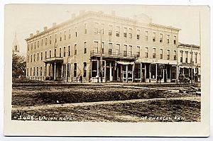
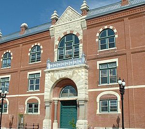
McPherson, Kansas facts for kids
Quick facts for kids
McPherson, Kansas
|
|
|---|---|
|
City and County seat
|
|
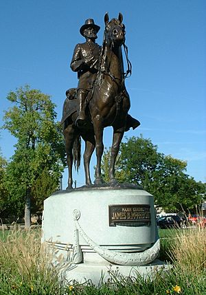
Sculpture of James B. McPherson (2004)
|
|
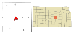
Location within McPherson County and Kansas
|
|
|
|
| Country | United States |
| State | Kansas |
| County | McPherson |
| Founded | 1870 |
| Incorporated | 1874 |
| Named for | James B. McPherson |
| Area | |
| • Total | 7.48 sq mi (19.38 km2) |
| • Land | 7.43 sq mi (19.25 km2) |
| • Water | 0.05 sq mi (0.13 km2) |
| Elevation | 1,493 ft (455 m) |
| Population
(2020)
|
|
| • Total | 14,082 |
| • Density | 1,882.6/sq mi (726.63/km2) |
| Time zone | UTC-6 (CST) |
| • Summer (DST) | UTC-5 (CDT) |
| ZIP code |
67460
|
| Area code | 620 |
| FIPS code | 20-43950 |
| GNIS ID | 485617 |
McPherson (pronounced mək-FUR-sən) is a city in Kansas, United States. It is the county seat of McPherson County, Kansas. This means it's where the main government offices for the county are located.
In 2020, about 14,082 people lived in McPherson. The city is named after James Birdseye McPherson, a general who fought for the Union during the American Civil War. McPherson is also home to two colleges: McPherson College and Central Christian College of Kansas.
Contents
History of McPherson
Early Beginnings: 19th Century
For thousands of years, the land that is now Kansas was home to Native American tribes. In 1803, the United States bought most of this land as part of the Louisiana Purchase. Kansas became the 34th U.S. state in 1861.
McPherson County was created in 1867. The city of McPherson itself was started in 1870 by a group called the McPherson Town Company. The first post office opened in 1873, and McPherson officially became a city in 1874.
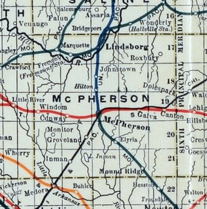
In the late 1800s, railroads became very important for McPherson. By 1888, four different railroad lines met in the city. This helped McPherson grow and become a center for businesses. Major industries at the time included a large flour mill, an insurance company, and an oil refinery.
McPherson in the 20th Century
In 1912, a famous road called the National Old Trails Road (also known as the Ocean-to-Ocean Highway) was built through McPherson. This road helped connect the city to other parts of the country.
One of the most exciting parts of McPherson's history involves basketball! In the 1930s, the local oil refinery sponsored a basketball team called the McPherson Globe Refiners. This team was coached by Gene Johnson.
The Globe Refiners were known for their very tall players, like Joe Fortenberry (6 feet 8 inches) and Willard Schmidt (6 feet 9 inches). They played a fast-paced game. In 1936, the Refiners won the national championship for amateur teams. This win earned them a chance to compete for the very first USA Olympic basketball team.
The Refiners' players helped the USA team win the gold medal at the 1936 Summer Olympics in Berlin, Germany. Their home court, the McPherson Community Building, can still be visited today. A mural celebrating their victory was painted in 2010.
Geography and Nature
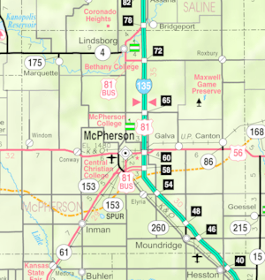
McPherson is located in central Kansas. The city covers about 7.23 square miles, with most of it being land. It is situated near U.S. Route 56 and Interstate 135.
The city is part of the Little Arkansas River area. Dry Turkey Creek, a stream that flows when it rains, creates several lakes within the city, like Lakeside Park Lagoon and Wall Park Lake.
South and west of McPherson are parts of the McPherson Valley Wetlands. These natural wetlands are important for waterfowl (birds that live near water) and other wildlife. They are a key stop for migratory birds, meaning birds that travel long distances.
McPherson's Climate
McPherson has a climate with hot, humid summers and generally mild to cool winters. This type of climate is called a humid subtropical climate.
| Climate data for McPherson, Kansas, 1991–2020 normals, extremes 1893–present | |||||||||||||
|---|---|---|---|---|---|---|---|---|---|---|---|---|---|
| Month | Jan | Feb | Mar | Apr | May | Jun | Jul | Aug | Sep | Oct | Nov | Dec | Year |
| Record high °F (°C) | 79 (26) |
83 (28) |
94 (34) |
99 (37) |
106 (41) |
114 (46) |
117 (47) |
117 (47) |
109 (43) |
98 (37) |
89 (32) |
81 (27) |
117 (47) |
| Mean maximum °F (°C) | 64.7 (18.2) |
69.7 (20.9) |
79.6 (26.4) |
85.9 (29.9) |
92.5 (33.6) |
98.0 (36.7) |
103.3 (39.6) |
101.7 (38.7) |
97.2 (36.2) |
88.8 (31.6) |
75.2 (24.0) |
64.2 (17.9) |
104.6 (40.3) |
| Mean daily maximum °F (°C) | 42.4 (5.8) |
47.2 (8.4) |
57.6 (14.2) |
67.1 (19.5) |
77.0 (25.0) |
87.9 (31.1) |
92.8 (33.8) |
90.7 (32.6) |
83.3 (28.5) |
70.6 (21.4) |
56.3 (13.5) |
44.3 (6.8) |
68.1 (20.1) |
| Daily mean °F (°C) | 30.7 (−0.7) |
34.6 (1.4) |
44.4 (6.9) |
53.9 (12.2) |
64.7 (18.2) |
75.6 (24.2) |
80.6 (27.0) |
78.5 (25.8) |
70.4 (21.3) |
57.5 (14.2) |
43.8 (6.6) |
33.3 (0.7) |
55.7 (13.2) |
| Mean daily minimum °F (°C) | 19.0 (−7.2) |
22.0 (−5.6) |
31.3 (−0.4) |
40.6 (4.8) |
52.3 (11.3) |
63.4 (17.4) |
68.3 (20.2) |
66.3 (19.1) |
57.6 (14.2) |
44.4 (6.9) |
31.4 (−0.3) |
22.2 (−5.4) |
43.2 (6.3) |
| Mean minimum °F (°C) | 2.5 (−16.4) |
5.8 (−14.6) |
15.1 (−9.4) |
26.4 (−3.1) |
37.6 (3.1) |
52.4 (11.3) |
58.4 (14.7) |
56.0 (13.3) |
43.0 (6.1) |
27.2 (−2.7) |
15.7 (−9.1) |
7.0 (−13.9) |
−3.0 (−19.4) |
| Record low °F (°C) | −22 (−30) |
−22 (−30) |
−11 (−24) |
9 (−13) |
22 (−6) |
32 (0) |
47 (8) |
43 (6) |
27 (−3) |
12 (−11) |
−3 (−19) |
−21 (−29) |
−22 (−30) |
| Average precipitation inches (mm) | 0.90 (23) |
1.22 (31) |
2.35 (60) |
2.98 (76) |
5.42 (138) |
4.75 (121) |
4.19 (106) |
3.51 (89) |
2.97 (75) |
2.44 (62) |
1.56 (40) |
1.29 (33) |
33.58 (854) |
| Average snowfall inches (cm) | 4.1 (10) |
3.3 (8.4) |
2.6 (6.6) |
0.6 (1.5) |
0.0 (0.0) |
0.0 (0.0) |
0.0 (0.0) |
0.0 (0.0) |
0.0 (0.0) |
0.1 (0.25) |
0.6 (1.5) |
2.9 (7.4) |
14.2 (35.65) |
| Average precipitation days (≥ 0.01 in) | 4.2 | 4.7 | 7.0 | 8.7 | 10.9 | 9.4 | 8.9 | 8.4 | 6.9 | 6.7 | 4.8 | 4.9 | 85.5 |
| Average snowy days (≥ 0.1 in) | 2.6 | 2.0 | 1.0 | 0.2 | 0.0 | 0.0 | 0.0 | 0.0 | 0.0 | 0.1 | 0.3 | 2.0 | 8.2 |
| Source 1: NOAA | |||||||||||||
| Source 2: National Weather Service | |||||||||||||
People of McPherson
| Historical population | |||
|---|---|---|---|
| Census | Pop. | %± | |
| 1880 | 1,590 | — | |
| 1890 | 3,172 | 99.5% | |
| 1900 | 2,996 | −5.5% | |
| 1910 | 3,546 | 18.4% | |
| 1920 | 4,595 | 29.6% | |
| 1930 | 6,147 | 33.8% | |
| 1940 | 7,194 | 17.0% | |
| 1950 | 8,689 | 20.8% | |
| 1960 | 9,996 | 15.0% | |
| 1970 | 10,851 | 8.6% | |
| 1980 | 11,753 | 8.3% | |
| 1990 | 12,422 | 5.7% | |
| 2000 | 13,770 | 10.9% | |
| 2010 | 13,155 | −4.5% | |
| 2020 | 14,082 | 7.0% | |
| U.S. Decennial Census 2010-2020 |
|||
In 2020, the city of McPherson had 14,082 people living in 5,645 households. Most residents (about 85%) are white. About 2.3% are Black or African-American, and 1.3% are Asian. About 7.5% of the population is Hispanic or Latino.
About 22.6% of the people in McPherson are under 18 years old. The average age in the city is 37.2 years.
Education in McPherson
McPherson is home to two colleges:
- McPherson College
- Central Christian College
The public schools in McPherson are managed by McPherson USD 418. This district includes:
- An Early Childhood center
- Four elementary schools (Eisenhower, Lincoln, Roosevelt, Washington)
- McPherson Middle School
- McPherson High School
The mascot for McPherson schools is the Bullpups. There is also a private school option at St. Joseph Catholic Church & School for students up to sixth grade.
Getting Around McPherson
McPherson was located on the National Old Trails Road, an important highway built in 1912.
Today, bus service is available daily. You can take a bus towards Wichita and Salina using BeeLine Express.
Media and News
McPherson has its own daily newspaper, The McPherson Sentinel. There is also a weekly newspaper called The McPherson Weekly News.
You can also listen to local radio stations:
- 1540 KNGL: This station plays Talk radio.
- 96.7 KMPK: This station plays Adult contemporary music.
Famous People from McPherson
- V. John Krehbiel: He was an Ambassador to Finland.
- Anna Larkin: A folk sculptor who lived in McPherson for many years.
- George Magerkurth: A Major League Baseball umpire who was born in McPherson.
- Sue Raney: A jazz singer.
- Brad Underwood: A basketball coach at the University of Illinois, originally from McPherson.
See also
 In Spanish: McPherson (Kansas) para niños
 | Frances Mary Albrier |
 | Whitney Young |
 | Muhammad Ali |


