Laramie Plains facts for kids
The Laramie Plains is a high, dry area in south-central Wyoming, United States. It's about 8,000 feet (2,438 meters) above sea level. These plains stretch along the Laramie River, on the east side of the Medicine Bow Mountains. The biggest town in this valley is Laramie.
The Laramie Plains are separated from the larger Great Plains to the east by the Laramie Mountains. These mountains are part of the Front Range. Because it's so high up, the area has a cold climate. This means the growing season for plants is quite short. For a long time, the plains have been used for raising livestock, mainly sheep and cattle.
Contents
Exploring the Laramie Plains
In the 1840s, an explorer named John C. Frémont traveled through Wyoming. He created maps and wrote reports for the U.S. Congress. Frémont used the name "Laramie Plains" for the flat areas surrounded by mountains in southeast Wyoming.
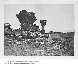
His 1842 map showed the term "Laramie Plains" in two spots. One was near Red Buttes, south of the city of Laramie. The other was along the Laramie River. In 1843, he even camped on the Laramie Plains, near Elk Mountain. Over time, this name became official. The U.S. Geologic Survey adopted "Laramie Plains" in 2004.
History of the Laramie Plains
Native American Use of the Plains
In the 1800s, no single Native American tribe lived permanently on the Laramie Plains. Instead, many different tribes used the area. These included the Northern Arapaho, Northern Cheyenne, Oglala Sioux, Eastern Shoshone, and White River Utes. The Laramie Plains were a shared space where these tribes hunted and traveled.
In 1846, a writer named Francis Parkman joined a group of Oglala Sioux on a buffalo hunt there. He wrote about their concerns about other tribes. He learned that a group of Oglala warriors had been defeated by Shoshone warriors in 1845. This shows that even though the plains were shared, conflicts could happen.
Trails and Transportation
The Laramie Plains also served as an important route for travelers. Trails like the Cherokee Trail passed through the area. This trail was used by Cherokee people traveling from what is now Oklahoma to California.
In 1849, Captain Howard Stansbury of the U.S. Army explored a route across the Laramie Plains. His group met a large herd of buffalo, which suggested Native American hunters were nearby. His guide, the famous mountain man Jim Bridger, met with a group of Sioux. They were worried Stansbury's group might be Crow warriors. The Sioux invited Bridger and Stansbury to their village for a feast.
After his journey, Stansbury suggested a route from Fort Bridger through the Laramie Plains. This route later became part of the Overland Trail. It was also used by the Overland Stage Line, which carried mail and passengers.
Railroads and Modern Routes
Before 1862, important communication lines like the Pony Express and the transcontinental telegraph followed the Oregon Trail. This trail went to Fort Laramie and over South Pass. However, challenges from Native American groups forced the stage line to change its route to the Overland Trail. Soldiers built Fort Halleck near Elk Mountain to protect this new route.
In 1868, the First Transcontinental Railroad was built across the Laramie Plains. This brought many new people to the area. "Laramie City" was founded, which later became home to the University of Wyoming.
Today, U.S. Route 30 (also known as the Lincoln Highway) follows the railroad route. Interstate 80 also follows the path of the old Overland Trail. It passes very close to where Fort Halleck once stood, near Elk Mountain.
 | Charles R. Drew |
 | Benjamin Banneker |
 | Jane C. Wright |
 | Roger Arliner Young |


