Laramie River facts for kids
Quick facts for kids Laramie River |
|
|---|---|

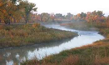
The Laramie River, as it flows past the site of old Fort Laramie
|
|

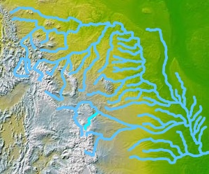
Map highlighting the Laramie River (in bright blue, below and slightly left of center)
|
|
| Country | United States |
| State | Colorado, Wyoming |
| Cities | Laramie, Wheatland, Fort Laramie |
| Physical characteristics | |
| Main source | Chambers Lake (Colorado) Larimer County, Colorado 9,192 ft (2,802 m) 40°36′56″N 105°51′29″W / 40.61556°N 105.85806°W |
| River mouth | North Platte River Goshen County, Wyoming 4,213 ft (1,284 m) 42°11′59″N 104°31′47″W / 42.19972°N 104.52972°W |
| Length | 280 mi (450 km) |
| Basin features | |
| Basin size | 4,564 sq mi (11,820 km2) |
| Tributaries |
|
The Laramie River is a long river, about 280 miles (450 km) long. It flows through the states of Colorado and Wyoming in the United States. This river eventually joins the North Platte River.
The river got its name from Jacques La Ramie. He was a fur trapper who explored this area a long time ago, in the early 1800s. Many places in the region, like Laramie County, Wyoming and the city of Laramie, are also named after him.
Contents
Where the Laramie River Flows
The Laramie River starts in northern Colorado. Its source is in the Roosevelt National Forest, which is part of the Front Range mountains. From there, it flows north into Wyoming.
As it travels, the river goes along the east side of the Medicine Bow Mountains. It passes by small towns like Jelm and Woods Landing. The river then turns northeast and leaves the mountains about 22 miles (35 km) southwest of the city of Laramie.
Journey Through Wyoming
The Laramie River flows north right through the city of Laramie. In an area called the Laramie Plains, another river, the Little Laramie River, joins it. The Laramie River continues its journey north through these plains and then flows into Wheatland Reservoir.
After the reservoir, the river heads northeast through the Laramie Mountains. When it leaves these mountains, it meets two more streams. The North Laramie River joins it about 5 miles (8.0 km) north of Wheatland. Then, Chugwater Creek flows into it about 7 miles (11 km) northeast of Wheatland. Finally, the Laramie River joins the North Platte River right across from the town of Fort Laramie.
Water for Farms
In its upper parts in Colorado, the Laramie River helps supply water to the Cache la Poudre River. This happens through a special path called the Laramie-Poudre Tunnel. This tunnel is about 2 miles (3.2 km) long. It was built in 1911 as part of a bigger plan to bring water for irrigation to farms in northern Colorado.
Fishing in the Laramie River
The Laramie River is a fantastic place for fishing! It is especially known for its excellent brown trout. Many people enjoy fly fishing here. You can also catch bigger fish using lures that look like minnows or crawfish.
There are many places where you can access the river to fish. These spots are found in Laramie and stretch south all the way to Woods Landing. During the summer and fall, lots of insects like mayflies, stoneflies, and caddisflies are around. These insects are great food for the trout, making it a perfect time for dry fly fishing.
North of Laramie, you might find other types of fish in the river. These include walleye and channel catfish. They have come from Grayrocks Reservoir near Wheatland. You can catch these fish using different kinds of artificial lures or natural baits.
See also
 In Spanish: Río Laramie para niños
 | Jackie Robinson |
 | Jack Johnson |
 | Althea Gibson |
 | Arthur Ashe |
 | Muhammad Ali |

