Goshen County, Wyoming facts for kids
Quick facts for kids
Goshen County
|
||
|---|---|---|

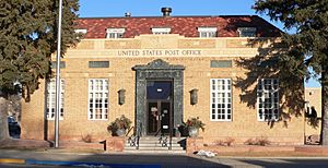
United States Post Office (Torrington, Wyoming)
|
||
|
||

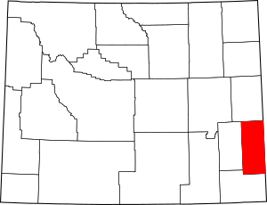
Location within the U.S. state of Wyoming
|
||
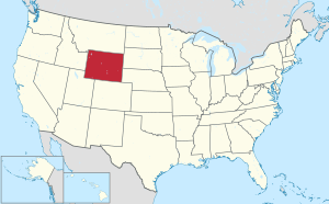
 Wyoming's location within the U.S. |
||
| Country | ||
| State | ||
| Founded | February 21, 1911 (authorized) 1913 (organized) |
|
| Named for | Land of Goshen | |
| Seat | Torrington | |
| Largest city | Torrington | |
| Area | ||
| • Total | 2,232 sq mi (5,780 km2) | |
| • Land | 2,225 sq mi (5,760 km2) | |
| • Water | 6.8 sq mi (18 km2) 0.3%% | |
| Population
(2020)
|
||
| • Total | 12,498 | |
| • Density | 5.5995/sq mi (2.1620/km2) | |
| Time zone | UTC−7 (Mountain) | |
| • Summer (DST) | UTC−6 (MDT) | |
| Congressional district | At-large | |
Goshen County is a county located in the state of Wyoming in the United States. In 2020, about 12,498 people lived there. The main town and county seat (where the county government is) is Torrington. The eastern edge of Goshen County is right next to the state of Nebraska.
Goshen County is famous for its cattle. It raises more cattle than any other county in Wyoming! In 1997, there were 688 farms and ranches in the county. Each farm or ranch was quite large, averaging about 1,840 acres.
Contents
History of Goshen County
Goshen County was officially created in 1911. It was formed from a part of Laramie County. The county government started working in 1913. Before it became part of the U.S., this land was claimed by several countries. These included Spain, France, Great Britain, Mexico, and even the Republic of Texas. In 1803, the Louisiana Purchase made it clear that the United States owned this area.
Early Trails and Communication
By the 1820s, the North Platte River became an important path. Fur traders and trappers used it to travel west. Later, in the 1840s, this path became part of the famous Oregon Trail and Mormon Trail. These trails were used by many pioneers moving west.
In the late 1850s, regular stagecoaches started using this route. They carried passengers and mail across the country. The short-lived Pony Express also used this route from 1860 to 1861. It carried mail very quickly from Missouri to California. By October 1861, telegraph lines were built along the route. This allowed messages to be sent much faster. From 1876 to 1887, a stagecoach line also ran through the county. It went from Cheyenne to the gold fields in the Dakota Territory.
How Goshen County Got Its Name
The county was likely named after a valley called Goshen Hole. This valley is in the southwest part of the county. John C. Frémont camped there in 1843 and wrote about the name in his journal.
There are a few stories about where the name "Goshen Hole" came from. Many people believe it comes from the Land of Goshen in Egypt. This land is mentioned in the Bible. John Hunton, an early rancher, was told this story by Seth Ward. Seth Ward was a storekeeper at Fort Laramie. The name Goshen Hole first appeared on a map in 1888.
Geography and Nature
Goshen County covers a total area of about 2,232 square miles. Most of this (2,225 square miles) is land. Only a small part (6.8 square miles) is water. The county is located in the High Plains. This area is just east of the Rocky Mountains.
Neighboring Counties
Goshen County shares its borders with several other counties:
- Niobrara County - to the north
- Platte County - to the west
- Laramie County - to the south
- Banner County, Nebraska - to the southeast
- Scotts Bluff County, Nebraska - to the east
- Sioux County, Nebraska - to the east
Protected Areas
One important protected area in Goshen County is the Fort Laramie National Historic Site. This site helps preserve a historic fort.
Climate and Weather

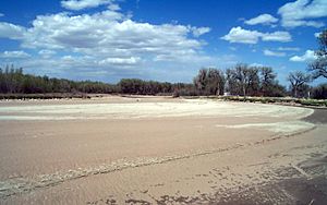
Goshen County is located on the North Platte River. It has a semi-arid climate. This means it gets some rain, but it's generally dry.
On June 5, 2009, a special weather research team called VORTEX2 visited Goshen County. They watched and studied a tornado from start to finish. This helped them learn more about how tornadoes form and behave.
People and Population
The number of people living in Goshen County has changed over the years.
| Historical population | |||
|---|---|---|---|
| Census | Pop. | %± | |
| 1920 | 8,064 | — | |
| 1930 | 11,754 | 45.8% | |
| 1940 | 12,207 | 3.9% | |
| 1950 | 12,634 | 3.5% | |
| 1960 | 11,941 | −5.5% | |
| 1970 | 10,885 | −8.8% | |
| 1980 | 12,040 | 10.6% | |
| 1990 | 12,373 | 2.8% | |
| 2000 | 12,538 | 1.3% | |
| 2010 | 13,249 | 5.7% | |
| 2020 | 12,498 | −5.7% | |
| 2023 (est.) | 12,642 | −4.6% | |
| US Decennial Census 1870–2000 2010 2020 |
|||
In 2010, there were 13,249 people living in Goshen County. Most people (94.5%) were white. About 9.7% of the population was of Hispanic or Latino background. Many people had ancestors from Germany (38.3%), Ireland (15.5%), or England (15.3%).
Towns and Communities
Goshen County has one city and several towns and smaller communities.
City
- Torrington (This is the county seat)
Towns
Census-designated places
These are areas that are like towns but are not officially incorporated.
Unincorporated communities
These are smaller communities that are not officially part of a city or town.
- Jay Em
- Rockeagle
Getting Around
Main Roads
Goshen County has several important highways that help people travel.
 US 26
US 26 US 85
US 85
There are also many state routes that connect smaller towns and areas.
 WYO 92 (Huntley Road)
 WYO 151 (LaGrange Road)
 WYO 152 (Yoder Road)
 WYO 153 (Springer Reservoir Road)
 WYO 154 (Veteran Road)
 WYO 156 (Sugar Factory Road)
 WYO 158 (Horse Creek Road)
 WYO 159 (Van Tassell Road)
 WYO 160 (Old Fort Laramie Road)
 WYO 161 (Yoder-Huntley Road)
 WYO 313 (Chugwater Road)
Airport
- Torrington Municipal Airport (TOR) – located in Torrington
See also
 In Spanish: Condado de Goshen para niños
 | Delilah Pierce |
 | Gordon Parks |
 | Augusta Savage |
 | Charles Ethan Porter |


