Platte County, Wyoming facts for kids
Quick facts for kids
Platte County
|
||
|---|---|---|

|
||
|
||

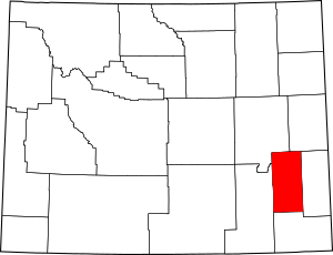
Location within the U.S. state of Wyoming
|
||
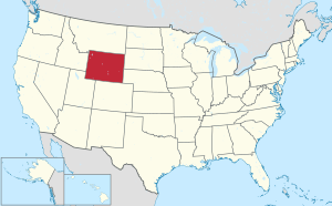
 Wyoming's location within the U.S. |
||
| Country | ||
| State | ||
| Founded | February 21, 1911 (authorized) 1913 (organized) |
|
| Named for | North Platte River | |
| Seat | Wheatland | |
| Largest town | Wheatland | |
| Area | ||
| • Total | 2,111 sq mi (5,470 km2) | |
| • Land | 2,084 sq mi (5,400 km2) | |
| • Water | 27 sq mi (70 km2) 1.3%% | |
| Population
(2020)
|
||
| • Total | 8,605 | |
| • Density | 4.0763/sq mi (1.5739/km2) | |
| Time zone | UTC−7 (Mountain) | |
| • Summer (DST) | UTC−6 (MDT) | |
| Congressional district | At-large | |
Platte County is a county located in the state of Wyoming, United States. As of the 2020 United States Census, about 8,605 people live here. The main town and county seat is Wheatland. The county is named after the North Platte River, which flows through it.
Contents
History of Platte County
Platte County was officially created on February 21, 1911. It was formed from land that used to be part of Laramie County. The county then became fully organized in 1913. It got its name from the North Platte River, a major river that runs through the northeastern part of the county.
Geography and Nature
According to the United States Census Bureau, Platte County covers a total area of 2,111 square miles. Most of this area, 2,084 square miles, is land. The remaining 27 square miles, or 1.3%, is water. Platte County is the third-smallest county in Wyoming by land area.
Neighboring Counties
Platte County shares borders with several other counties:
- Niobrara County (to the northeast)
- Goshen County (to the east)
- Laramie County (to the south)
- Albany County (to the west)
- Converse County (to the northwest)
Protected Natural Areas
Part of the Medicine Bow National Forest is located within Platte County. This forest offers beautiful natural spaces for outdoor activities.
Main Roads and Highways
Several important roads pass through Platte County, connecting it to other parts of Wyoming and beyond:
 Interstate 25
 U.S. Highway 26
 U.S. Highway 87
 Wyoming Highway 34
Population and People
| Historical population | |||
|---|---|---|---|
| Census | Pop. | %± | |
| 1920 | 7,421 | — | |
| 1930 | 9,695 | 30.6% | |
| 1940 | 8,013 | −17.3% | |
| 1950 | 7,925 | −1.1% | |
| 1960 | 7,195 | −9.2% | |
| 1970 | 6,486 | −9.9% | |
| 1980 | 11,975 | 84.6% | |
| 1990 | 8,145 | −32.0% | |
| 2000 | 8,807 | 8.1% | |
| 2010 | 8,667 | −1.6% | |
| 2020 | 8,605 | −0.7% | |
| 2023 (est.) | 8,546 | −1.4% | |
| US Decennial Census 1870–2000 2010–2016 |
|||
2010 Census Information
In 2010, there were 8,667 people living in Platte County. These people lived in 3,838 households, and 2,505 of these were families. On average, there were about 4.2 people per square mile.
Most people in the county were white (95.4%). Smaller groups included Asian (0.4%), American Indian (0.4%), and Black or African American (0.3%). About 6.7% of the population identified as Hispanic or Latino. Many residents have German (45.3%), English (21.1%), or Irish (17.3%) family backgrounds.
About 24.5% of households had children under 18 living with them. The average household had 2.23 people, and the average family had 2.76 people. The average age of people in Platte County was 47.5 years old.
Communities in Platte County
Platte County has several towns and smaller communities.
Towns
- Chugwater
- Glendo
- Guernsey
- Hartville
- Wheatland (This is the county seat, where the main government offices are.)
Census-Designated Places
These are areas that are like towns but are not officially incorporated as one.
- Chugcreek
- El Rancho
- Lakeview North
- Slater
- Westview Circle
- Y-O Ranch
- Whiting
Unincorporated Communities
These are small settlements that are not officially part of a town or city.
- Bordeaux
- Diamond
- Dwyer
- Dwyer Junction
- Uva
- Wendover
Ghost Towns
- Sunrise (A ghost town is a town that has been abandoned.)
Notable People from Platte County
- Jim Geringer: He served as the governor of Wyoming.
- Robert Mills Grant: He was a State Representative for Wyoming.
See also
 In Spanish: Condado de Platte (Wyoming) para niños
 | Victor J. Glover |
 | Yvonne Cagle |
 | Jeanette Epps |
 | Bernard A. Harris Jr. |


