Laramie County, Wyoming facts for kids
Quick facts for kids
Laramie County
|
||
|---|---|---|
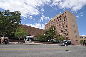
United States Post Office and Courthouse, Cheyenne, Wyoming
|
||
|
||
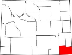
Location within the U.S. state of Wyoming
|
||
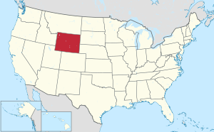 Wyoming's location within the U.S. |
||
| Country | ||
| State | ||
| Founded | January 9, 1867 | |
| Named for | Jacques La Ramee | |
| Seat | Cheyenne | |
| Largest city | Cheyenne | |
| Area | ||
| • Total | 2,688 sq mi (6,960 km2) | |
| • Land | 2,686 sq mi (6,960 km2) | |
| • Water | 1.6 sq mi (4 km2) 0.06%% | |
| Population
(2020)
|
||
| • Total | 100,512 | |
| • Density | 37.39/sq mi (14.44/km2) | |
| Time zone | UTC−7 (Mountain) | |
| • Summer (DST) | UTC−6 (MDT) | |
| Congressional district | At-large | |
Laramie County is a county located in the southeast corner of Wyoming, a state in the United States. In 2020, about 100,512 people lived here. This makes it the most populated county in Wyoming.
The main city and county seat is Cheyenne. Cheyenne is also the capital city of Wyoming. Laramie County is located west of Nebraska and north of Colorado. It is part of the larger Cheyenne, WY Metropolitan Statistical Area.
It's important to know that the city of Laramie, Wyoming is in a different county, called Albany County.
Contents
History of Laramie County
Laramie County was first created in 1867. At that time, it was part of the Dakota Territory. The county was named after Jacques La Ramee. He was a French-Canadian fur-trader, someone who traded animal furs.
Over the years, parts of Laramie County were used to create other counties. For example, Sweetwater County was formed in 1867. Later, Albany County and Carbon County were created in 1868.
In 1869, Laramie County became part of the new Wyoming Territory. More changes happened in the following years. Crook County was formed in 1875. Converse County was created in 1888. Finally, in 1911, Goshen County and Platte County were formed. These changes gave Laramie County its current shape and size.
In its early days, the county's economy focused on farming and raising livestock. The Wyoming Stock Growers Association, which still exists today, started around that time. Many different types of animal farming were important. Some early settlers in Laramie County were immigrants from other countries. For instance, the town of Burns was mostly settled by German immigrants.
Arts and Culture
Laramie County Library System
The Laramie County Library System is one of the oldest library systems in the United States. It has been open continuously for a very long time. The first library branch opened in Cheyenne in 1886.
In 1899, a famous businessman named Andrew Carnegie gave $50,000. This money helped build Wyoming's first Carnegie Public Library, which opened in 1902. The library moved to a bigger building in 1969. In 2007, a second library branch opened to serve more people.
Geography of Laramie County
Laramie County covers a total area of about 2,688 square miles. Most of this area, about 2,686 square miles, is land. Only a small part, about 1.6 square miles, is water.
Adjacent Counties
Laramie County shares its borders with several other counties:
- Goshen County – to the north
- Banner County, Nebraska – to the northeast
- Kimball County, Nebraska – to the east
- Weld County, Colorado – to the south
- Larimer County, Colorado – to the southwest
- Albany County – to the west
- Platte County – to the northwest
Major Roads
Several important highways pass through Laramie County. These roads help people travel and transport goods across the state and beyond.
 Interstate 25
 Interstate 80
 Interstate 180
 U.S. Highway 30
 U.S. Highway 85
 U.S. Highway 87
Population and People
| Historical population | |||
|---|---|---|---|
| Census | Pop. | %± | |
| 1870 | 2,957 | — | |
| 1880 | 6,409 | 116.7% | |
| 1890 | 16,777 | 161.8% | |
| 1900 | 20,181 | 20.3% | |
| 1910 | 26,127 | 29.5% | |
| 1920 | 20,699 | −20.8% | |
| 1930 | 26,845 | 29.7% | |
| 1940 | 33,651 | 25.4% | |
| 1950 | 47,662 | 41.6% | |
| 1960 | 60,149 | 26.2% | |
| 1970 | 56,360 | −6.3% | |
| 1980 | 68,649 | 21.8% | |
| 1990 | 73,142 | 6.5% | |
| 2000 | 81,607 | 11.6% | |
| 2010 | 91,738 | 12.4% | |
| 2020 | 100,512 | 9.6% | |
| 2023 (est.) | 100,984 | 10.1% | |
| US Decennial Census 1870–2000 2010–2020 |
|||
Population in 2010
In 2010, there were 91,738 people living in Laramie County. The population density was about 34 people per square mile. Most people (88.5%) were white. About 13.1% of the population identified as Hispanic or Latino.
The average age of people in the county was 37 years old. The average income for a household was about $52,824 per year.
Communities
Laramie County has one main city and several towns and smaller communities.
City
- Cheyenne (This is the county seat and the largest city.)
Towns
Unincorporated Areas
These are areas that are not officially part of a city or town.
Census-Designated Places
These places are recognized by the U.S. Census Bureau for collecting population data.
- Carpenter
- Fox Farm-College
- Hillsdale
- Ranchettes
- South Greeley
- FE Warren AFB
Other Communities
- Altvan
- Egbert
- Granite
- Horse Creek
- Meriden
Education
Laramie County has two main school districts. These districts manage the public schools for students in the area.
- Laramie County School District 1
- Laramie County School District 2
Images for kids
See also
 In Spanish: Condado de Laramie (Wyoming) para niños
 | Ernest Everett Just |
 | Mary Jackson |
 | Emmett Chappelle |
 | Marie Maynard Daly |


